-
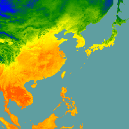
CHIRTS 温度(每日):气候危害中心红外温度(含观测站)每日数据产品

气候危害中心红外温度与站点每日温度数据产品 (CHIRTS-daily; Verdin et al. 2020) 是一种准全球高分辨率网格化数据集(分辨率为 0.05° × 0.05°,范围为 60°S - 70°N),可提供每日最低温度 (Tmin) 和最高 2 米温度 (Tmax),以及四个派生变量:饱和蒸汽… chg climate daily era5 geophysical reanalysis -
ECMWF 近实时 IFS 大气预报

此数据集包含 ECMWF 综合预测系统 (IFS) 以 0.25 度分辨率生成的大气模型变量的 15 天预报。我们将这些数据称为近实时 (NRT) 数据,因为在 ECMWF 实时预测数据发布后,每天会发布两次新产品,作为其… climate dewpoint ecmwf forecast global humidity -
ERA5 日聚合 - ECMWF / 哥白尼气候变化服务生成的最新气候再分析数据

ERA5 是 ECMWF 对全球气候进行的第五代大气再分析。重新分析将模型数据与全球观测数据相结合,形成一个全球完整且一致的数据集。ERA5 取代了其前身 ERA-Interim 再分析。ERA5 DAILY 提供了每天的汇总值,适用于以下变量… climate copernicus dewpoint ecmwf era5 precipitation -
ERA5 每小时 - ECMWF 气候再分析

ERA5 是 ECMWF 对全球气候进行的第五代大气再分析。该数据集由 ECMWF 的哥白尼气候变化服务 (C3S) 生成。再分析将模型数据与全球观测数据相结合,利用物理定律生成全球完整且一致的数据集。 atmosphere climate copernicus ecmwf era5 hourly -
ERA5 月度汇总 - ECMWF / 哥白尼气候变化服务生成的最新气候再分析数据

ERA5 是 ECMWF 对全球气候进行的第五代大气再分析。重新分析将模型数据与全球观测数据相结合,形成一个全球完整且一致的数据集。ERA5 取代了其前身 ERA-Interim 再分析。ERA5 MONTHLY 提供了每个月的汇总值,适用于以下变量… climate copernicus dewpoint ecmwf era5 precipitation -
ERA5-Land 每日汇总 - ECMWF 气候再分析

ERA5-Land 是一种再分析数据集,可提供数十年来陆地变量演变的一致视图,与 ERA5 相比,分辨率更高。ERA5-Land 是通过重放 ECMWF ERA5 气候再分析的陆地分量生成的。重新分析将模型数据与…相结合 cds climate copernicus ecmwf era5-land evaporation -
ERA5-Land 每小时 - ECMWF 气候再分析

ERA5-Land 是一种再分析数据集,可提供数十年来陆地变量演变的一致视图,与 ERA5 相比,分辨率更高。ERA5-Land 是通过重放 ECMWF ERA5 气候再分析的陆地分量生成的。重新分析将模型数据与…相结合 cds climate copernicus ecmwf era5-land evaporation -
ERA5-Land 月度汇总 - ECMWF 气候再分析

ERA5-Land 是一种再分析数据集,可提供数十年来陆地变量演变的一致视图,与 ERA5 相比,分辨率更高。ERA5-Land 是通过重放 ECMWF ERA5 气候再分析的陆地分量生成的。重新分析将模型数据与…相结合 cds climate copernicus ecmwf era5-land evaporation -
ERA5-Land 按小时平均的月度数据 - ECMWF 气候再分析

ERA5-Land 是一种再分析数据集,可提供数十年来陆地变量演变的一致视图,与 ERA5 相比,分辨率更高。ERA5-Land 是通过重放 ECMWF ERA5 气候再分析的陆地分量生成的。重新分析将模型数据与…相结合 cds climate copernicus ecmwf era5-land evaporation -
FLDAS:饥荒预警系统网络 (FEWS NET) 陆面数据同化系统

FLDAS 数据集(McNally 等人,2017 年)旨在帮助在数据稀疏的发展中国家环境中进行粮食安全评估。它包含许多与气候相关的变量的信息,包括水分含量、湿度、蒸散量、平均土壤温度、总降水率等。FLDAS 数据集有多种不同的版本;… climate cryosphere evapotranspiration humidity ldas monthly -
GFS:全球预报系统 384 小时预测大气数据

全球预报系统 (GFS) 是由美国国家环境预报中心 (NCEP) 生成的天气预报模型。GFS 数据集由选定的模型输出(如下所述)组成,以网格化预报变量的形式呈现。384 小时预报,其中 1 小时(最长 120 小时)和 3 小时(之后… 气候 云 通量 预报 地球物理 湿度 -
GLDAS-2.1:全球陆面数据同化系统

NASA 全球陆面数据同化系统第 2 版 (GLDAS-2) 包含三个组成部分:GLDAS-2.0、GLDAS-2.1 和 GLDAS-2.2。GLDAS-2.0 完全由普林斯顿气象强迫输入数据强迫,并提供 1948 年至 2014 年的时间上一致的序列。GLDAS-2.1 采用模型…的组合进行强制 3 小时 气候 冰冻圈 蒸发 强迫 地球物理 -
GLDAS-2.2:全球陆面数据同化系统

NASA 全球陆面数据同化系统第 2 版 (GLDAS-2) 包含三个组成部分:GLDAS-2.0、GLDAS-2.1 和 GLDAS-2.2。GLDAS-2.0 完全由普林斯顿气象强迫输入数据强迫,并提供 1948 年至 2014 年的时间上一致的序列。GLDAS-2.1 采用模型…的组合进行强制 3 小时 气候 冰冻圈 蒸发 强迫 地球物理 -
GRIDMET:爱达荷大学网格化地面气象数据集

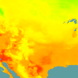
网格化地面气象数据集提供美国本土自 1979 年以来温度、降水、风、湿度和辐射的高空间分辨率(约 4 公里)每日地面场。该数据集将 PRISM 的高分辨率空间数据与…的高时间分辨率数据相融合 climate gridmet humidity merced metdata precipitation -
MERRA-2 M2T1NXSLV:单层诊断 V5.12.4

M2T1NXSLV(或 tavg1_2d_slv_Nx)是现代研究和应用时代回顾性分析版本 2 (MERRA-2) 中的每小时时间平均二维数据集。此集合包含常用垂直层级(例如 2 米(或 10 米、850hPa、500 hPa、250hPa)处的空气温度)的气象诊断信息… atmosphere climate humidity merra nasa pressure -
NLDAS-2:北美陆面数据同化系统驱动场

陆面数据同化系统 (LDAS) 会结合多种观测源(例如雨量计数据、卫星数据和雷达降水测量数据),生成地表或近地表气候属性的估计值。此数据集是北美陆面数据同化系统 (NLDAS-2) 第 2 阶段的主要(默认)驱动文件(文件 A)… 气候 蒸发 强迫 地球物理 每小时 湿度 -
NOAA AVHRR Pathfinder 第 5.3 版整理的全球 4 公里海表温度

AVHRR Pathfinder 第 5.3 版海面温度数据集 (PFV53) 是由 NOAA 国家海洋数据中心和迈阿密大学的 Rosenstiel 海洋与大气科学学院合作制作的全球性海面温度数据,每天更新两次,分辨率为 4 公里。PFV53 … avhrr noaa oceans sst temperature wind -
NOAA CDR:海洋近地表大气属性,版本 2

“海洋近地表大气属性”数据集是 NOAA 海洋表面捆绑包 (OSB) 的一部分,可提供冰封海洋表面上方空气温度、风速和比湿的高质量气候数据记录 (CDR)。这些大气属性是根据亮度温度计算得出的… atmospheric cdr hourly humidity noaa ocean -
RTMA:实时中尺度分析

实时中尺度分析 (RTMA) 是一种针对近地表天气条件的高空间和时间分辨率分析。此数据集包含美国本土的每小时分析数据(分辨率为 2.5 公里)。 atmosphere climate cloud geophysical humidity noaa -
重新处理的 GLDAS-2.0:全球陆面数据同化系统

NASA 全球陆面数据同化系统第 2 版 (GLDAS-2) 包含三个组成部分:GLDAS-2.0、GLDAS-2.1 和 GLDAS-2.2。GLDAS-2.0 完全由普林斯顿气象强迫输入数据强迫,并提供 1948 年至 2014 年的时间上一致的序列。GLDAS-2.1 采用模型…的组合进行强制 3 小时 气候 冰冻圈 蒸发 强迫 地球物理 -
TerraClimate:全球陆地表面的月度气候和气候水文平衡,爱达荷大学

TerraClimate 是一个数据集,包含全球陆地表面的月度气候和气候水文平衡数据。该模型使用气候辅助插值,将 WorldClim 数据集中的高空间分辨率气候平均值与 CRU Ts4.0 和日本 55 年再分析 (JRA55) 中的较低空间分辨率但随时间变化的数据相结合。… 气候 干旱 蒸发蒸腾 地球物理 全球 梅赛德 -
WeatherNext 2

WeatherNext 2 是一个实验性数据集,包含由 Google DeepMind 的功能网络生成式天气模型的业务版本生成的全球中期集合天气预报。此实验性数据集包含实时数据和历史数据。实时数据是指与… climate forecast gcp-public-data-weathernext precipitation publisher-dataset temperature -
WeatherNext Gen 预报

WeatherNext Gen 是一个实验性数据集,包含由 Google DeepMind 的基于扩散的集合天气模型的业务版本生成的全球中期集合天气预报。此实验性数据集包含实时数据和历史数据。实时数据是指与不超过 48 小时前的时间相关的所有数据… climate forecast gcp-public-data-weathernext precipitation publisher-dataset temperature -
WeatherNext 图表预测

WeatherNext Graph 是一个实验性数据集,包含由 Google DeepMind 的图形神经网络天气模型的业务版本生成的全球中期天气预报。此实验性数据集包含实时数据和历史数据。实时数据是指与不超过 48 小时前的时间相关的所有数据… climate forecast gcp-public-data-weathernext precipitation publisher-dataset temperature
Datasets tagged wind in Earth Engine
[null,null,[],[],["The documents detail various climate datasets, including ERA5, ERA5-Land, GRIDMET, TerraClimate, FLDAS, GLDAS, MERRA-2, NLDAS-2, NOAA CDR, NOAA AVHRR, GFS, RTMA, CHIRTS-daily, WeatherNext Gen and WeatherNext Graph. These resources offer data on temperature, precipitation, humidity, evapotranspiration, wind, and other meteorological variables. Datasets are derived from reanalysis combining models with observations, high-resolution spatial data, or model outputs, and are available at daily, monthly, or hourly intervals. They cover global or regional areas, with some focused on land or ocean surfaces.\n"]]