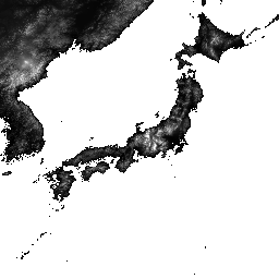
ALOS World 3D – 30m (AW3D30) là một tập dữ liệu mô hình bề mặt kỹ thuật số (DSM) toàn cầu với độ phân giải ngang khoảng 30 mét (lưới 1 giây cung). Tập dữ liệu này dựa trên tập dữ liệu DSM (phiên bản lưới 5 mét) của Dữ liệu địa hình 3D toàn cầu.
Bạn có thể xem thêm thông tin chi tiết trong tài liệu về tập dữ liệu.
Tập dữ liệu được nhập này kết hợp dữ liệu từ các phiên bản 3.1, 4.0 và 4.1.
Phiên bản 4.1 (tháng 4 năm 2024): Bản cập nhật lớn này phát hành 19.051 ô bao phủ các khu vực trên toàn cầu (ngoại trừ Nam Cực và Nhật Bản). Bản cập nhật này kết hợp dữ liệu bổ sung mới để lấp đầy khoảng trống và sửa các điểm bất thường một phần được tìm thấy trong phiên bản 3.1 và 3.2, cùng với việc lấp đầy lại các khoảng trống. Đối với các bản cập nhật ô cụ thể trong phiên bản 4.1, vui lòng sử dụng bộ lọc phiên bản 4.1 trên các ô bản đồ hoặc tham khảo nội dung mô tả định dạng mới nhất.
Phiên bản 4.0 (tháng 4 năm 2023): Bản cập nhật này phát hành 1.886 ô,cải thiện các khu vực ở vĩ độ thấp và trung bình, cũng như các khu vực ở phía nam vĩ độ 60 độ.
Sau đây là những thay đổi chính:
1. Dữ liệu bổ sung mới để lấp đầy khoảng trống.
2. Sửa chữa một phần các điểm bất thường và lấp đầy các khoảng trống (2 ô).
3. Đường bờ biển được cập nhật cho các khu vực ở phía nam vĩ độ 60 độ (44 ô).
4. Tắt mặt nạ nước Biển Caspi và bổ sung dữ liệu độ cao (54 ô).
5. Trích xuất và sửa các khu vực bất thường một phần mới ở Nam Mỹ (1.786 ô).
6. Để biết thông tin chi tiết về ô cho phiên bản 4.0, vui lòng sử dụng bộ lọc phiên bản 4.0 trên các ô bản đồ hoặc tham khảo nội dung mô tả định dạng.
Phiên bản 3.2, phát hành vào tháng 1 năm 2021, là phiên bản cải tiến được tạo ra bằng cách xem xét lại định dạng ở khu vực có vĩ độ cao, dữ liệu phụ trợ và phương pháp xử lý. Khoảng cách pixel khác nhau cho từng vùng vĩ độ được áp dụng ở vùng vĩ độ cao. Dữ liệu đường bờ biển (một trong các tập dữ liệu phụ trợ) đã được thay đổi và dữ liệu bổ sung mới đã được sử dụng. Ngoài ra, AW3D phiên bản 3 cũng được dùng làm dữ liệu nguồn cho Nhật Bản.
Hơn nữa, phương pháp phát hiện các giá trị bất thường trong quy trình đã được cải thiện.
Độ cao AW3D DSM được tính bằng quy trình so khớp hình ảnh sử dụng một cặp hình ảnh quang học lập thể. Mây, tuyết và băng được tự động xác định trong quá trình xử lý và áp dụng thông tin mặt nạ. Tuy nhiên, đôi khi vẫn còn những điểm không khớp, đặc biệt là xung quanh (hoặc ở rìa) các khu vực có mây, tuyết và băng, gây ra một số lỗi về độ cao trong DSM cuối cùng.
Băng tần
Kích thước pixel 30 mét
Băng tần
Tên
Phút
Tối đa
Kích thước pixel
Mô tả
DSM
-433*
8768*
mét
Độ cao so với mực nước biển. 16 bit có dấu.
Độ cao (tính bằng mét) được chuyển đổi từ chiều cao hình elip dựa trên ITRF97 và GRS80, sử dụng mô hình trắc địa EGM96†1.
STK
1*
54*
mét
Số lượng chồng của đơn vị cảnh DSM được dùng để tạo DSM. Dải tần được lấy bằng cách lấy mẫu lại số lượng xếp chồng cho DSM có độ phân giải 5 m thành độ phân giải 30 m.
MSK
mét
Mặt nạ 8 bit cho dải tần.
Bitmask cho MSK
Bit 0-7: Được tạo từ DSM lấy mẫu lại.
0: Hợp lệ
1: Mặt nạ đám mây và tuyết (không hợp lệ).
2: Mặt nạ nước trên đất liền và mặt nạ có mối tương quan thấp (hợp lệ).
3: Mặt nạ biển (hợp lệ).
4: Khoảng trống được điền bằng DTM GSI (hợp lệ).
8: Khoảng trống được lấp đầy bằng Shuttle Radar Topography Mission SRTM-1 Phiên bản 3 (hợp lệ).
12: Khoảng trống được lấp đầy bằng PRISM DSM (hợp lệ).
16: Khoảng trống chứa DEM toàn cảnh của ViewFinder (hợp lệ).
24: Khoảng trống được lấp đầy bằng ASTER GDEM phiên bản 2 (hợp lệ).
28: Khoảng trống được lấp đầy bằng ArcticDEM phiên bản 2 (hợp lệ).
32: Khoảng trống được điền bằng DEM 90m TanDEM-X (hợp lệ).
36: Khoảng trống được lấp đầy bằng ArcticDEM phiên bản 3 (hợp lệ).
40: Khoảng trống chứa ASTER GDEM phiên bản 3 (hợp lệ).
44: Khoảng trống được điền bằng REMA phiên bản 1.1 (hợp lệ).
48: Khoảng trống được điền bằng Copernicus DEM GLO-30 (hợp lệ).
52: Khoảng trống được lấp đầy bằng ArcticDEM phiên bản 4 (hợp lệ).
252: Khoảng trống được điền bằng phương pháp IDW đã áp dụng (gdal_fillnodata) (hợp lệ)
T. Tadono, H. Ishida, F. Oda, S. Naito, K. Minakawa, H. Iwamoto
Tạo mô hình độ cao kỹ thuật số (DEM) toàn cầu chính xác bằng ALOS PRISM, Biên niên sử về phép đo ảnh, viễn thám và khoa học thông tin không gian của ISPRS, Tập II-4, trang 71-76, 2014. Tệp PDF
J. Takaku, T. Tadono, K. Tsutsui : Generation of High Resolution Global DSM from ALOS PRISM (Tạo DSM toàn cầu có độ phân giải cao từ ALOS PRISM), The International Archives of the Photogrammetry, Remote Sensing and Spatial Information Sciences (Tập lưu trữ quốc tế về phép đo ảnh, viễn thám và khoa học thông tin không gian), Tập XL-4, trang 243-248, ISPRS, 2014. Tệp PDF
J. Takaku, T. Tadono, K. Tsutsui, M. Ichikawa : Xác thực DSM toàn cầu "AW3D" được tạo từ ALOS PRISM, Biên niên sử về phép đo ảnh, viễn thám và khoa học thông tin không gian của ISPRS, Tập III-4, trang 25-31, 2016. Tệp PDF
T. Tadono, H. Nagai, H. Ishida, F. Oda, S. Naito, K. Minakawa,
H. Iwamoto : Initial Validation of the 30 m-mesh Global Digital Surface Model Generated by ALOS PRISM (Xác nhận ban đầu về Mô hình bề mặt kỹ thuật số toàn cầu có lưới 30 m do ALOS PRISM tạo ra), The International Archives of the Photogrammetry, Remote Sensing and Spatial Information Sciences (Tài liệu lưu trữ quốc tế về phép đo ảnh, viễn thám và khoa học thông tin không gian), ISPRS, Tập XLI-B4, trang 157-162, 2016. Tệp PDF
J. Takaku, T. Tadono, M. Doutsu, F. Ohgushi và H. Kai, : "Updates of
'AW3D30' ALOS Global Digital Surface Model in Antarctica with Other Open
Access Datasets", Int. Arch. Photogramm. Remote Sens. Spatial Inf. Sci.,
XLIII-B4-2021, 401-408, 2021. Tệp PDF
ALOS World 3D – 30m (AW3D30) là một tập dữ liệu mô hình bề mặt kỹ thuật số (DSM) toàn cầu có độ phân giải ngang khoảng 30 mét (lưới 1 giây cung). Tập dữ liệu này dựa trên tập dữ liệu DSM (phiên bản lưới 5 mét) của Dữ liệu địa hình 3D trên thế giới. Bạn có thể xem thêm thông tin chi tiết trong tài liệu về tập dữ liệu. …
[null,null,[],[],[],null,["# ALOS DSM: Global 30m v4.1\n\nDataset Availability\n: 2006-01-24T00:00:00Z--2011-05-12T00:00:00Z\n\nDataset Provider\n:\n\n\n [JAXA Earth Observation Research Center](https://www.eorc.jaxa.jp/ALOS/en/dataset/aw3d30/aw3d30_e.htm)\n\nTags\n:\n[alos](/earth-engine/datasets/tags/alos) [dem](/earth-engine/datasets/tags/dem) [elevation](/earth-engine/datasets/tags/elevation) [elevation-topography](/earth-engine/datasets/tags/elevation-topography) [geophysical](/earth-engine/datasets/tags/geophysical) [jaxa](/earth-engine/datasets/tags/jaxa) [topography](/earth-engine/datasets/tags/topography) \n\n#### Description\n\nALOS World 3D - 30m (AW3D30) is a global digital surface\nmodel (DSM) dataset with a horizontal resolution of approximately\n30 meters (1 arcsec mesh). The dataset is based on the DSM dataset\n(5-meter mesh version) of the [World 3D Topographic Data](https://www.aw3d.jp/en/).\nMore details are available in the dataset [documentation](https://www.eorc.jaxa.jp/ALOS/en/dataset/aw3d30/data/aw3d30v4.1_product_e_1.0.pdf).\n\nThis ingested dataset combines data from versions 3.1, 4.0, and 4.1.\n\nVersion 4.1 (April 2024): This major update released 19,051 tiles covering\nglobal regions (excluding Antarctica and Japan). It incorporates new\nsupplementary data for void filling and corrects partial anomalies found in\nversions 3.1 and 3.2, along with re-filling voids. For specific tile updates\nin v4.1, please use the v4.1 filter on map tiles or consult the latest\nformat description.\n\nVersion 4.0 (April 2023): This update released 1,886 tiles, improving low\nand mid-latitude regions and areas south of 60 degrees latitude.\n\nKey changes include:\n1. New supplementary data for void filling.\n2. Correction of partial anomalies and re-filling of voids (2 tiles).\n3. Updated coastlines for regions south of 60 degrees latitude (44 tiles).\n4. Disabled Caspian Sea water mask and supplemented with elevation data\n(54 tiles).\n5. Extracted and corrected new partial anomaly areas in South America\n(1,786 tiles).\n6. For detailed tile information for v4.0, please use the v4.0 filter on\nmap tiles or refer to the format description.\n\nVersion 3.2, released in January 2021, is an improved version created by\nreconsidering the format in the high latitude area, auxiliary data, and\nprocessing method. Different pixel spacing for each latitude zone was\nadopted at high latitude area. Coastline data, which is one of the\nauxiliary datasets, was changed, and new supplementary data was used. In\naddition, as a source data for Japan, AW3D version 3 was also used.\nFurthermore, the method of detecting anomalous values in the process was\nimproved.\n| **Note:** See the code example for the recommended way of computing slope. Unlike most DEMs in Earth Engine, this is an image collection due to multiple resolutions of source files that make it impossible to mosaic them into a single asset, so the slope computations need a reprojection.\n\nThe AW3D DSM elevation is calculated by an image matching process\nthat uses a stereo pair of optical images. Clouds, snow, and ice are\nautomatically identified during processing and applied the\nmask information. However, mismatched points sometimes\nremain especially surrounding (or at the edges of) clouds, snow,\nand ice areas, which cause some height errors in the final DSM.\n\n### Bands\n\n\n**Pixel Size**\n\n30 meters\n\n**Bands**\n\n| Name | Min | Max | Pixel Size | Description |\n|-------|--------|--------|------------|-------------------------------------------------------------------------------------------------------------------------------------------------------------|---|---|---|---|---|---|---|---|---|---|---|---|---|---|---|---|---|---|---|---|---|---|---|---|---|---|---|---|---|---|---|---|---|---|---|---|---|---|---|---|---|---|---|---|---|---|---|---|---|---|---|---|---|---|---|---|---|---|---|---|---|---|---|---|---|---|---|---|---|---|---|---|---|---|---|---|---|---|---|---|---|---|---|---|---|---|---|---|---|---|---|---|---|---|---|\n| `DSM` | -433\\* | 8768\\* | meters | Height above sea level. Signed 16 bits. Elevation (in meter) converted from the ellipsoidal height based on ITRF97 and GRS80, using EGM96†1 geoid model. |\n| `STK` | 1\\* | 54\\* | meters | Stacking number of the scene unit DSM used in producing DSM. The band is derived by resampling the stacking number for 5m resolution DSM to 30m resolution. |\n| `MSK` | | | meters | 8-bit mask for the band. |\n| Bitmask for MSK - Bits 0-7: Generated from resampled DSM. - 0: Valid - 1: Cloud and snow mask (invalid). - 2: Land water and low correlation mask (valid). - 3: Sea mask (valid). - 4: Void filled with GSI DTM (valid). - 8: Void filled with Shuttle Radar Topography Mission SRTM-1 Version 3 (valid). - 12: Void filled with PRISM DSM (valid). - 16: Void filled with ViewFinder Panoramas DEM (valid). - 24: Void filled with ASTER GDEM v2 (valid). - 28: Void filled with ArcticDEM v2 (valid). - 32: Void filled with TanDEM-X 90m DEM (valid). - 36: Void filled with ArcticDEM v3 (valid). - 40: Void filled with ASTER GDEM v3 (valid). - 44: Void filled with REMA v1.1 (valid). - 48: Void filled with Copernicus DEM GLO-30 (valid). - 52: Void filled with ArcticDEM v4 (valid). - 252: Void filled with applied IDW method (gdal_fillnodata) (valid) ||||||||||||||||||||||||||||||||||||||||||||||||||||||||||||||||||||||||||||||||||||||||||||||||||||\n\n\\* estimated min or max value\n\n### Terms of Use\n\n**Terms of Use**\n\nThis dataset is available to use with no charge under\nthe conditions specified in the [Terms of use for ALOS Global Digital\nSurface Model](https://earth.jaxa.jp/en/data/policy/).\n\n### Citations\n\nCitations:\n\n-\n\n T. Tadono, H. Ishida, F. Oda, S. Naito, K. Minakawa, H. Iwamoto\n : Precise Global DEM Generation By ALOS PRISM, ISPRS Annals of\n the Photogrammetry, Remote Sensing and Spatial Information Sciences,\n Vol.II-4, pp.71-76, 2014. [PDF file](https://www.isprs-ann-photogramm-remote-sens-spatial-inf-sci.net/II-4/71/2014/isprsannals-II-4-71-2014.pdf)\n- J. Takaku, T. Tadono, K. Tsutsui : Generation of High Resolution\n Global DSM from ALOS PRISM, The International Archives of the Photogrammetry,\n Remote Sensing and Spatial Information Sciences, Vol. XL-4, pp.243-248,\n ISPRS, 2014. [PDF file](https://www.int-arch-photogramm-remote-sens-spatial-inf-sci.net/XL-4/243/2014/isprsarchives-XL-4-243-2014.pdf)\n- J. Takaku, T. Tadono, K. Tsutsui, M. Ichikawa : Validation of\n 'AW3D' Global DSM Generated from ALOS PRISM, ISPRS\n Annals of the Photogrammetry, Remote Sensing and Spatial Information\n Sciences, Vol.III-4, pp.25-31, 2016. [PDF file](https://www.isprs-ann-photogramm-remote-sens-spatial-inf-sci.net/III-4/25/2016/isprs-annals-III-4-25-2016.pdf)\n- T. Tadono, H. Nagai, H. Ishida, F. Oda, S. Naito, K. Minakawa,\n H. Iwamoto : Initial Validation of the 30 m-mesh Global Digital\n Surface Model Generated by ALOS PRISM, The International Archives\n of the Photogrammetry, Remote Sensing and Spatial Information Sciences,\n ISPRS, Vol. XLI-B4, pp.157-162, 2016. [PDF file](https://www.int-arch-photogramm-remote-sens-spatial-inf-sci.net/XLI-B4/157/2016/isprs-archives-XLI-B4-157-2016.pdf)\n- J. Takaku, T. Tadono, M. Doutsu, F. Ohgushi, and H. Kai, : \"Updates of\n 'AW3D30' ALOS Global Digital Surface Model in Antarctica with Other Open\n Access Datasets\", Int. Arch. Photogramm. Remote Sens. Spatial Inf. Sci.,\n XLIII-B4-2021, 401-408, 2021. [PDF file](https://www.int-arch-photogramm-remote-sens-spatial-inf-sci.net/XLIII-B4-2021/401/2021/isprs-archives-XLIII-B4-2021-401-2021.pdf)\n\n### Explore with Earth Engine\n\n| **Important:** Earth Engine is a platform for petabyte-scale scientific analysis and visualization of geospatial datasets, both for public benefit and for business and government users. Earth Engine is free to use for research, education, and nonprofit use. To get started, please [register for Earth Engine access.](https://console.cloud.google.com/earth-engine)\n\n### Code Editor (JavaScript)\n\n```javascript\nvar dataset = ee.ImageCollection('JAXA/ALOS/AW3D30/V4_1');\nvar elevation = dataset.select('DSM');\nvar elevationVis = {\n min: 0,\n max: 5000,\n palette: ['0000ff', '00ffff', 'ffff00', 'ff0000', 'ffffff']\n};\nMap.setCenter(138.73, 35.36, 11);\nMap.addLayer(elevation, elevationVis, 'Elevation');\n\n// Reproject an image mosaic using a projection from one of the image tiles,\n// rather than using the default projection returned by .mosaic().\nvar proj = elevation.first().select(0).projection();\nvar slopeReprojected = ee.Terrain.slope(elevation.mosaic()\n .setDefaultProjection(proj));\nMap.addLayer(slopeReprojected, {min: 0, max: 45}, 'Slope');\n```\n[Open in Code Editor](https://code.earthengine.google.com/?scriptPath=Examples:Datasets/JAXA/JAXA_ALOS_AW3D30_V4_1) \n[ALOS DSM: Global 30m v4.1](/earth-engine/datasets/catalog/JAXA_ALOS_AW3D30_V4_1) \nALOS World 3D - 30m (AW3D30) is a global digital surface model (DSM) dataset with a horizontal resolution of approximately 30 meters (1 arcsec mesh). The dataset is based on the DSM dataset (5-meter mesh version) of the World 3D Topographic Data. More details are available in the dataset documentation. ... \nJAXA/ALOS/AW3D30/V4_1, alos,dem,elevation,elevation-topography,geophysical,jaxa,topography \n2006-01-24T00:00:00Z/2011-05-12T00:00:00Z \n-90 -180 90 180 \nGoogle Earth Engine \nhttps://developers.google.com/earth-engine/datasets\n\n- [](https://doi.org/https://www.eorc.jaxa.jp/ALOS/en/dataset/aw3d30/aw3d30_e.htm)\n- [](https://doi.org/https://developers.google.com/earth-engine/datasets/catalog/JAXA_ALOS_AW3D30_V4_1)"]]