- Dataset-Verfügbarkeit
- 2002-07-04T00:00:00Z–2023-02-25T00:00:00Z
- Ersteller des Datasets
- Intervall
- 1 Tag
- Tags
Beschreibung
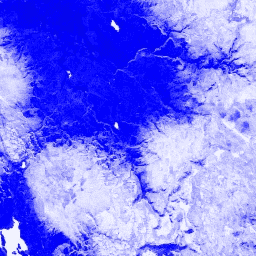
Der Normalized Difference Snow Index (NDSI) wird verwendet, um Schnee anhand seiner charakteristisch höheren Reflexion im sichtbaren Teil des Spektrums im Vergleich zum mittleren Infrarot zu identifizieren. Der NDSI wird anhand der grünen und mittleren Infrarotbänder berechnet und hat einen Bereich von -1,0 bis 1,0. Weitere Informationen finden Sie unter Riggs et al. (1994). Dieses Produkt wird aus den MODIS/006/MYD09GA-Oberflächenreflektanz-Composites generiert.
Bänder
Bänder
Pixelgröße: 463,313 Meter (alle Bänder)
| Name | Pixelgröße | Beschreibung |
|---|---|---|
NDSI |
463.313 Meter | Normalized Difference Snow Index |
Nutzungsbedingungen
Nutzungsbedingungen
Für MODIS-Daten und -Produkte, die über das LP DAAC bezogen werden, gelten keine Einschränkungen hinsichtlich der späteren Nutzung, des Verkaufs oder der Weitergabe.
Die Earth Engine nutzen
Code-Editor (JavaScript)
var dataset = ee.ImageCollection('MODIS/MYD09GA_006_NDSI')
                  .filter(ee.Filter.date('2018-04-01', '2018-06-01'));
var colorized = dataset.select('NDSI');
var colorizedVis = {
  palette: ['000088', '0000ff', '8888ff', 'ffffff'],
};
Map.setCenter(-7.03, 31.05, 2);
Map.addLayer(colorized, colorizedVis, 'Colorized');