- データセットの利用可能な期間
- 2012-01-19T00:00:00Z–2026-01-02T00:00:00Z
- データセット プロバイダ
- USGS EROS センターの NASA LP DAAC
- ケイデンス
- 1 日
- タグ
説明
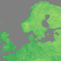
NASA の Suomi National Polar-Orbiting Partnership(Suomi NPP)の可視赤外撮像機放射計(VIIRS)の地表面温度と放射率(LST&E)の 1 日版プロダクト(VNP21A1D)は、日中のレベル 2 グリッド(L2G)中間プロダクトから毎日コンパイルされます。
L2G プロセスは、毎日の VNP21 スワス グラニュールを正弦波 MODIS グリッドにマッピングし、特定の日のグリッド セルと重複するすべての観測値を保存します。VNP21A1 アルゴリズムは、各セルについてこれらのすべての観測値を分類し、LST の精度が高いすべての雲のない観測値の平均として最終的な LST 値を推定します。この平均化では、観測範囲が特定のしきい値(15%)を超える観測のみが考慮されます。
ドキュメント:
バンド
ピクセルサイズ
1,000 メートル
バンド
| 名前 | 単位 | ピクセルサイズ | 説明 | ||||||||||||||||||||||||||||||||||||||||||||||||||||||||||||||||||||||||||||||||||||||||||||||||
|---|---|---|---|---|---|---|---|---|---|---|---|---|---|---|---|---|---|---|---|---|---|---|---|---|---|---|---|---|---|---|---|---|---|---|---|---|---|---|---|---|---|---|---|---|---|---|---|---|---|---|---|---|---|---|---|---|---|---|---|---|---|---|---|---|---|---|---|---|---|---|---|---|---|---|---|---|---|---|---|---|---|---|---|---|---|---|---|---|---|---|---|---|---|---|---|---|---|---|---|
LST_1KM |
K | メートル | 1 日の地表温度(1 km)。 |
||||||||||||||||||||||||||||||||||||||||||||||||||||||||||||||||||||||||||||||||||||||||||||||||
QC |
メートル | LST と放射率の毎日の品質管理 |
|||||||||||||||||||||||||||||||||||||||||||||||||||||||||||||||||||||||||||||||||||||||||||||||||
Emis_14 |
メートル | 1 日の M14 放射率 |
|||||||||||||||||||||||||||||||||||||||||||||||||||||||||||||||||||||||||||||||||||||||||||||||||
Emis_15 |
メートル | 1 日の M15 放射率 |
|||||||||||||||||||||||||||||||||||||||||||||||||||||||||||||||||||||||||||||||||||||||||||||||||
Emis_16 |
メートル | M16 の 1 日の放射率 |
|||||||||||||||||||||||||||||||||||||||||||||||||||||||||||||||||||||||||||||||||||||||||||||||||
View_Angle |
deg | メートル | LST の天頂角を表示する |
||||||||||||||||||||||||||||||||||||||||||||||||||||||||||||||||||||||||||||||||||||||||||||||||
View_Time |
h | メートル | LST 観測時間 |
||||||||||||||||||||||||||||||||||||||||||||||||||||||||||||||||||||||||||||||||||||||||||||||||
利用規約
利用規約
LP DAAC NASA データは自由にアクセスできますが、著者がこれらのデータやデータに基づく作品を公開する場合は、出版物の本文内でデータセットを引用し、参考文献リストに参考文献を含めることが求められます。
引用
引用:
LP DAAC データセットの引用については、LP DAAC の「Citing Our Data」ページを参照してください。
DOI
Earth Engine で探索する
コードエディタ(JavaScript)
var dataset = ee.ImageCollection('NASA/VIIRS/002/VNP21A1D')
                  .filter(ee.Filter.date('2022-11-01', '2022-12-01'));

var visualization = {
  bands: ['LST_1KM'],
  min: [150],
  max: [300],
  palette: [
    'a50026',
    'd73027',
    'f46d43',
    'fdae61',
    'fee08b',
    'ffffbf',
    'd9ef8b',
    'a6d96a',
    '66bd63',
    '1a9850',
    '006837',
  ]
};
Map.setCenter(41.2, 38.84, 3);
Map.addLayer(dataset, visualization, 'LST');