- 데이터 세트 제공
- 1985-03-01T00:00:00Z–2016-09-30T00:00:00Z
- 데이터 세트 출처
- CIRES의 NASA NSIDC DAAC
- 태그
설명
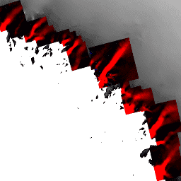
NASA Making Earth System Data Records for Use in Research Environments (MEaSUREs) 프로그램의 일부인 이 데이터 세트는 선택한 빙하 출구 영역의 평균 월별 속도 지도로 구성됩니다. 이 지도는 Landsat 4 및 5 주제 매퍼 (TM), Landsat 7 향상된 주제 매퍼 플러스 (ETM+), Landsat 8 운영 지상 이미저 (OLI), 고급 우주 열 방출 및 반사 방사계 (ASTER)에서 획득한 광학 이미지 쌍 간의 표시되는 특징을 추적하여 생성됩니다.
참고
월별 평균은 이전 달 또는 다음 달의 획득 날짜가 있을 수 있는 이미지에서 계산됩니다. 명명 규칙의 경우 월은 중간점 율리우스력이 속하는 위치에서 결정됩니다. 예를 들어 9월 월별 평균은 8월이나 10월에 획득한 이미지에서 생성되었을 수 있지만 이미지 간의 중간 율리우스 날짜가 9월에 속합니다. 사용된 정확한 날짜는 이미지별 메타데이터 필드로 포함됩니다.
대역
대역
픽셀 크기: 100미터 (모든 밴드)
| 이름 | 단위 | 픽셀 크기 | 설명 |
|---|---|---|---|
velocity_x |
미터/년 | 100m | 얼음 흐름 x 속도 |
velocity_y |
미터/년 | 100m | Ice flow y velocity(얼음 흐름 y 속도) |
error_x |
미터/년 | 100m | Ice flow x 오류 |
error_y |
미터/년 | 100m | Ice flow y error |
이미지 속성
이미지 속성
| 이름 | 유형 | 설명 |
|---|---|---|
| CENTRAL_JULIAN_DATES | STRING_LIST | 이미지에 사용된 이미지 쌍의 중앙 율리우스력 날짜 목록입니다. |
| FIRST_IMAGE_DATES | STRING_LIST | 이미지에 사용된 첫 번째 이미지 날짜 목록입니다. |
| NOMINAL_TIMES | STRING_LIST | 이미지 쌍의 명목 관측 시간 목록입니다. |
| PRODUCTION_DATE | 문자열 | 제작일입니다. |
| SECOND_IMAGE_DATES | STRING_LIST | 이미지에 사용된 두 번째 이미지 날짜 목록입니다. |
| 센서 | STRING_LIST | 이미지에 사용된 센서 쌍 목록입니다. |
이용약관
이용약관
이 데이터를 사용하려면 제공된 인용을 사용하여 이 데이터 세트의 사용을 인용해야 합니다.
인용
Howat, I. 2017. MEaSUREs Greenland Ice Velocity: Selected Glacier Site Velocity Maps from Optical Images, Version 2. [사용한 하위 집합 표시] 미국 콜로라도주 볼더 NASA National Snow and Ice Data Center Distributed Active Archive Center. doi:10.5067/VM5DZ20MYF5C. [액세스한 날짜].
DOI
Earth Engine으로 탐색
코드 편집기(JavaScript)
var dataset = ee.ImageCollection('OSU/GIMP/ICE_VELOCITY_OPT')
                  .filter(ee.Filter.date('2016-01-01', '2016-09-15'));
var iceVelocityVis = {
  min: [-1000],
  max: [1000],
  palette: ['red', 'black', 'blue'],
  bands: ['velocity_x']
};
Map.setCenter(-66.82, 76.151, 7);
Map.addLayer(dataset, iceVelocityVis, 'Ice Velocity');