- Доступность набора данных
- 1984-01-01T00:00:00Z–2017-01-01T00:00:00Z
- Поставщик наборов данных
- Мюррей/UQ/Google/USGS/NASA
- Теги
Описание
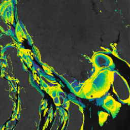
Набор данных Murray Global Intertidal Change Dataset содержит глобальные карты экосистем приливных отмелей, созданные с помощью контролируемой классификации 707 528 изображений из архива Landsat. Каждый пиксель был классифицирован как «приливная отмель», «постоянная вода» или «другое» на основе глобально распределённого набора обучающих данных.
Классификация проводилась вдоль всего мирового побережья между 60° северной широты и 60° южной широты с 1 января 1984 года по 31 декабря 2016 года. Коллекция изображений представляет собой временной ряд из 11 глобальных карт приливных отмелей с разрешением 30 м за заданные периоды времени (1984–1986; 1987–1989; 1990–1992; 1993–1995; 1996–1998; 1999–2001; 2002–2004; 2005–2007; 2008–2010; 2011–2013; 2014–2016).
Флаг, указывающий пространственные пределы реализации классификатора приливных отмелей, определяемые высотными (+100 м) и батиметрическими (-100 м) пределами.
Группы
Размер пикселя
30 метров
Группы
| Имя | Единицы | Размер пикселя | Описание | ||||||||||||||||||||||||||||||||||||||||||||||||||||||||||||||||||||||||||||||||||||||||||||||||
|---|---|---|---|---|---|---|---|---|---|---|---|---|---|---|---|---|---|---|---|---|---|---|---|---|---|---|---|---|---|---|---|---|---|---|---|---|---|---|---|---|---|---|---|---|---|---|---|---|---|---|---|---|---|---|---|---|---|---|---|---|---|---|---|---|---|---|---|---|---|---|---|---|---|---|---|---|---|---|---|---|---|---|---|---|---|---|---|---|---|---|---|---|---|---|---|---|---|---|---|
datamask | возникновение | метров | Флаг, указывающий на включение данных. | ||||||||||||||||||||||||||||||||||||||||||||||||||||||||||||||||||||||||||||||||||||||||||||||||
Условия эксплуатации
Условия эксплуатации
Данная работа лицензирована в соответствии с лицензией Creative Commons Attribution 4.0 International.
Любое использование данных по приливной зоне должно сопровождаться соответствующим указанием источника, включая ссылку на соответствующую журнальную статью.
Цитаты
Мюррей, Нью-Джерси, Финн, С.Р., ДеВитт, М., Феррари, Р., Джонстон, Р., Лайонс, М.Б., Клинтон, Н., Тау, Д. и Фуллер, Р.А. (2019) Глобальное распределение и траектория приливных отмелей. Природа, 565, 222–225. дои:10.1038/s41586-018-0805-8 ,
Мюррей, Нью-Джерси, Финн, С.П., Фуллер, Р.А., ДеВитт, М., Феррари, Р., Джонстон, Р., Клинтон, Н. и Лайонс, М.Б. (2022). Высокоразрешающие глобальные карты экосистем приливных отмелей с 1984 по 2019 год. Scientific Data, 9(1). doi:10.1038/s41597-022-01635-5 .
DOI
Исследуйте с Earth Engine
Редактор кода (JavaScript)
var dataset = ee.Image('UQ/murray/Intertidal/v1_1/data_mask');

var visualization = {
  bands: ['datamask'],
  min: 0,
  max: 1,
  palette: ['000000', 'ffffff']
};

Map.setCenter(126.6339, 37.4394, 10);

Map.addLayer(dataset, visualization, 'Data mask');