- Dataset-Verfügbarkeit
- 2010-01-01T00:00:00Z–2010-01-01T00:00:00Z
- Ersteller des Datasets
- USGS
- Tags
Beschreibung
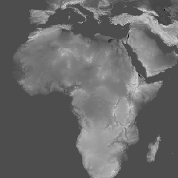
Das Dataset „Global Multi-resolution Terrain Elevation Data 2010 (GMTED2010)“ enthält Höhendaten für die gesamte Welt, die aus verschiedenen Quellen mit einer Auflösung von 7,5 Bogensekunden stammen. Weitere Informationen finden Sie im Dataset-Bericht.
Der primäre Quelldatensatz für GMTED2010 sind die SRTM Digital Terrain Elevation Data (DTED®, https://www2.jpl.nasa.gov/srtm/) der NGA (National Geospatial-Intelligence Agency) mit einer Auflösung von 1 Bogensekunde (ohne Lücken). Für die geografischen Gebiete außerhalb des SRTM-Abdeckungsbereichs und zum Schließen der verbleibenden Lücken in den SRTM-Daten wurden die folgenden Quellen verwendet: DTED®-Daten, die nicht auf SRTM basieren, Canadian Digital Elevation Data (CDED) mit zwei Auflösungen, Satellite Pour l'Observation de la Terre (SPOT 5) Reference3D, National Elevation Dataset (NED) für die kontinentalen USA und Alaska, GEODATA 9-Sekunden-DEM (Digital Elevation Model) für Australien, ein DEM für Antarktika, das auf Satellitenradar- und Laser-Altimeterdaten basiert, und ein DEM für Grönland, das auf Satellitenradar-Altimeterdaten basiert.
Dieses Dataset ersetzt das GTOPO30-Höhenmodell.
Bänder
Bänder
Pixelgröße: 231,92 Meter (alle Bänder)
| Name | Einheiten | Pixelgröße | Beschreibung |
|---|---|---|---|
std |
m | 231,92 Meter | Standardabweichung |
min |
m | 231,92 Meter | Minimum |
med |
m | 231,92 Meter | Medianwert |
mea |
m | 231,92 Meter | Durchschnitt |
max |
m | 231,92 Meter | Maximum |
dsc |
m | 231,92 Meter | Beispiel |
be75 |
m | 231,92 Meter | Durch die Hervorhebung von Bruchlinien werden die kritischen topografischen Merkmale (Bäche oder Bergrücken) in der Landschaft beibehalten, indem alle Mindest- oder Höchstwerte auf einer Bruchlinie beibehalten werden, die innerhalb des angegebenen Analysefensters verläuft. |
Nutzungsbedingungen
Nutzungsbedingungen
Die meisten Informationen des U.S. Geological Survey (USGS) sind öffentlich und dürfen ohne Einschränkungen verwendet werden. Weitere Informationen
Zitationen
Globale Höhendaten für das Gelände mit mehreren Auflösungen, 2010, mit freundlicher Genehmigung des U.S. Geological Survey
Die Earth Engine nutzen
Code-Editor (JavaScript)
var dataset = ee.Image('USGS/GMTED2010_FULL');
var elevation = dataset.select('min');
var elevationVis = {
  min: -100.0,
  max: 6500.0,
  gamma: 3.5,
};
Map.setCenter(17.93, 7.71, 2);
Map.addLayer(elevation, elevationVis, 'Minimum Elevation');