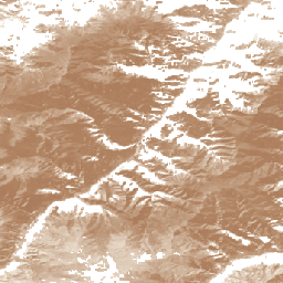
এই ডেটাসেটটি 30-মি স্থানিক রেজোলিউশনে 2000 থেকে 2022 পর্যন্ত প্রাকৃতিক/আধা-প্রাকৃতিক তৃণভূমির বিশ্বব্যাপী বার্ষিক সম্ভাব্যতার মানচিত্র সরবরাহ করে। ল্যান্ড অ্যান্ড কার্বন ল্যাব গ্লোবাল পাশ্চার ওয়াচ উদ্যোগের দ্বারা উত্পাদিত, ম্যাপ করা তৃণভূমির সীমার মধ্যে যেকোন ভূমি আবরণের ধরন অন্তর্ভুক্ত, যেখানে কমপক্ষে 30% শুকনো বা ভেজা নিম্ন গাছপালা রয়েছে, যা ঘাস এবং ফরব দ্বারা প্রভাবিত (3 মিটারের কম) এবং একটি:
সর্বাধিক 50% গাছের ছাউনি কভার (5 মিটারের বেশি),
সর্বাধিক 70% অন্যান্য কাঠের গাছপালা (স্ক্রাব এবং খোলা গুল্মভূমি), এবং
শস্যভূমি এবং অন্যান্য গাছপালা মোজাইক ল্যান্ডস্কেপে সর্বাধিক 50% সক্রিয় শস্যভূমি কভার।
তৃণভূমির ব্যাপ্তি দুটি শ্রেণীতে বিভক্ত: - চাষকৃত তৃণভূমি : এমন এলাকা যেখানে ঘাস এবং অন্যান্য চারণ উদ্ভিদ ইচ্ছাকৃতভাবে রোপণ করা হয়েছে এবং পরিচালনা করা হয়েছে, সেইসাথে স্থানীয় তৃণভূমি-জাতীয় গাছপালাগুলির এলাকা যেখানে তারা স্পষ্টভাবে মানব-নির্দেশিত ব্যবহারের জন্য সক্রিয় এবং ভারী ব্যবস্থাপনা প্রদর্শন করে, যেমন পশুদের নির্দেশিত চারণ। - প্রাকৃতিক/আধা-প্রাকৃতিক তৃণভূমি : তুলনামূলকভাবে নিরবচ্ছিন্ন স্থানীয় তৃণভূমি/স্বল্প-উচ্চতার গাছপালা, যেমন স্টেপস এবং টুন্ড্রা, সেইসাথে এমন এলাকা যা অতীতে বিভিন্ন মাত্রার মানুষের কার্যকলাপের অভিজ্ঞতা লাভ করেছে, যাতে ঐতিহাসিক ভূমি ব্যবহার এবং প্রাকৃতিক প্রক্রিয়ার কারণে স্থানীয় এবং প্রবর্তিত প্রজাতির মিশ্রণ থাকতে পারে। সাধারণভাবে, তারা বৈচিত্র্যময় উদ্ভিদের প্রাকৃতিক-সুদর্শন নিদর্শন প্রদর্শন করে এবং পুরো আড়াআড়ি জুড়ে স্পষ্টভাবে নির্দেশিত জলবিদ্যুৎ সম্পর্ক।
বাস্তবায়িত পদ্ধতিতে বিবেচনা করা হয়েছে GLAD Landsat ARD-2 চিত্রগুলি (ক্লাউড-মুক্ত দ্বি-মাসিক সমষ্টিতে প্রক্রিয়া করা হয়েছে, দেখুন কনসোলি এট আল, 2024 ), জলবায়ু, ল্যান্ডফর্ম এবং প্রক্সিমিটি কোভেরিয়েটস, স্প্যাটিওটেম্পোরাল মেশিন লার্নিং (প্রতি-শ্রেণি র্যান্ডম ফরেস্ট) এবং উচ্চ 3 মিলিয়নের বেশি নমুনা 3 মিলিয়নের বেশি নমুনা। রেজোলিউশন চিত্র)। কাস্টম সম্ভাব্যতা থ্রেশহোল্ড (পাঁচ-গুণ স্থানিক ক্রস-ভ্যালিডেশন এবং সুষম নির্ভুলতা এবং প্রত্যাহার মানের উপর ভিত্তি করে) প্রভাবশালী শ্রেণীর মানচিত্র, যথাক্রমে 0.32 এবং 0.42 চাষকৃত এবং প্রাকৃতিক/আধা-প্রাকৃতিক তৃণভূমি সম্ভাব্যতা থ্রেশহোল্ডের জন্য ব্যবহার করা হয়েছিল।
সীমাবদ্ধতা: দক্ষিণ-পূর্ব আফ্রিকায় (জিম্বাবুয়ে এবং মোজাম্বিক) এবং পূর্ব অস্ট্রেলিয়ায় (মুলগা ইকোরিজিয়নের ঝোপঝাড় এবং বনভূমি) তৃণভূমির পরিমাণ আংশিকভাবে অনুমান করা হয়নি। উত্তর আফ্রিকা, আরব উপদ্বীপ, পশ্চিম অস্ট্রেলিয়া, নিউজিল্যান্ড, বলিভিয়ার কেন্দ্র এবং মাতো গ্রোসো রাজ্য (ব্রাজিল) এর কিছু অংশে শস্যভূমিকে তৃণভূমি হিসাবে ভুল শ্রেণিবদ্ধ করা হয়েছে। ল্যান্ডস্যাট 7 এসএলসি ব্যর্থতার কারণে, তৃণভূমির সম্ভাব্যতার নিয়মিত স্ট্রিপগুলি পার্সেল-লেভেলে দৃশ্যমান হয়, বিশেষ করে 2012 সালে। মোটা রেজোলিউশন স্তরের ব্যবহার (অ্যাক্সেসিবিলিটি ম্যাপ এবং MODIS পণ্য) বক্ররেখার ম্যাক্রোস্কোপিক ত্রুটির সূচনা করেছে (ডাউনস্কেলিং কৌশলের কারণে), সাউথের সাউথের সাউথ স্ট্র্যাটেজির উপর ভিত্তি করে। অ্যাঙ্গোলা এবং আফ্রিকার সাহেল অঞ্চলে। ব্যবহারকারীদের সীমাবদ্ধতা এবং পরিচিত সমস্যা সম্পর্কে সচেতন হতে হবে; এই প্রাথমিক ভবিষ্যদ্বাণী পর্যায়ে মানচিত্রের যথাযথ ব্যবহার নিশ্চিত করার জন্য সেগুলিকে সাবধানে বিবেচনা করা। GPW সক্রিয়ভাবে কাজ করছে জিও-উইকি প্ল্যাটফর্মের মাধ্যমে পদ্ধতিগত প্রতিক্রিয়া সংগ্রহ করতে, বর্তমান সংস্করণকে যাচাই করতে এবং ডেটাসেটের ভবিষ্যত সংস্করণগুলিকে উন্নত করতে।
Parente, L., Sloat, L., Mesquita, V., et al. (2024)। স্প্যাটিওটেম্পোরাল মেশিন লার্নিং, বৈজ্ঞানিক ডেটার উপর ভিত্তি করে বৈশ্বিক তৃণভূমি শ্রেণী এবং ব্যাপ্তির (2000-2022) বার্ষিক 30-মিটার মানচিত্র। doi: http://doi.org/10.1038/s41597-024-04139-6
এই ডেটাসেটটি 30-মি স্থানিক রেজোলিউশনে 2000 থেকে 2022 পর্যন্ত প্রাকৃতিক/আধা-প্রাকৃতিক তৃণভূমির বিশ্বব্যাপী বার্ষিক সম্ভাব্যতার মানচিত্র সরবরাহ করে। ল্যান্ড অ্যান্ড কার্বন ল্যাব গ্লোবাল পাশ্চার ওয়াচ উদ্যোগের দ্বারা উত্পাদিত, ম্যাপ করা তৃণভূমির সীমার মধ্যে যে কোনও ভূমি কভারের ধরন অন্তর্ভুক্ত রয়েছে, যার মধ্যে অন্তত 30% শুষ্ক বা ভিজা নিম্ন গাছপালা রয়েছে, যার আধিপত্য …
[null,null,[],[[["\u003cp\u003eThis dataset provides annual probability maps of natural/semi-natural grasslands globally from 2000 to 2022 at a 30-meter resolution.\u003c/p\u003e\n"],["\u003cp\u003eThe grassland extent is classified into two categories: cultivated and natural/semi-natural, based on vegetation characteristics and human management.\u003c/p\u003e\n"],["\u003cp\u003eThe dataset was created using Landsat imagery, environmental covariates, and machine learning, incorporating over 2.3 million reference samples.\u003c/p\u003e\n"],["\u003cp\u003eWhile generally accurate, the dataset has limitations, including potential under-prediction in certain regions and misclassification of cropland as grassland in others.\u003c/p\u003e\n"],["\u003cp\u003eThe dataset is available under a CC-BY-4.0 license and is part of the Land & Carbon Lab Global Pasture Watch initiative.\u003c/p\u003e\n"]]],["The dataset offers annual global probability maps of natural/semi-natural grasslands from 2000 to 2022, at a 30-meter resolution. It's provided by the Land & Carbon Lab Global Pasture Watch and classifies land with at least 30% low vegetation, grasses, and forbs, considering tree canopy, woody vegetation, and cropland presence. Data, based on Landsat ARD-2 images, is generated with spatiotemporal machine learning and visual reference samples. Users can access and explore the dataset through Google Earth Engine and download it from zenodo.\n"],null,["# GPW Annual Probabilities of Natural/Semi-natural Grasslands v1\n\ninfo\n\n\nThis dataset is part of a Publisher Catalog, and not managed by Google Earth Engine.\n\nContact [Land \\& Carbon Lab](https://landcarbonlab.org/subscribe)\n\nfor bugs or [view more datasets](https://developers.google.com/earth-engine/datasets/publisher/global-pasture-watch)\nfrom the Global Pasture Watch Catalog. [Learn more about Publisher datasets](/earth-engine/datasets/publisher). \n[](https://landcarbonlab.org/data/global-grassland-and-livestock-monitoring) \n\nCatalog Owner\n: Global Pasture Watch\n\nDataset Availability\n: 2000-01-01T00:00:00Z--2023-01-01T00:00:00Z\n\nDataset Provider\n:\n\n\n [Land and Carbon Lab Global Pasture Watch](https://landcarbonlab.org/data/global-grassland-and-livestock-monitoring)\n\nContact\n: [Land \\& Carbon Lab](https://landcarbonlab.org/subscribe)\n\nCadence\n: 1 Year\n\nTags\n:\n[global](/earth-engine/datasets/tags/global) [global-pasture-watch](/earth-engine/datasets/tags/global-pasture-watch) [land](/earth-engine/datasets/tags/land) [landcover](/earth-engine/datasets/tags/landcover) [landuse](/earth-engine/datasets/tags/landuse) [landuse-landcover](/earth-engine/datasets/tags/landuse-landcover) [pasture](/earth-engine/datasets/tags/pasture) [publisher-dataset](/earth-engine/datasets/tags/publisher-dataset) [rangeland](/earth-engine/datasets/tags/rangeland) [vegetation](/earth-engine/datasets/tags/vegetation) \n\n#### Description\n\nThis dataset provides global annual probability maps of natural/semi-natural\ngrassland from 2000 to 2022 at 30-m spatial resolution.\nProduced by Land \\&\nCarbon Lab Global Pasture Watch initiative, the mapped grassland extent\nincludes any land cover type, which contains at least 30% of dry or wet\nlow vegetation, dominated by grasses and forbs (less than 3 meters)\nand a:\n\n- maximum of 50% tree canopy cover (greater than 5 meters),\n- maximum of 70% of other woody vegetation (scrubs and open shrubland), and\n- maximum of 50% active cropland cover in mosaic landscapes of cropland \\& other vegetation.\n\nThe grassland extent is classified into two classes:\n- **Cultivated grassland** : Areas where grasses and other forage plants have\nbeen intentionally planted and managed, as well as areas of native\ngrassland-type vegetation where they clearly exhibit active and\nheavy management for specific human-directed uses, such as directed\ngrazing of livestock.\n- **Natural/Semi-natural grassland**: Relatively undisturbed native\ngrasslands/short-height vegetation, such as steppes and tundra,\nas well as areas that have experienced varying degrees of human\nactivity in the past, which may contain a mix of native and\nintroduced species due to historical land use and natural processes.\nIn general, they exhibit natural-looking patterns of varied vegetation\nand clearly ordered hydrological relationships throughout the landscape.\n\nThe implemented methodology considered [GLAD Landsat ARD-2 images](https://glad.umd.edu/ard) (processed into cloud-free bi-monthly\naggregates, see [Consoli et al, 2024](https://doi.org/10.7717/peerj.18585)\n), accompanied by climatic, landform and proximity covariates,\nspatiotemporal machine learning (per-class Random Forest) and over\n2.3 million reference samples (visually interpreted in Very High\nResolution imagery). Custom probability thresholds (based on five-fold\nspatial cross-validation and balanced precision and recall values)\nwere used to derive dominant class maps, 0.32 and 0.42 for\ncultivated and natural/semi-natural grassland probability thresholds, respectively.\n\n**Limitations:** Grassland extent is partly under-predicted in southeastern\nAfrica (Zimbabwe and Mozambique) and in eastern Australia (shrublands and\nwoodlands of the Mulga ecoregion). Cropland is misclassified as grassland\nin parts of northern Africa, the Arabian Peninsula, Western Australia,\nNew Zealand, the center of Bolivia, and Mato Grosso state (Brazil). Due\nto the Landsat 7 SLC failure, regular stripes of grassland probabilities\nare visible at parcel-level, particularly in the year 2012. The usage of\ncoarser resolution layers (accessibility maps and MODIS products)\nintroduced curvilinear macroscopic errors (due to the downscaling\nstrategy based on cubicspline) in Uruguay, Southwest Argentina, South\nof Angola and in the Sahel region in Africa. Users need to be aware\nof the limitations and known issues; whilst considering them\ncarefully to ensure appropriate use of maps at this initial prediction\nstage. GPW is working actively to collect systematic feedback via the [Geo-Wiki\nplatform](https://www.geo-wiki.org), validate the current version\nand improve future versions of the dataset.\n\n**For more information see [Parente et. al, 2024](http://doi.org/10.1038/s41597-024-04139-6),\n[Zenodo](https://zenodo.org/records/13890401) and\n\u003chttps://github.com/wri/global-pasture-watch\u003e**\n\n### Bands\n\n**Bands**\n\n| Name | Min | Max | Pixel Size | Description |\n|---------------|-----|-----|------------|---------------------------------------------------------------------------------|\n| `probability` | 0 | 100 | 30 meters | Natural/Semi-natural grassland probability value derived through Random Forest. |\n\n### Image Properties\n\n**Image Properties**\n\n| Name | Type | Description |\n|---------|------|-----------------|\n| version | INT | Product version |\n\n### Terms of Use\n\n**Terms of Use**\n\n[CC-BY-4.0](https://spdx.org/licenses/CC-BY-4.0.html)\n\n### Citations\n\nCitations:\n\n- Parente, L., Sloat, L., Mesquita, V., et al. (2024)\n Global Pasture Watch - Annual grassland class and extent\n maps at 30-m spatial resolution (2000---2022) (Version v1)\n \\[Data set\\]. Zenodo\n [doi:https://doi.org/10.5281/zenodo.13890401](https://doi.org/10.5281/zenodo.13890401)\n- Parente, L., Sloat, L., Mesquita, V., et al. (2024).\n Annual 30-m maps of global grassland class and extent (2000--2022)\n based on spatiotemporal Machine Learning, Scientific Data.\n [doi: http://doi.org/10.1038/s41597-024-04139-6](http://doi.org/10.1038/s41597-024-04139-6)\n\n### DOIs\n\n- \u003chttps://doi.org/10.1038/s41597-024-04139-6\u003e\n- \u003chttps://doi.org/10.5281/zenodo.13890401\u003e\n\n### Explore with Earth Engine\n\n| **Important:** Earth Engine is a platform for petabyte-scale scientific analysis and visualization of geospatial datasets, both for public benefit and for business and government users. Earth Engine is free to use for research, education, and nonprofit use. To get started, please [register for Earth Engine access.](https://console.cloud.google.com/earth-engine)\n\n### Code Editor (JavaScript)\n\n```javascript\nMap.setCenter(63.72366666, 38.30182604, 4);\n\nvar nat_semi_grassland = ee.ImageCollection(\n \"projects/global-pasture-watch/assets/ggc-30m/v1/nat-semi-grassland_p\"\n)\nvar min_prob = 42 // Probability threshold\nvar visParams = {min: 15, max: 85, palette: 'f7f1e5,af8260,803d3b,322c2b'}\n\nvar nat_semi_grassland_2022 = nat_semi_grassland.filterDate('2022-01-01', '2023-01-01').first();\nMap.addLayer(\n nat_semi_grassland_2022.mask(nat_semi_grassland_2022.gte(min_prob)), \n visParams, 'Natural/Semi-natural grassland prob. (2022)'\n);\n\nvar nat_semi_grassland_2000 = nat_semi_grassland.filterDate('2000-01-01', '2001-01-01').first();\nMap.addLayer(\n nat_semi_grassland_2000.mask(nat_semi_grassland_2000.gte(min_prob)), \n visParams, 'Natural/Semi-natural grassland prob. (2000)'\n);\n```\n[Open in Code Editor](https://code.earthengine.google.com/?scriptPath=Examples:Datasets/global-pasture-watch/projects_global-pasture-watch_assets_ggc-30m_v1_nat-semi-grassland_p) \n[GPW Annual Probabilities of Natural/Semi-natural Grasslands v1](/earth-engine/datasets/catalog/projects_global-pasture-watch_assets_ggc-30m_v1_nat-semi-grassland_p) \nThis dataset provides global annual probability maps of natural/semi-natural grassland from 2000 to 2022 at 30-m spatial resolution. Produced by Land \\& Carbon Lab Global Pasture Watch initiative, the mapped grassland extent includes any land cover type, which contains at least 30% of dry or wet low vegetation, dominated by ... \nprojects/global-pasture-watch/assets/ggc-30m/v1/nat-semi-grassland_p, global,global-pasture-watch,land,landcover,landuse,landuse-landcover,pasture,publisher-dataset,rangeland,vegetation \n2000-01-01T00:00:00Z/2023-01-01T00:00:00Z \n-90 -180 90 180 \nGoogle Earth Engine \nhttps://developers.google.com/earth-engine/datasets\n\n- [https://doi.org/10.5281/zenodo.13890401](https://doi.org/https://landcarbonlab.org/data/global-grassland-and-livestock-monitoring)\n- [https://doi.org/10.5281/zenodo.13890401](https://doi.org/https://developers.google.com/earth-engine/datasets/catalog/projects_global-pasture-watch_assets_ggc-30m_v1_nat-semi-grassland_p)"]]