-
فسيفساء غرينلاند لعام 2000 - مشروع رسم خرائط الجليد في غرينلاند (GIMP)

توفّر مجموعة البيانات هذه صورة فسيفسائية كاملة بدقة مكانية تبلغ 15 مترًا لغطاء غرينلاند الجليدي، وهي مستمدّة من صور Landsat 7 ETM+ وRADARSAT-1 SAR من الأعوام 1999 إلى 2002. وتشمل الطرق مجموعة من إخفاء السحب في الصور، وتحسين الدقة، وأخذ عينات من الصور وتغيير حجمها، … arctic gimp greenland imagery nasa polar -
ArcticDEM Mosaic V4.1
ArcticDEM هي مبادرة مشتركة بين القطاعَين العام والخاص أطلقتها "الوكالة الوطنية للاستخبارات الجغرافية المكانية" (NGA) و"المؤسسة الوطنية للعلوم" (NSF) بهدف إنتاج نموذج رقمي عالي الدقة وعالي الجودة لسطح القطب الشمالي تلقائيًا باستخدام صور مجسمة بصرية وحوسبة عالية الأداء وبرامج قياس الصور مفتوحة المصدر. وتشمل الغطاء النباتي وأغصان الأشجار والمباني و… arctic dem elevation-topography geophysical pgc umn -
ArcticDEM Strips

ArcticDEM هي مبادرة مشتركة بين القطاعَين العام والخاص أطلقتها "الوكالة الوطنية للاستخبارات الجغرافية المكانية" (NGA) و"المؤسسة الوطنية للعلوم" (NSF) بهدف إنتاج نموذج رقمي عالي الدقة وعالي الجودة لسطح القطب الشمالي تلقائيًا باستخدام صور مجسمة بصرية وحوسبة عالية الأداء وبرامج قياس الصور مفتوحة المصدر. وتشمل الغطاء النباتي وأغصان الأشجار والمباني و… arctic dem elevation-topography geophysical pgc umn -
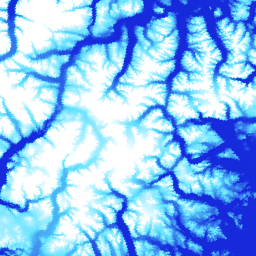
نموذج الارتفاع الرقمي في غرينلاند - مشروع رسم الخرائط في غرينلاند (GIMP)

تم إنشاء نموذج الارتفاع الرقمي (DEM) هذا من خلال الجمع بين نماذج الارتفاع الرقمي ASTER وSPOT-5 الخاصة بمحيط الصفيحة الجليدية وحافتها (أي تحت خط الارتفاع المتساوي) جنوب 82.5 درجة شمالاً تقريبًا، بالإضافة إلى قياسات الميل الضوئي AVHRR في الجزء الداخلي من الصفيحة الجليدية وأقصى الشمال (Scambos و… arctic elevation-topography gimp greenland nasa polar -
قناع الجليد والمحيط في غرينلاند - مشروع رسم خرائط غرينلاند (GIMP)

تقدّم مجموعة البيانات هذه أقنعة تصنيف كاملة للجليد الأرضي والمحيطات بدقة مكانية تبلغ 15 مترًا في الصفيحة الجليدية في غرينلاند. تمت مطابقة الغطاء الجليدي باستخدام مجموعة من الصور البانكروماتية المصححة جغرافيًا (النطاق 8) من جهاز Landsat 7 Enhanced Thematic Mapper Plus (ETM+)، والتي وزعتها هيئة المسح الجيولوجي الأمريكية (USGS)، و… arctic cryosphere gimp greenland ice nasa -
MEaSUREs Greenland Ice Velocity: Selected Glacier Site Velocity Maps from Optical Images Version 2

تتألف مجموعة البيانات هذه، وهي جزء من برنامج "إعداد سجلات بيانات نظام الأرض للاستخدام في البيئات البحثية" (MEaSUREs) التابع لوكالة ناسا، من خرائط متوسط السرعة الشهرية لمناطق مختارة من منافذ الأنهار الجليدية. يتم إنشاء الخرائط من خلال تتبُّع العناصر المرئية بين أزواج الصور الضوئية التي تم الحصول عليها بواسطة Landsat … arctic cryosphere gimp greenland ice nasa
Datasets tagged arctic in Earth Engine
[null,null,[],[],["The content details datasets from the Greenland Ice Mapping Project (GIMP) and ArcticDEM initiatives. GIMP provides a 15m resolution ice/ocean classification mask and a 2000 image mosaic of Greenland derived from Landsat 7 and RADARSAT-1. It also includes a digital elevation model (DEM) and mean monthly glacier velocity maps. ArcticDEM, a joint NGA/NSF project, offers high-resolution digital surface models (DSMs) of the Arctic, encompassing features like vegetation and buildings.\n"]]