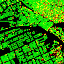
GHSL: Глобальная высота здания 2018 г. (P2023A) Этот набор пространственных растровых данных отображает глобальное распределение высот зданий с разрешением 100 м, относящееся к 2018 году. Входными данными, используемыми для прогнозирования высоты зданий, являются глобальная цифровая модель поверхности ALOS (30 м), топографическая миссия NASA Shuttle Radar… алос здание построено застроенная среда застроенная Коперник GHSL: Глобальный объем строительства 1975–2030 гг. (P2023A) Этот набор растровых данных отображает глобальное распределение объема зданий, выраженное в кубических метрах на 100-метровую ячейку сетки. Набор данных измеряет общий объем зданий и объем зданий, отнесенных к ячейкам сетки преимущественного нежилого использования (NRES). Оценки основаны на накопленном… алос строит искусственную среду Коперник дем ghsl GHSL: Глобальные характеристики расчетов (10 м), 2018 г. (P2023A) Этот набор пространственных растровых данных описывает населенные пункты с разрешением 10 м и описывает их внутренние характеристики с точки зрения функциональных и высотных компонентов застроенной среды. Более подробную информацию о продуктах данных GHSL можно найти в отчете GHSL Data Package 2023… здание построено застроенное коперник ghsl высота Открытые здания V3 Полигоны Этот крупномасштабный набор открытых данных состоит из очертаний зданий, полученных на основе спутниковых снимков с высоким разрешением 50 см. Он содержит 1,8 млрд обнаруженных зданий в Африке, Латинской Америке, Карибском бассейне, Южной Азии и Юго-Восточной Азии. Вывод охватывал площадь в 58 миллионов км². Для каждого здания в этом наборе данных… Африка Азия здание застроенные открытые здания население
Datasets tagged building in Earth Engine
[null,null,[],[[["\u003cp\u003eThis collection of datasets provides information on building footprints, heights, and volumes across the globe.\u003c/p\u003e\n"],["\u003cp\u003eThe Open Buildings V3 dataset offers high-resolution (50 cm) building outlines for regions in Africa, Latin America, Caribbean, South Asia, and Southeast Asia.\u003c/p\u003e\n"],["\u003cp\u003eThe GHSL datasets present insights into global settlement characteristics, including building heights and volumes, at varying resolutions (10 m and 100 m).\u003c/p\u003e\n"],["\u003cp\u003eBuilding height and volume data are derived from sources like ALOS, SRTM, and the GHSL built-up layer, enabling analysis of built environments worldwide.\u003c/p\u003e\n"]]],["The content describes four datasets focused on building data. One dataset, \"Open Buildings V3 Polygons,\" provides 1.8 billion building outlines derived from 50 cm satellite imagery across Africa, Latin America, the Caribbean, and South and Southeast Asia. The other three, from GHSL, provide spatial raster data describing human settlements at 10m resolution with functional and height characteristics; global building heights at 100m resolution; and global building volume from 1975-2030 in cubic meters.\n"],null,["# Datasets tagged building in Earth Engine\n\n-\n\n |-------------------------------------------------------------------------------------------------------------------------------------------------------------------------------------------------------------------------------------------------------------------------------------------------------------|\n | [### GHSL: Global building height 2018 (P2023A)](/earth-engine/datasets/catalog/JRC_GHSL_P2023A_GHS_BUILT_H) |\n | This spatial raster dataset depicts the global distribution of building heights at a resolution of 100 m, referred to the year 2018. The input data used to predict building heights are the ALOS Global Digital Surface Model (30 m), the NASA Shuttle Radar Topographic Mission ... |\n | [alos](/earth-engine/datasets/tags/alos) [building](/earth-engine/datasets/tags/building) [built](/earth-engine/datasets/tags/built) [built-environment](/earth-engine/datasets/tags/built-environment) [builtup](/earth-engine/datasets/tags/builtup) [copernicus](/earth-engine/datasets/tags/copernicus) |\n\n-\n\n |----------------------------------------------------------------------------------------------------------------------------------------------------------------------------------------------------------------------------------------------------------------------------------------------------------|\n | [### GHSL: Global building volume 1975-2030 (P2023A)](/earth-engine/datasets/catalog/JRC_GHSL_P2023A_GHS_BUILT_V) |\n | This raster dataset depicts the global distribution of building volume, expressed in cubic metres per 100 m grid cell. The dataset measures the total building volume and the building volume allocated to grid cells of predominant non-residential (NRES) use. Estimates are based on the built-up ... |\n | [alos](/earth-engine/datasets/tags/alos) [building](/earth-engine/datasets/tags/building) [built-environment](/earth-engine/datasets/tags/built-environment) [copernicus](/earth-engine/datasets/tags/copernicus) [dem](/earth-engine/datasets/tags/dem) [ghsl](/earth-engine/datasets/tags/ghsl) |\n\n-\n\n |---------------------------------------------------------------------------------------------------------------------------------------------------------------------------------------------------------------------------------------------------------------------------------------------------------------|\n | [### GHSL: Global settlement characteristics (10 m) 2018 (P2023A)](/earth-engine/datasets/catalog/JRC_GHSL_P2023A_GHS_BUILT_C) |\n | This spatial raster dataset delineates human settlements at 10 m resolution, and describes their inner characteristics in terms of the functional and height-related components of the built environment. More information about the GHSL data products can be found in the GHSL Data Package 2023 report ... |\n | [building](/earth-engine/datasets/tags/building) [built](/earth-engine/datasets/tags/built) [builtup](/earth-engine/datasets/tags/builtup) [copernicus](/earth-engine/datasets/tags/copernicus) [ghsl](/earth-engine/datasets/tags/ghsl) [height](/earth-engine/datasets/tags/height) |\n\n-\n\n |----------------------------------------------------------------------------------------------------------------------------------------------------------------------------------------------------------------------------------------------------------------------------------------------------------------|\n | [### Open Buildings V3 Polygons](/earth-engine/datasets/catalog/GOOGLE_Research_open-buildings_v3_polygons) |\n | This large-scale open dataset consists of outlines of buildings derived from high-resolution 50 cm satellite imagery. It contains 1.8B building detections in Africa, Latin America, Caribbean, South Asia and Southeast Asia. The inference spanned an area of 58M km². For each building in this dataset ... |\n | [africa](/earth-engine/datasets/tags/africa) [asia](/earth-engine/datasets/tags/asia) [building](/earth-engine/datasets/tags/building) [built-up](/earth-engine/datasets/tags/built-up) [open-buildings](/earth-engine/datasets/tags/open-buildings) [population](/earth-engine/datasets/tags/population) |"]]