-
Google Global Landsat 기반 CCDC 세그먼트 (1999~2019)
이 컬렉션에는 20년간의 Landsat 지표 반사율 데이터에 연속 변경 감지 및 분류 (CCDC) 알고리즘을 실행하여 사전 계산된 결과가 포함되어 있습니다. CCDC는 동적 RMSE 임계값이 있는 조화 피팅을 사용하여 시계열 데이터에서 중단점을 감지하는 중단점 찾기 알고리즘입니다. … change-detection google landcover landsat-derived landuse landuse-landcover -
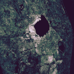
JRC 전 세계 지표수 매핑 레이어, v1.4
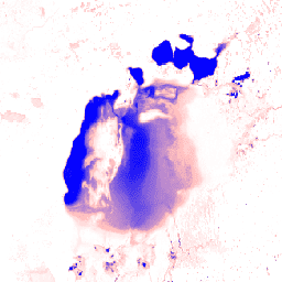
이 데이터 세트에는 1984년~2021년까지의 지표수 위치 및 시계열 분포를 보여주는 지도가 포함되어 있으며 해당 지표수의 범위와 변화에 대한 통계를 제공합니다. 자세한 내용은 관련 학술지 게재 논문인 High-resolution mapping of global surface water and its …을 참고하세요. change-detection geophysical google jrc landsat-derived surface -
MCD64A1.061 MODIS 소실 면적 월별 전 세계 500m
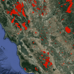
Terra 및 Aqua 결합 MCD64A1 버전 6.1 소실 면적 데이터 제품은 픽셀별 소실 면적 및 품질 정보가 포함된 월별 전 세계 그리드 500m 제품입니다. MCD64A1 소실 면적 매핑 접근 방식은 1km MODIS 활성 화재 관측과 결합된 500m MODIS 지표 반사율 이미지를 사용합니다. 알고리즘 … burn change-detection fire geophysical global mcd64a1 -
USFS Landscape Change Monitoring System v2025-11 (CONUS 및 OCONUS)

이 제품은 Landscape Change Monitoring System (LCMS) 데이터 모음의 일부입니다. 각 연도의 LCMS 모델링 변경사항, 토지 피복 또는 토지 이용 클래스를 보여주며 미국 본토 (CONUS)와 알래스카 (AK), 푸에르토 …를 비롯한 CONUS 외부 지역 (OCONUS)을 포함합니다. change-detection forest gtac landcover landuse landuse-landcover -
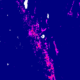
VNP64A1.002: 소실 면적 월별 L4 전 세계 500m SIN 그리드

일일 Suomi National Polar-Orbiting Partnership (Suomi NPP) NASA Visible Infrared Imaging Radiometer Suite (VIIRS) 소실 면적 (VNP64A1) 버전 2 데이터 제품은 픽셀별 소실 면적 및 품질 정보가 포함된 월별 전 세계 그리드 500m 제품입니다. VNP64 소실 면적 매핑 접근 방식은 750m VIIRS …를 사용합니다. burn change-detection fire land nasa surface -
VNP64A1: 소실 면적 월별 L4 전 세계 500m SIN 그리드
일일 Suomi National Polar-Orbiting Partnership (Suomi NPP) NASA Visible Infrared Imaging Radiometer Suite (VIIRS) 소실 면적 (VNP64A1) 버전 1 데이터 제품은 픽셀별 소실 면적 및 품질 정보가 포함된 월별 전 세계 그리드 500m 제품입니다. VNP64 소실 면적 매핑 접근 방식은 750m VIIRS …를 사용합니다. burn change-detection fire land nasa noaa
Datasets tagged change-detection in Earth Engine
[null,null,[],[],[]]