-
WWF HydroSHEDS Drainage Direction, 15 Arc-Seconds
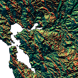
HydroSHEDS to produkt mapowy, który zawiera informacje hydrograficzne do zastosowań regionalnych i globalnych w spójnym formacie. Zawiera zestaw danych geograficznych (wektorowych i rastrowych) w różnych skalach, w tym sieci rzeczne, granice zlewni, kierunki odpływu i akumulację przepływu. HydroSHEDS opiera się na … direction drainage flow geophysical hydrography hydrology -
WWF HydroSHEDS Drainage Direction, 3 Arc-Seconds
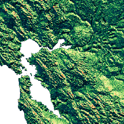
HydroSHEDS to produkt mapowy, który zawiera informacje hydrograficzne do zastosowań regionalnych i globalnych w spójnym formacie. Zawiera zestaw danych geograficznych (wektorowych i rastrowych) w różnych skalach, w tym sieci rzeczne, granice zlewni, kierunki odpływu i akumulację przepływu. HydroSHEDS opiera się na … direction drainage flow geophysical hydrography hydrology -
WWF HydroSHEDS Drainage Direction, 30 Arc-Seconds
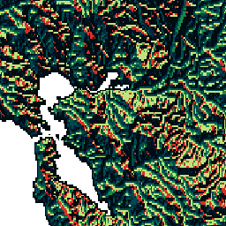
HydroSHEDS to produkt mapowy, który zawiera informacje hydrograficzne do zastosowań regionalnych i globalnych w spójnym formacie. Zawiera zestaw danych geograficznych (wektorowych i rastrowych) w różnych skalach, w tym sieci rzeczne, granice zlewni, kierunki odpływu i akumulację przepływu. HydroSHEDS opiera się na … direction drainage flow geophysical hydrography hydrology -
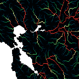
WWF HydroSHEDS Flow Accumulation, 15 sekund łuku
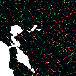
HydroSHEDS to produkt mapowy, który zawiera informacje hydrograficzne do zastosowań regionalnych i globalnych w spójnym formacie. Zawiera zestaw danych geograficznych (wektorowych i rastrowych) w różnych skalach, w tym sieci rzeczne, granice zlewni, kierunki odpływu i akumulację przepływu. HydroSHEDS opiera się na … akumulacja odpływ przepływ geofizyka hydrografia hydrologia -
WWF HydroSHEDS Flow Accumulation, 30 Arc-Seconds
HydroSHEDS to produkt mapowy, który zawiera informacje hydrograficzne do zastosowań regionalnych i globalnych w spójnym formacie. Zawiera zestaw danych geograficznych (wektorowych i rastrowych) w różnych skalach, w tym sieci rzeczne, granice zlewni, kierunki odpływu i akumulację przepływu. HydroSHEDS opiera się na … akumulacja odpływ przepływ geofizyka hydrografia hydrologia
Datasets tagged drainage in Earth Engine
[null,null,[],[],[]]