Page Summary
-
Emissivity datasets from ASTER and MERRA-2 provide valuable data for climate and geophysical research.
-
MODIS Terra and Aqua satellites offer daily, 8-day, and monthly global land surface temperature and emissivity products at various resolutions.
-
These datasets are useful for studying land surface temperature and emissivity trends and their impact on climate.
-
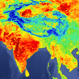
AG100: ASTER Global Emissivity Dataset 100-meter V003
The Advanced Spaceborne Thermal Emission and Reflection Radiometer Global Emissivity Database (ASTER-GED) was developed by the National Aeronautics and Space Administration's (NASA) Jet Propulsion Laboratory (JPL), California Institute of Technology. This product includes the mean emissivity and standard deviation for all 5 ASTER Thermal Infrared … aster elevation emissivity geophysical infrared jpl -
MERRA-2 M2T1NXRAD: Radiation Diagnostics V5.12.4
M2T1NXRAD (or tavg1_2d_rad_Nx) is an hourly time-averaged data collection in Modern-Era Retrospective analysis for Research and Applications version 2 (MERRA-2). This collection consists of radiation diagnostics, such as surface albedo, cloud area fraction, in cloud optical thickness, surface incoming shortwave flux (i.e. solar radiation), surface … albedo atmosphere climate emissivity merra shortwave -
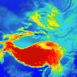
MOD11A1.061 Terra Land Surface Temperature and Emissivity Daily Global 1km

The MOD11A1 V6.1 product provides daily land surface temperature (LST) and emissivity values in a 1200 x 1200 kilometer grid. The temperature value is derived from the MOD11_L2 swath product. Above 30 degrees latitude, some pixels may have multiple observations where the criteria for clear-sky … climate daily emissivity global lst modis -
MOD11A2.061 Terra Land Surface Temperature and Emissivity 8-Day Global 1km

The MOD11A2 V6.1 product provides an average 8-day land surface temperature (LST) in a 1200 x 1200 kilometer grid. Each pixel value in MOD11A2 is a simple average of all the corresponding MOD11A1 LST pixels collected within that 8 day period. The MOD11A2 does a … 8-day climate emissivity global lst mod11a2 -
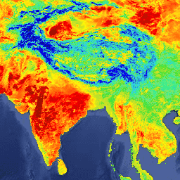
MOD21A1D.061 Terra Land Surface Temperature and 3-Band Emissivity Daily Global 1km

The MOD21A1D dataset is produced daily from daytime Level 2 Gridded (L2G) intermediate LST products at a spatial resolution of 1,000 meters. The L2G process maps the daily MOD21 swath granules onto a sinusoidal MODIS grid and stores all observations falling over a gridded cell … climate daily emissivity global lst nasa -
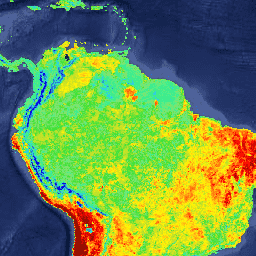
MOD21A1N.061 Terra Land Surface Temperature and 3-Band Emissivity Daily Global 1km

The MOD21A1N dataset is produced daily from nighttime Level 2 Gridded (L2G) intermediate LST products at a spatial resolution of 1,000 meters. The L2G process maps the daily MOD21 swath granules onto a sinusoidal MODIS grid and stores all observations falling over a gridded cell … climate daily emissivity global lst nasa -
MOD21C1.061 Terra Land Surface Temperature and 3-Band Emissivity Daily L3 Global 0.05 Deg CMG

The MOD21C1 dataset is produced daily in a 0.05 degree (5,600 meters at the equator) Climate Modeling Grid (CMG) from daytime Level 2 Gridded (L2G) intermediate LST products. The L2G process maps the daily MOD21 swath granules onto a sinusoidal MODIS grid and stores all … climate daily emissivity global lst nasa -
MOD21C2.061 Terra Land Surface Temperature and 3-Band Emissivity 8-Day L3 Global 0.05 Deg CMG
The MOD21C2 dataset is an 8-day composite LST product that uses an algorithm based on a simple averaging method. The algorithm calculates the average from all the cloud free MOD21A1D and MOD21A1N daily acquisitions from the 8-day period. Unlike the MOD21A1 data sets where the … climate emissivity global lst nasa surface-temperature -
MOD21C3.061 Terra Land Surface Temperature and 3-Band Emissivity Monthly L3 Global 0.05 Deg CMG

The MOD21C3 dataset is a monthly composite LST product that uses an algorithm based on a simple averaging method. The algorithm calculates the average from all the cloud free MOD21A1D and MOD21A1N daily acquisitions from the 8-day period. Unlike the MOD21A1 data sets where the … climate emissivity global lst monthly nasa -
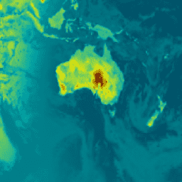
MYD11A1.061 Aqua Land Surface Temperature and Emissivity Daily Global 1km

The MYD11A1 V6.1 product provides daily land surface temperature (LST) and emissivity values in a 1200 x 1200 kilometer grid. The temperature value is derived from the MYD11_L2 swath product. Above 30 degrees latitude, some pixels may have multiple observations where the criteria for clear-sky … aqua climate daily emissivity global lst -
MYD11A2.061 Aqua Land Surface Temperature and Emissivity 8-Day Global 1km
The MYD11A2 V6.1 product provides an average 8-day land surface temperature (LST) in a 1200 x 1200 kilometer grid. Each pixel value in MYD11A2 is a simple average of all the corresponding MYD11A1 LST pixels collected within that 8 day period. The MYD11A2 does a … 8-day aqua climate emissivity global lst -
MYD21A1D.061 Aqua Land Surface Temperature and 3-Band Emissivity Daily Global 1km
The MYD21A1D dataset is produced daily from daytime Level 2 Gridded (L2G) intermediate LST products at a spatial resolution of 1,000 meters. The L2G process maps the daily MOD21 swath granules onto a sinusoidal MODIS grid and stores all observations falling over a gridded cell … aqua climate daily emissivity global lst -
MYD21A1N.061 Aqua Land Surface Temperature and 3-Band Emissivity Daily Global 1km

The MYD21A1N dataset is produced daily from nighttime Level 2 Gridded (L2G) intermediate LST products at a spatial resolution of 1,000 meters. The L2G process maps the daily MOD21 swath granules onto a sinusoidal MODIS grid and stores all observations falling over a gridded cell … aqua climate daily emissivity global lst -
MYD21C1.061 Aqua Land Surface Temperature and 3-Band Emissivity Daily L3 Global 0.05 Deg CMG

The MYD21C1 dataset is produced daily in a 0.05 degree (5,600 meters at the equator) Climate Modeling Grid (CMG) from daytime Level 2 Gridded (L2G) intermediate LST products. The L2G process maps the daily MYD21 swath granules onto a sinusoidal MODIS grid and stores all … aqua climate daily emissivity global lst -
MYD21C2.061 Aqua Land Surface Temperature and 3-Band Emissivity 8-Day L3 Global 0.05 Deg CMG

The MYD21C2 dataset is an 8-day composite LST product that uses an algorithm based on a simple averaging method. The algorithm calculates the average from all the cloud free MYD21A1D and MYD21A1N daily acquisitions from the 8-day period. Unlike the MYD21A1 data sets where the … aqua climate emissivity global lst nasa -
MYD21C3.061 Aqua Land Surface Temperature and 3-Band Emissivity Monthly L3 Global 0.05 Deg CMG

The MYD21C3 dataset is a monthly composite LST product that uses an algorithm based on a simple averaging method. The algorithm calculates the average from all the cloud free MYD21A1D and MYD21A1N daily acquisitions from the 8-day period. Unlike the MYD21A1 data sets where the … aqua climate emissivity global lst monthly