-
Dynamic World V1

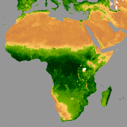
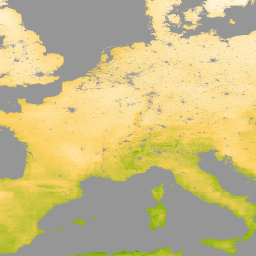
Dynamic World 是一个分辨率为 10 米的近乎实时 (NRT) 土地使用/土地覆盖 (LULC) 数据集,其中包含九个类别的类别概率和标签信息。Dynamic World 预测数据覆盖从 2015 年 6 月 27 日至今的 Sentinel-2 L1C 数据集。Sentinel-2 的重访频率为 2-5 天… global google landcover landuse landuse-landcover nrt -
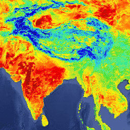
ECMWF 近实时 IFS 大气预报
此数据集包含 ECMWF 综合预报系统 (IFS) 生成的 15 天大气模型变量预报数据,分辨率为 0.25 度。我们将这些数据称为近实时 (NRT) 数据,因为在 ECMWF 实时预测数据发布后,每天会发布两次新产品,作为其… climate ecmwf 预报 全球 湿度 -
ECMWF 近实时 IFS 海浪(短截止期)预报
此数据集包含 ECMWF 综合预报系统 (IFS) 生成的 6 天海浪模型场预报数据,分辨率为 0.25 度。我们将这些数据称为近实时 (NRT) 数据,因为在 ECMWF 实时预测数据发布后,每天会发布两次新产品,作为其… 气候 ecmwf 预报 全球 海洋 -
ECMWF 近实时 IFS 海浪预报
此数据集包含 ECMWF 综合预报系统 (IFS) 生成的 15 天海浪模型场预报数据,分辨率为 0.25 度。我们将这些数据称为近实时 (NRT) 数据,因为在 ECMWF 实时预测数据发布后,每天会发布两次新产品,作为其… 气候 ecmwf 预报 全球 海洋 -
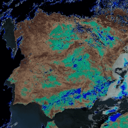
ESA WorldCereal 10 m v100

欧洲空间局 (ESA) WorldCereal 10 米 2021 年产品套件包含全球范围的年度和季节性作物地图及其相关置信度。这些数据是作为 ESA-WorldCereal 项目的一部分生成的。如需详细了解这些产品的内容以及用于…的方法,请参阅… 农业 哥白尼 农作物 欧洲航天局 全球 土地覆盖 -
ESA WorldCereal AEZ v100

欧洲航天局 (ESA) WorldCereal 分类系统的目标是在特定生长季结束后一个月内生成产品。由于全球各地生长季的动态特性,我们根据… 农业 边界 农作物 esa 全球 表格 -
ESA WorldCereal Active Cropland 10 m v100

欧洲空间局 (ESA) WorldCereal Active Cropland 10 m 2021 产品套件包含全球范围的季节性活跃耕地标记。这些数据是作为 ESA-WorldCereal 项目的一部分生成的。有效农田产品表示被识别为临时作物的像素是否已积极… 农业 哥白尼 农作物 欧洲航天局 全球 土地覆盖 -
FireCCI51:MODIS Fire_cci 烧毁面积像素产品,版本 5.1

MODIS Fire_cci 烧毁面积像素产品版本 5.1 (FireCCI51) 是一个每月更新的全球数据集,空间分辨率约为 250 米,其中包含烧毁面积信息以及辅助数据。该指数基于 MODIS 仪器在近红外 (NIR) 波段的地表反射率计算得出,… burn cci climate-change copernicus esa fire -
森林附近的人群 (FPP) 1.0

“森林附近的人口”(FPP) 数据集是促成开发森林合作伙伴关系 (CPF) 全球核心森林相关指标集 (GCS) 中指标 13“极度贫困的森林依赖人口数量”的数据层之一。FPP 数据集提供了一个… 农业 粮农组织 森林 全球 植物生产力 人口 -
GPW 草地年主导类 v1

此数据集提供 2000 年至 2022 年全球草地(人工和天然/半天然)年度主要类别地图,空间分辨率为 30 米。此地图由 Land & Carbon Lab Global Pasture Watch 计划制作,其中显示的草地范围包括任何地表覆盖类型,只要其中包含至少 … 全球 全球牧场监测 土地 土地覆盖 土地利用 土地利用和土地覆盖 -
GPW 耕地草地年概率 v1

此数据集提供 2000 年至 2022 年全球人工草地年度概率地图,空间分辨率为 30 米。此地图由 Land & Carbon Lab Global Pasture Watch 计划制作,其中显示的草地范围包括任何土地覆盖类型,这些类型至少包含 30% 的干… 全球 全球牧场监测 土地 土地覆盖 土地利用 土地利用和土地覆盖 -
GPW 天然/半天然草地的年度概率 v1

此数据集提供 2000 年至 2022 年全球天然/半天然草地年度概率地图,空间分辨率为 30 米。此地图由 Land & Carbon Lab Global Pasture Watch 计划制作,其中显示的草地范围包括任何土地覆盖类型,这些类型至少包含 30% 的干… 全球 全球牧场监测 土地 土地覆盖 土地利用 土地利用和土地覆盖 -
GPW 年短植被高度 v1

此数据集提供 2000 年以来的全球植被高度中位数,空间分辨率为 30 米。该数据集由 Land & Carbon Lab 的 Global Pasture Watch 计划生成,提供自 2000 年以来全球 30 米空间分辨率的中值植被高度值(第 50 百分位)。该数据集基于… 冠层 全球 全球牧场监测 土地 土地覆盖 植物生产力 -
GPW 年未校准初级生产总值 (uGPP) v1

此数据集提供自 2000 年以来基于 EO 的全球未校准总初级生产力,空间分辨率为 30 米。当前数据集由 Land & Carbon Lab Global Pasture Watch 计划生成,提供自 2000 年以来全球范围内的总初级生产力 (GPP) 值,空间分辨率为 30 米。GPP 值… 全球 全球牧场监测 土地 土地覆盖 土地利用 植物生产力 -
全球 ALOS CHILI(持续热能-日照负荷指数)

CHILI 是日照和地形阴影对蒸散影响的替代变量,通过计算初午时(即太阳高度相当于春分时)的日照来表示。该数据集基于 JAXA 的 ALOS DEM(在 EE 中以 JAXA/ALOS/AW3D30_V1_1 提供)的 30 米“AVE”波段。保护科学… 坡向 csp 海拔 海拔-地形 ergo 地球物理 -
全球 ALOS 地貌

ALOS 地貌数据集通过组合连续热日照负荷指数 (ALOS CHILI) 和多尺度地形位置指数 (ALOS mTPI) 数据集来创建地貌类别。该数据集基于 JAXA 的 ALOS DEM(在 EE 中以 JAXA/ALOS/AW3D30_V1_1 提供)的 30 米“AVE”波段。The Conservation … 坡向 csp 海拔 海拔-地形 ergo 地球物理 -
全球 ALOS 地形多样性

地形多样性 (D) 是一个替代变量,表示物种作为当地栖息地可获得的温度和湿度条件的多样性。它表达了这样一种逻辑:更多样的地形气候生态位应支持更高的多样性(尤其是植物),并支持物种在气候变化下的持续存在… 坡向 csp 海拔 海拔-地形 ergo 地球物理 -
全球 ALOS mTPI(多尺度地形位置指数)

mTPI 可区分山脊地形和山谷地形。它是通过从每个位置的海拔数据中减去邻域内的平均海拔来计算的。mTPI 使用半径(以公里为单位)为 115.8、89.9、35.5、13.1、5.6、2.8 和 1.2 的移动窗口。它基于 30 米分辨率的… 坡向 csp 海拔 海拔-地形 ergo 地球物理 -
全球红树林面积年变化图(1984 年至 2023 年)

CGMD-Extent30(连续全球红树林动态 - 分辨率为 30 米的年度红树林范围)数据集提供 1984 年至 2023 年的全球年度红树林范围。该数据集以单个 Earth Engine FeatureCollection 的形式分发,其中每个要素代表特定年份的红树林多边形地图。数据集… 年度 沿海 森林生物质 全球 基于 Landsat 的 土地利用和土地覆盖 -
全球红树林年均部分树冠覆盖率(1984 年至 2023 年)

此数据集提供 1984 年至 2023 年全球红树林冠层覆盖率 (FCC) 的年度数据,空间分辨率为 30 米,可用于大规模分析长期红树林动态,包括冠层退化和恢复、蓝碳评估和沿海生态系统监测。FCC 可量化每个陆地卫星… 年度 沿海 森林生物质 全球 基于 Landsat 的 红树林 -
全球红树林分布,v1 (2000)

该数据库是使用 2000 年的 Landsat 卫星数据准备的。使用混合监督式和非监督式数字图像分类技术对从 USGS 地球资源观测和科学中心 (EROS) 获取的 1,000 多个 Landsat 场景进行了分类。此数据库是第一个也是最… 年度 CIESIN 森林生物质 全球 Landsat 衍生数据 红树林 -
全球油棕种植园地图

该数据集是 2019 年全球工业和小农户油棕榈地图,分辨率为 10 米。它涵盖了检测到油棕榈种植园的区域。分类后的图片是基于 Sentinel-1 和 Sentinel-2 半年合成数据的卷积神经网络的输出。如需了解更多…,请参阅相关文章 农业 生物多样性 保护 作物 全球 土地利用 -
全球 SRTM CHILI(连续热能-日照负荷指数)

CHILI 是日照和地形阴影对蒸散影响的替代变量,通过计算初午时(即太阳高度相当于春分时)的日照来表示。它基于 30 米 SRTM DEM(在 EE 中以 USGS/SRTMGL1_003 的形式提供)。Conservation Science Partners (CSP) Ecologically Relevant … 坡向 csp 海拔 海拔-地形 ergo 地球物理 -
全球 SRTM 地貌

SRTM 地貌数据集提供通过组合连续热日照负荷指数 (SRTM CHILI) 和多尺度地形位置指数 (SRTM mTPI) 数据集创建的地貌类别。它基于 30 米 SRTM DEM(在 EE 中以 USGS/SRTMGL1_003 的形式提供)。The Conservation Science Partners (CSP) Ecologically … 坡向 csp 海拔 海拔-地形 ergo 地球物理 -
全球 SRTM 地形多样性

地形多样性 (D) 是一个替代变量,表示物种作为当地栖息地可获得的温度和湿度条件的多样性。它表达了这样一种逻辑:更多样的地形气候生态位应支持更高的多样性(尤其是植物),并支持物种在气候变化下的持续存在… 坡向 csp 海拔 海拔-地形 ergo 地球物理 -
全球 SRTM mTPI(多尺度地形位置指数)

mTPI 可区分山脊地形和山谷地形。它是通过从每个位置的海拔数据中减去邻域内的平均海拔来计算的。mTPI 使用半径(以公里为单位)为 115.8、89.9、35.5、13.1、5.6、2.8 和 1.2 的移动窗口。它基于 30 米分辨率的… 坡向 csp 海拔 海拔-地形 ergo 地球物理 -
IUCN 全球生态系统类型学第 3 级:1.0
全球生态系统类型学是一种基于生态系统独特特征的生态系统分类法。它是一个全球分类系统,可为描述和分类生态系统提供一致的框架。全球生态系统类型学有六个级别。前三个级别(界、功能性生物群系、… 生态系统 生态系统 全球 表格 -
Landsat 全球陆地调查 1975 年

全球陆地调查 (GLS) 1975 是 Landsat 多光谱扫描仪 (MSS) 拍摄的全球图像集合。大多数场景都是在 1972 年至 1983 年间由 Landsat 1-3 拍摄的。Landsat 1-3 数据中的一些缺口已通过 Landsat 4-5 在 … 期间获取的场景进行填补 全球 gls 陆地卫星 辐射 卫星图像 usgs -
MCD12Q2.006 土地覆盖动态年度全球 500 米

Terra 和 Aqua 卫星组合的中等分辨率成像光谱辐射计 (MODIS) 土地覆盖动态 (MCD12Q2) 版本 6.1 数据产品以年为间隔提供全球地表物候指标。MCD12Q2 版本 6.1 数据产品源自双波段增强型植被指数 (EVI2) 的时间序列… EVI 全球 土地利用和土地覆盖 MODIS 绿度起始 物候 -
MCD15A3H.061 MODIS 叶面积指数/FPAR 4 天全球 500 米

MCD15A3H 版本 6.1 中等分辨率成像光谱辐射计 (MODIS) 4 级产品,即组合的光合有效辐射吸收比 (FPAR) 和叶面积指数 (LAI) 产品,是一个 4 天合成数据集,像素大小为 500 米。该算法会从所有…中选择最佳像素 fpar global lai modis nasa plant-productivity -
MCD19A1.061:陆地表面 BRF 每日 L2G 全球 500 米和 1 公里

MCD19A1 版本 6.1 数据产品是中等分辨率成像光谱辐射计 (MODIS) Terra 和 Aqua 组合地表双向反射率因子 (BRF) 格网化 2 级产品,以 500 米和 1 千米分辨率每日生成。如需了解详情,请参阅 MAIAC 用户指南。 气溶胶 aod aqua 每日 全球 maiac -
MCD19A2.061:Terra 和 Aqua MAIAC 陆地气溶胶光学深度(每日 1 公里)

MCD19A2 V6.1 数据产品是 MODIS Terra 和 Aqua 组合的多角度大气校正 (MAIAC) 陆地气溶胶光学厚度 (AOD) 格网 2 级产品,以 1 公里分辨率每日生成。如需了解详情,请参阅 MAIAC 用户指南。注意:此产品具有… 气溶胶 aod aqua 大气 每日 全球 -
MCD43A1.061 MODIS BRDF-Albedo 模型参数 每日 500 米

MCD43A1 V6.1 双向反射率分布函数和反照率 (BRDF/Albedo) 模型形参数据集是一种 500 米分辨率的每日 16 天产品。儒略日表示 16 天反演周期的第 9 天,因此观测结果会加权,以估计当天的 BRDF/反照率。… 反照率 brdf 每日 全球 modis nasa -
MCD43A2.061 MODIS BRDF-Albedo 质量每日 500 米

MCD43A2 V6.1 双向反射率分布函数和反照率 (BRDF/Albedo) 质量数据集是一种 500 米分辨率的每日 16 天产品。它包含相应 16 天 MCD43A3 反照率和 MCD43A4 天顶 BRDF (NBAR) 产品的所有质量信息。MCD43A2 包含各个波段的质量和观测数据… 反照率 brdf 每日 全球 modis nasa -
MCD43A3.061 MODIS 反照率每日 500 米

MCD43A3 V6.1 反照率模型数据集是一种每日 16 天的产品。它为每个 MODIS 地表反射率波段(波段 1 至波段 7)以及 3 个宽光谱波段提供方向半球反射率(黑空反照率)和双半球反射率(白空反照率)… albedo black-sky daily global modis nasa -
MCD43A4.061 MODIS 天底 BRDF 调整后的反射率每日 500 米

MCD43A4 V6.1 天底双向反射率分布函数调整后的反射率 (NBAR) 产品提供 MODIS“陆地”波段 1-7 的 500 米反射率数据。这些值会使用双向反射率分布函数进行调整,以模拟从天底视角收集的值。… 反照率 brdf 每日 全球 modis nasa -
MCD43C3.061 BRDF/反照率每日 L3 0.05 度 CMG

MCD43C3 版本 6.1 双向反射率分布函数和反照率 (BRDF/Albedo) 反照率数据集采用 Terra 和 Aqua 卫星 MODIS 16 天观测数据,基于 0.05 度(赤道处约 5,600 米)气候模拟网格 (CMG) 每日生成。数据在时间维度上加权至反演周期的第 9 天… 反照率 晴空 双向反射率分布函数 (BRDF) 每日 全球 MODIS -
MCD64A1.061 MODIS 烧毁区域月度全球 500 米

Terra 和 Aqua 组合的 MCD64A1 版本 6.1 烧毁面积数据产品是一种每月更新的全球网格化 500 米产品,包含每个像素的烧毁面积和质量信息。MCD64A1 烧毁区域测绘方法采用 500 米 MODIS 地表反射率影像,并结合 1 公里 MODIS 火点观测数据。该算法… burn change-detection fire geophysical global mcd64a1 -
MOD08_M3.061 Terra 大气月度全球产品

MOD08_M3 V6.1 是一种大气全球产品,包含大气参数的月度 1x1 度网格平均值。这些参数与大气气溶胶粒子属性、总臭氧负荷、大气水汽、云光学和物理属性以及大气稳定性指数有关。… 大气 气候 地球物理 全球 modis 月度 -
MOD09A1.061 Terra 地表反射率 8 天全球 500 米
MOD09A1 V6.1 产品提供 Terra MODIS 波段 1-7 在 500 米分辨率下的地表光谱反射率估计值,并针对气体、气溶胶和瑞利散射等大气条件进行了校正。除了七个反射率波段外,还有质量层和四个观测… 8 天 全球 modis nasa satellite-imagery sr -
MOD09GA.061 Terra 地表反射率每日全球 1 公里和 500 米

MODIS 地表反射率产品可提供地表光谱反射率的估计值,该值是在没有大气散射或吸收的情况下于地面测得的。低级别数据已针对大气气体和气溶胶进行校正。MOD09GA 版本 6.1 以 … 格式提供波段 1-7。 daily global modis nasa satellite-imagery sr -
MOD09GQ.061 Terra 地表反射率每日全球 250 米
MODIS 地表反射率产品可提供地表光谱反射率的估计值,该值是在没有大气散射或吸收的情况下于地面测得的。低级别数据已针对大气气体和气溶胶进行校正。MOD09GQ 版本 6.1 提供波段 1 和 … daily global modis nasa satellite-imagery sr -
MOD09Q1.061 Terra 地表反射率 8 天全球 250 米
MOD09Q1 产品提供 250 米分辨率下波段 1 和 2 的地表光谱反射率估计值,并针对气体、气溶胶和瑞利散射等大气条件进行了校正。除了这两个反射率波段,还包括一个质量层。对于每个… 8 天 全球 mod09q1 modis nasa 卫星图像 -
MOD10A1.061 Terra Snow Cover Daily Global 500m

MOD10A1 V6.1 积雪每日全球 500 米产品包含积雪、积雪反照率、部分积雪和质量评估 (QA) 数据。积雪覆盖率数据基于一种积雪测绘算法,该算法采用归一化差异积雪指数 (NDSI) 和其他标准测试。常规… albedo cryosphere daily geophysical global modis -
MOD10A2.061 Terra 雪盖 8 天 L3 全球 500 米

MOD10A2 是 Terra 卫星上 MODIS 提供的积雪覆盖率数据集。该数据集报告了 8 天内最大积雪范围,分辨率为 500 米。之所以选择 8 天的合成周期,是因为这是精确的地面轨道重复周期… 冰冻圈 每日 地球物理 全球 modis nasa -
MOD11A1.061 Terra 地表温度与发射率每日全球 1 公里

MOD11A1 V6.1 产品以 1200 x 1200 公里网格提供每日地表温度 (LST) 和发射率值。温度值源自 MOD11_L2 观测带产品。在 30 度纬度以上,部分像素可能有多项观测结果,其中晴空条件… climate daily emissivity global lst modis -
MOD11A2.061 Terra 地表温度与发射率 8 天全球 1 公里

MOD11A2 V6.1 产品以 1200 x 1200 公里网格提供平均 8 天地表温度 (LST)。MOD11A2 中的每个像素值都是相应 8 天时间段内收集的所有相应 MOD11A1 LST 像素的简单平均值。MOD11A2 会执行… 8 天 气候 发射率 全球 lst mod11a2 -
MOD13A1.061 Terra Vegetation Indices 16-Day Global 500m

MOD13A1 V6.1 产品以像素为基础提供植被指数 (VI) 值。主要有两层植被。第一个是归一化差值植生指数 (NDVI),它被称为现有美国国家海洋和大气管理局 (NOAA) … 16-day evi global modis nasa ndvi -
MOD13A2.061 Terra Vegetation Indices 16-Day Global 1km

MOD13A2 V6.1 产品提供两种植被指数 (VI):归一化差值植被指数 (NDVI) 和增强型植被指数 (EVI)。NDVI 被称为连续性指数,可与现有的美国国家海洋和大气管理局-高级甚高分辨率辐射计 (NOAA-AVHRR) 派生的 NDVI 进行比较。… 16-day evi global modis nasa ndvi -
MOD13A3.061 Vegetation Indices Monthly L3 Global 1 km SIN Grid

MOD13A3 V6.1 产品数据以 1 公里 (km) 的空间分辨率按月提供。在生成此月度产品时,算法会纳入与相应月份重叠的所有 MOD13A2 产品,并采用加权时间平均值。植被指数用于在全球范围内监测植被… evi global modis monthly nasa ndvi -
MOD13C1.061:Terra 植被指数 16 天 L3 全球 0.05 度气候模型网格

Terra 中等分辨率成像光谱辐射计 (MODIS) 植被指数 16 天 (MOD13C1) 版本 6.1 产品以每像素为基础提供植被指数 (VI) 值。主要有两层植被。第一个是归一化差值植被指数 (NDVI),它与…保持连续性 16 天 全球 nasa terra usgs 植被 -
MOD13Q1.061 Terra Vegetation Indices 16-Day Global 250m

MOD13Q1 V6.1 产品以像素为单位提供植被指数 (VI) 值。主要有两层植被。第一个是归一化差值植生指数 (NDVI),它被称为现有美国国家海洋和大气管理局 (NOAA) … 16-day evi global modis nasa ndvi -
MOD14A1.061:Terra 热异常和火灾每日全球 1 公里

MOD14A1 V6.1 数据集提供每日 1 公里分辨率的火灾掩膜合成数据,这些数据源自 MODIS 4 微米和 11 微米辐射亮度。火灾检测策略基于对火灾的绝对检测(当火势足以检测到时)以及相对于…的检测。 daily fire global modis nasa terra -
MOD14A2.061:Terra 热异常与火灾 8 天全球 1 公里

MOD14A2 V6.1 数据集以 1 公里分辨率提供 8 天的火灾掩膜合成数据。它包含合成期内各个像素类的最大值。除了火点掩模之外,系统还会提供相关联的质量信息层。文档:用户指南 - 算法理论基础… 8 天 火灾 全球 modis nasa terra -
MOD15A2H.061:Terra 叶面积指数/FPAR 8 天全球 500 米

MOD15A2H V6.1 MODIS 组合叶面积指数 (LAI) 和光合有效辐射吸收比 (FPAR) 产品是一个 8 天合成数据集,分辨率为 500 米。该算法会从 Terra 传感器在 8 天内采集的所有图像中选择“最佳”像素。… 8 天 fpar 全球 lai modis nasa -
MOD16A2.061:Terra 净蒸发蒸腾量 8 天全球 500 米

MOD16A2 第 6.1 版蒸散量/潜热通量产品是一种 8 天合成产品,以 500 米像素分辨率生成。MOD16 数据产品集合所用的算法基于 Penman-Monteith 方程的逻辑,其中包括每日气象再分析数据输入… 8 天 蒸发蒸腾 全球 mod16a2 modis nasa -
MOD16A2:MODIS 全球陆地蒸散量 8 天全球 1 公里

MOD16A2 V105 产品提供有关 8 天全球陆地蒸散的信息,像素分辨率为 1 公里。蒸发蒸腾 (ET) 是指从地球表面到大气层的蒸发量和植物蒸腾量之和。借助长期 ET 数据,可以评估气候、土地利用和… 8 天 蒸发蒸腾 全球 mod16a2 modis 水汽 -
MOD16A2GF.061:Terra 净蒸发蒸腾量(已填补缺口)8 天全球 500 米

Terra 中等分辨率成像光谱辐射计 (MODIS) MOD16A2GF 版本 6.1 蒸发蒸腾/潜热通量 (ET/LE) 产品是一种年终间隙填充的 8 天合成数据集,以 500 米 (m) 像素分辨率生成。用于 MOD16 数据产品集合的算法基于以下逻辑… 8 天 蒸发蒸腾 全球 modis nasa 水汽 -
MOD17A2H.061:Terra 总初级生产力 8 天全球 500 米

MOD17A2H V6.1 总初级生产力 (GPP) 产品是累积的 8 天合成产品,像素大小为 500 米。该产品基于辐射利用效率概念,可作为数据模型的输入,用于计算陆地能量、碳、水循环过程等。 8 天 全球 gpp modis nasa 光合作用 -
MOD17A2HGF.061:Terra 总初级生产力 8 天全球 500 米

MOD17A2HGF 版本 6.1 总初级生产力 (GPP) 产品是基于辐射利用效率概念的累积 8 天合成值,像素大小为 500 米 (m),可潜在用作数据模型的输入来计算陆地能量、碳、水… 8 天 全球 gpp modis nasa 光合作用 -
MOD17A3HGF.061:Terra 净初级生产力(间隙填充)年度全球 500 米
MOD17A3HGF V6.1 产品提供 500 米像素分辨率的年总初级生产力和净初级生产力(GPP 和 NPP)信息。年度 NPP 是根据指定年份的所有 8 天净光合作用(PSN) 产品 (MOD17A2H) 的总和计算得出的。PSN 值是 … 的差值 global gpp nasa npp photosynthesis plant-productivity -
MOD21A1D.061 Terra 地表温度和 3 波段发射率每日全球 1 公里

MOD21A1D 数据集每天由白天 2 级格网 (L2G) 中间 LST 产品生成,空间分辨率为 1,000 米。L2G 流程可将每日 MOD21 轨道分片数据映射到正弦 MODIS 网格,并存储落在网格单元格中的所有观测结果… climate daily emissivity global lst nasa -
MOD21A1N.061 Terra 地表温度和 3 波段发射率每日全球 1 公里

MOD21A1N 数据集每天由夜间 2 级格网 (L2G) 中间 LST 产品生成,空间分辨率为 1,000 米。L2G 流程可将每日 MOD21 轨道分片数据映射到正弦 MODIS 网格,并存储落在网格单元格中的所有观测结果… climate daily emissivity global lst nasa -
MOD21C1.061 Terra 地表温度和 3 波段发射率每日 L3 全球 0.05 度 CMG

MOD21C1 数据集基于白天 2 级格网 (L2G) 中间 LST 产品,采用 0.05 度(赤道处约 5,600 米)气候模拟网格 (CMG) 每日生成。L2G 流程可将每日 MOD21 轨道分片数据映射到正弦 MODIS 网格,并存储所有… climate daily emissivity global lst nasa -
MOD21C2.061 Terra 地表温度和 3 波段发射率 8 天 L3 全球 0.05 度 CMG

MOD21C2 数据集是一种 8 天合成 LST 产品,它使用基于简单平均方法的算法。该算法会计算 8 天内所有无云 MOD21A1D 和 MOD21A1N 每日采集数据的平均值。与 MOD21A1 数据集不同,… climate emissivity global lst nasa surface-temperature -
MOD21C3.061 Terra 地表温度和 3 波段发射率月度 L3 全球 0.05 度 CMG
MOD21C3 数据集是一种月度合成 LST 产品,它使用基于简单平均方法的算法。该算法会计算 8 天内所有无云 MOD21A1D 和 MOD21A1N 每日采集数据的平均值。与 MOD21A1 数据集不同,… climate emissivity global lst monthly nasa -
MOD44B.061 Terra 植被连续场年度全球 250 米

Terra MODIS 植被连续场 (VCF) 产品是全球地表植被覆盖估计值的亚像素级表示。该模型旨在以基本植被特征的比例来连续表示地球陆地表面,它提供了三种地表覆盖成分的梯度:树木覆盖率百分比、… 年度 地球物理 全球 土地利用和土地覆盖 MODIS NASA -
MODOCGA.006 Terra 海洋反射率每日全球 1 公里
MODOCGA V6 海洋反射率产品包含来自 Terra MODIS 波段 8-16 的 1 公里反射率数据。该产品被称为海洋反射率,因为波段 8-16 主要用于生成海洋产品,但由于图块…,因此该产品并非海洋产品 daily global modis nasa oceans reflectance -
MYD08_M3.061 Aqua 大气月度全球产品

MYD08_M3 V6.1 是一种大气全球产品,包含大气形参的月度 1x1 度网格平均值。这些参数与大气气溶胶粒子属性、总臭氧负荷、大气水汽、云光学和物理属性以及大气稳定性指数有关。… aqua 大气 气候 地球物理 全球 modis -
MYD09A1.061 Aqua 地表反射率 8 天全球 500 米

MYD09A1 V6.1 产品提供 Aqua MODIS 波段 1-7 在 500 米分辨率下的地表光谱反射率估计值,并针对气体、气溶胶和瑞利散射等大气条件进行了校正。除了七个反射率波段外,还有质量层和四个观测… 8 天 aqua 全球 modis nasa 卫星图像 -
MYD09GA.061 Aqua 地表反射率每日全球 1 公里和 500 米
MODIS 地表反射率产品可提供地表光谱反射率的估计值,该值是在没有大气散射或吸收的情况下于地面测得的。低级别数据已针对大气气体和气溶胶进行校正。MYD09GA 版本 6.1 以 … 格式提供波段 1-7。 aqua daily global modis nasa satellite-imagery -
MYD09GQ.061 Aqua 地表反射率每日全球 250 米

MODIS 地表反射率产品可提供地表光谱反射率的估计值,该值是在没有大气散射或吸收的情况下于地面测得的。低级别数据已针对大气气体和气溶胶进行校正。MYD09GQ 版本 6.1 提供波段 1 和 … aqua daily global modis nasa satellite-imagery -
MYD09Q1.061 Aqua 地表反射率 8 天全球 250 米

MYD09Q1 产品提供 250 米分辨率下波段 1 和 2 的地表光谱反射率估计值,并针对气体、气溶胶和瑞利散射等大气条件进行了校正。除了这两个反射率波段,还包括一个质量层。对于每个… 8 天 aqua 全球 modis nasa 卫星图像 -
MYD10A1.061 Aqua 积雪每日全球 500 米

MYD10A1 V6 积雪每日全球 500 米产品包含积雪、积雪反照率、积雪覆盖率和质量评估 (QA) 数据。积雪覆盖率数据基于一种积雪测绘算法,该算法采用归一化差异积雪指数 (NDSI) 和其他标准测试。常规… albedo aqua cryosphere daily geophysical global -
MYD11A1.061 Aqua 地表温度与发射率每日全球 1 公里

MYD11A1 V6.1 产品以 1200 x 1200 公里网格提供每日地表温度 (LST) 和发射率值。温度值源自 MYD11_L2 扫描带产品。在 30 度纬度以上,部分像素可能有多项观测结果,其中晴空条件… aqua climate daily emissivity global lst -
MYD11A2.061 Aqua 地表温度与发射率 8 天全球 1 公里
MYD11A2 V6.1 产品以 1200 x 1200 公里网格提供平均 8 天地表温度 (LST)。MYD11A2 中的每个像素值都是相应 MYD11A1 LST 像素在相应 8 天内收集的所有值的简单平均值。MYD11A2 可执行… 8 天 aqua climate emissivity global lst -
MYD13A1.061 Aqua Vegetation Indices 16-Day Global 500m

MYD13A1 V6.1 产品以每个像素为基础提供植被指数 (VI) 值。主要有两层植被。第一个是归一化差值植生指数 (NDVI),它被称为现有美国国家海洋和大气管理局 (NOAA) … 16-day aqua evi global modis nasa -
MYD13A2.061 Aqua Vegetation Indices 16-Day Global 1km

MYD13A2 V6.1 产品提供两种植被指数 (VI):归一化差值植被指数 (NDVI) 和增强型植被指数 (EVI)。NDVI 被称为连续性指数,可与现有的美国国家海洋和大气管理局-高级甚高分辨率辐射计 (NOAA-AVHRR) 派生的 NDVI 进行比较。… 16-day aqua evi global modis nasa -
MYD13A3.061 Aqua Vegetation Indices Monthly L3 Global 1 km SIN Grid
Aqua 中等分辨率成像光谱辐射计 (MODIS) 植被指数 (MYD13A3) 版本 6.1 数据以正弦投影网格化 3 级产品的形式按月提供,空间分辨率为 1 公里 (km)。在生成此月度产品时,该算法会提取所有 MYD13A2 产品,这些产品… aqua evi global modis monthly nasa -
MYD13C1.061:Aqua 植被指数 16 天 L3 全球 0.05 度 CMG

Aqua 中等分辨率成像光谱辐射计 (MODIS) 植被指数 16 天 (MYD13C1) 版本 6.1 产品以像素为单位提供植被指数 (VI) 值。主要有两层植被。第一个是归一化差值植被指数 (NDVI),它与…保持连续性 16 天 aqua 全球 nasa usgs 植被 -
MYD13Q1.061 Aqua Vegetation Indices 16-Day Global 250m

MYD13Q1 V6.1 产品以每个像素为基础提供植被指数 (VI) 值。主要有两层植被。第一个是归一化差值植生指数 (NDVI),它被称为现有美国国家海洋和大气管理局 (NOAA) … 16-day aqua evi global modis nasa -
MYD14A1.061:Aqua 热异常和火灾每日全球 1 公里

MYD14A1 V6.1 数据集提供每日火灾掩膜合成数据,分辨率为 1 公里,基于 MODIS 4 微米和 11 微米辐射率得出。火灾检测策略基于对火灾的绝对检测(当火势足以检测到时)以及相对于…的检测。 aqua daily fire global modis nasa -
MYD14A2.061:Aqua 热异常与火灾 8 天全球 1 公里

MYD14A2 V6.1 数据集以 1 公里分辨率提供 8 天的火灾掩码合成数据。它包含合成期内各个像素类的最大值。除了火点掩模之外,系统还会提供相关联的质量信息层。文档:用户指南 - 算法理论基础… 8 天 aqua fire global modis nasa -
MYD15A2H.061:Aqua 叶面积指数/FPAR 8 天全球 500 米

MYD15A2H V6.1 MODIS 组合叶面积指数 (LAI) 和光合有效辐射吸收比 (FPAR) 产品是一个 8 天合成数据集,分辨率为 500 米。该算法会从 Aqua 传感器在 8 天内采集的所有像素中选择“最佳”像素。… 8 天 aqua fpar global lai modis -
MYD16A2.061:Aqua 净蒸发量 8 天 L4 全球 500 米 SIN 网格 V061
MYD16A2 版本 6.1 蒸散/潜热通量产品是一种 8 天合成产品,像素分辨率为 500 米。用于 MOD16 数据产品集合的算法基于 Penman-Monteith 方程的逻辑,其中包括每日气象再分析数据输入以及… 8 天 蒸发蒸腾 全球 modis nasa 水汽 -
MYD17A2H.061:Aqua 总初级生产力 8 天全球 500 米

MYD17A2H V6.1 总初级生产力 (GPP) 产品是累积的 8 天合成产品,分辨率为 500 米。该产品基于辐射利用效率概念,可潜在用作数据模型的输入,以计算陆地能量、碳、水循环过程,以及… 8 天 aqua global gpp modis nasa -
MYD17A3HGF.061:Aqua 净初级生产量缺口填充年度全球 500 米

MYD17A3HGF V6.1 产品提供有关年总初级生产力 (GPP) 和净初级生产力 (NPP) 的信息,分辨率为 500 米。年 NPP 是根据指定年份的所有 8 天净光合作用(PSN) 产品 (MYD17A2H) 的总和得出的。PSN 值是 … 的差值 aqua global gpp nasa npp photosynthesis -
MYD21A1D.061 Aqua 地表温度和 3 波段发射率每日全球 1 公里

MYD21A1D 数据集每天由白天 2 级格网 (L2G) 中间 LST 产品生成,空间分辨率为 1,000 米。L2G 流程可将每日 MOD21 轨道分片数据映射到正弦 MODIS 网格,并存储落在网格单元格中的所有观测结果… aqua climate daily emissivity global lst -
MYD21A1N.061 Aqua 地表温度和 3 波段发射率每日全球 1 公里

MYD21A1N 数据集每天由夜间 2 级格网 (L2G) 中间 LST 产品生成,空间分辨率为 1,000 米。L2G 流程可将每日 MOD21 轨道分片数据映射到正弦 MODIS 网格,并存储落在网格单元格中的所有观测结果… aqua climate daily emissivity global lst -
MYD21C1.061 Aqua 地表温度和 3 波段发射率每日 L3 全球 0.05 度 CMG

MYD21C1 数据集基于白天 2 级格网 (L2G) 中间 LST 产品,采用 0.05 度(赤道处约 5,600 米)气候模拟网格 (CMG) 每日生成。L2G 流程可将每日 MYD21 轨道分片数据映射到正弦 MODIS 网格,并存储所有… aqua climate daily emissivity global lst -
MYD21C2.061 Aqua 地表温度和 3 波段发射率 8 天 L3 全球 0.05 度 CMG

MYD21C2 数据集是一种 8 天合成 LST 产品,它使用基于简单平均方法的算法。该算法会计算 8 天内所有无云 MYD21A1D 和 MYD21A1N 每日采集的平均值。与 MYD21A1 数据集不同,… aqua climate emissivity global lst nasa -
MYD21C3.061 Aqua 地表温度和 3 波段发射率月度 L3 全球 0.05 度 CMG

MYD21C3 数据集是一种月度合成 LST 产品,它使用基于简单平均方法的算法。该算法会计算 8 天内所有无云 MYD21A1D 和 MYD21A1N 每日采集的平均值。与 MYD21A1 数据集不同,… aqua climate emissivity global lst monthly -
MYDOCGA.006 Aqua 海洋反射率每日全球 1 公里

MYDOCGA V6 海洋反射率产品包含来自 Aqua MODIS 波段 8-16 的 1 公里反射率数据。该产品被称为海洋反射率,因为波段 8-16 主要用于生成海洋产品,但由于图块…,因此该产品并非海洋产品 aqua daily global modis nasa oceans -
Overture Maps - Places:地点

Overture Maps Places 主题包含超过 6,400 万个现实世界实体的点表示形式,包括商家、学校、医院、宗教组织、地标、山峰等等。每条地点记录都包含位置坐标、名称、类别、联系信息(网站、社交媒体、电子邮件地址、电话号码)、品牌信息、地址,以及… 全球 基础设施边界 地图 人口 发布商数据集 城市 -
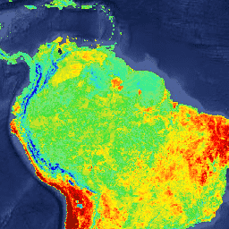
原始湿润热带森林

原生湿热带森林可提供众多全球生态系统服务,但仍面临因经济因素而持续遭到砍伐的威胁。为了促进国家土地利用规划,并平衡经济发展和维护生态系统服务的目标,我们创建了一张主要的热带湿润森林地图… 森林 森林生物质 全球 Landsat 衍生 UMD -
RESOLVE 生态区 2017 年
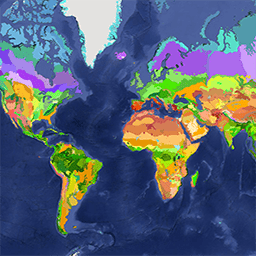
RESOLVE 生态区域数据集于 2017 年更新,其中描绘了代表我们这个生机勃勃的星球的 846 个陆地生态区域。您可以在 https://ecoregions2017.appspot.com/ 或 Earth Engine 中查看样式化地图。从最简单的定义来看,生态区域是指具有区域范围的生态系统。具体而言,生态区代表着不同的组合… 生物多样性 保护 生态区 生态系统 全球 表格 -
SPEIbase:标准化降水蒸散指数数据库,版本 2.11

全球 SPEI 数据库 (SPEIbase) 提供有关全球干旱情况的长期可靠信息,像素大小为 0.5 度,频率为每月一次。它提供 1 到 48 个月的 SPEI 时间尺度。标准化降水蒸散指数 (SPEI) 以标准化变量的形式表示… climate climate-change drought evapotranspiration global monthly -
卫星嵌入 V1
Google Satellite Embedding 数据集是一个全球性的、随时可供分析的地理空间嵌入内容集合。此数据集中的每个 10 米像素都是一个 64 维表示形式(或“嵌入向量”),用于对该像素及其周围的地表状况的时间轨迹进行编码,这些轨迹是通过各种地球观测… annual global google landsat-derived satellite-imagery sentinel1-derived -
TerraClimate:全球陆地表面的月度气候和气候水平衡,爱达荷大学

TerraClimate 是一个数据集,其中包含全球陆地表面的月度气候和气候水文平衡数据。它使用气候辅助插值,将 WorldClim 数据集中的高空间分辨率气候平均值与 CRU Ts4.0 和日本 55 年再分析 (JRA55) 中的较低空间分辨率但随时间变化的数据相结合。… 气候 干旱 蒸发蒸腾 地球物理 全球 梅赛德 -
树木邻近人口 (TPP) 1.0

“Tree Proximate People”(TPP) 是有助于开发森林合作伙伴关系 (CPF) 全球核心森林相关指标集 (GCS) 中指标 13(极度贫困的森林依赖人口数量)的数据集之一。TPP 数据集提供了 4 种不同的估计值… 农业 粮农组织 森林 全球 植物生产力 人口 -
USGS Landsat 1 MSS Collection 2 Tier 1 原始场景

Landsat 1 MSS Collection 2 Tier 1 DN 值,表示经过缩放和校正的传感器处辐射率。数据质量最高的 Landsat 场景会放入第 1 级,并被认为适合进行时间序列处理分析。第 1 级包括经过 L1TP 处理的数据,这些数据… c2 global l1 landsat lm1 mss -
USGS Landsat 1 MSS Collection 2 Tier 2 原始场景

Landsat 1 MSS Collection 2 Tier 2 DN 值,表示经过缩放、校准的传感器处辐射亮度。在处理过程中,不符合第 1 层级条件的场景会被分配到第 2 层级。这包括系统地形 (L1GT) 和系统 (L1GS) 处理后的场景,以及任何执行以下操作的 L1TP 场景: c2 global l1 landsat lm1 mss -
USGS Landsat 2 MSS Collection 2 Tier 1 原始场景

Landsat 2 MSS Collection 2 Tier 1 DN 值,表示经过缩放、校准的传感器处辐射亮度。数据质量最高的 Landsat 场景会放入第 1 级,并被认为适合进行时间序列处理分析。第 1 级包括经过 L1TP 处理的数据,这些数据… c2 global l2 landsat lm2 mss -
USGS Landsat 2 MSS Collection 2 Tier 2 原始场景

Landsat 2 MSS Collection 2 Tier 2 DN 值,表示经过缩放和校准的传感器处辐射亮度。在处理过程中,不符合第 1 层级条件的场景会被分配到第 2 层级。这包括系统地形 (L1GT) 和系统 (L1GS) 处理后的场景,以及任何执行以下操作的 L1TP 场景: c2 global l2 landsat lm2 mss -
USGS Landsat 3 MSS Collection 2 Tier 1 原始场景

Landsat 3 MSS Collection 2 Tier 1 DN 值,表示经过缩放和校准的传感器处辐射亮度。数据质量最高的 Landsat 场景会放入第 1 级,并被认为适合进行时间序列处理分析。第 1 级包括经过 L1TP 处理的数据,这些数据… c2 全球 l3 陆地卫星 lm3 mss -
USGS Landsat 3 MSS Collection 2 Tier 2 原始场景

Landsat 3 MSS Collection 2 Tier 2 DN 值,表示经过缩放和校准的传感器处辐射亮度。在处理过程中,不符合第 1 层级条件的场景会被分配到第 2 层级。这包括系统地形 (L1GT) 和系统 (L1GS) 处理后的场景,以及任何执行以下操作的 L1TP 场景: c2 全球 l3 陆地卫星 lm3 mss -
USGS Landsat 4 Level 2,Collection 2,Tier 1

此数据集包含由 Landsat TM 传感器生成的数据得出的经过大气校正的地表反射率和地表温度。这些影像包含 4 个可见光和近红外 (VNIR) 波段以及 2 个经过处理的短波红外 (SWIR) 波段(正射校正的地表反射率),以及 1 个热红外波段。 cfmask cloud fmask global landsat lasrc -
USGS Landsat 4 Level 2,Collection 2,Tier 2

此数据集包含由 Landsat TM 传感器生成的数据得出的经过大气校正的地表反射率和地表温度。这些影像包含 4 个可见光和近红外 (VNIR) 波段以及 2 个经过处理的短波红外 (SWIR) 波段(正射校正的地表反射率),以及 1 个热红外波段。 cfmask cloud fmask global landsat lasrc -
USGS Landsat 4 MSS Collection 2 Tier 1 原始场景

Landsat 4 MSS Collection 2 Tier 1 DN 值,表示经过缩放和校准的传感器处辐射亮度。数据质量最高的 Landsat 场景会放入第 1 级,并被认为适合进行时间序列处理分析。第 1 级包括经过 L1TP 处理的数据,这些数据… c2 全球 l4 陆地卫星 lm4 mss -
USGS Landsat 4 MSS Collection 2 Tier 2 原始场景

Landsat 4 MSS Collection 2 Tier 2 DN 值,表示经过缩放、校准的传感器处辐射亮度。在处理过程中,不符合第 1 层级条件的场景会被分配到第 2 层级。这包括系统地形 (L1GT) 和系统 (L1GS) 处理后的场景,以及任何执行以下操作的 L1TP 场景: c2 全球 l4 陆地卫星 lm4 mss -
USGS Landsat 4 TM Collection 2 Tier 1 原始场景

Landsat 4 TM Collection 2 Tier 1 DN 值,表示经过缩放和校准的传感器处辐射度。数据质量最高的 Landsat 场景会放入第 1 级,并被认为适合进行时间序列处理分析。第 1 级包括经过 L1TP 处理的数据,这些数据… c2 global l4 landsat lt4 radiance -
USGS Landsat 4 TM Collection 2 Tier 1 TOA 反射率

Landsat 4 TM Collection 2 Tier 1 经过校准的大气表观 (TOA) 反射率。从图片元数据中提取校准系数。有关 TOA 计算的详细信息,请参阅 Chander 等人 (2009)。 全球 陆地卫星 卫星影像 toa usgs -
USGS Landsat 4 TM Collection 2 Tier 2 原始场景

Landsat 4 TM Collection 2 Tier 2 DN 值,表示经过缩放、校准的传感器处辐射亮度。在处理过程中,不符合第 1 层级条件的场景会被分配到第 2 层级。这包括系统地形 (L1GT) 和系统 (L1GS) 处理后的场景,以及任何执行以下操作的 L1TP 场景: c2 global l4 landsat lt4 radiance -
USGS Landsat 4 TM Collection 2 Tier 2 TOA 反射率

Landsat 4 TM Collection 2 Tier 2 经过校准的大气表观 (TOA) 反射率。从图片元数据中提取校准系数。有关 TOA 计算的详细信息,请参阅 Chander 等人 (2009)。 全球 陆地卫星 卫星影像 toa usgs -
USGS Landsat 5 Level 2,集合 2,Tier 1

此数据集包含由 Landsat TM 传感器生成的数据得出的经过大气校正的地表反射率和地表温度。这些影像包含 4 个可见光和近红外 (VNIR) 波段以及 2 个经过处理的短波红外 (SWIR) 波段(正射校正的地表反射率),以及 1 个热红外波段。 cfmask cloud fmask global landsat lasrc -
USGS Landsat 5 Level 2,Collection 2,Tier 2

此数据集包含由 Landsat TM 传感器生成的数据得出的经过大气校正的地表反射率和地表温度。这些影像包含 4 个可见光和近红外 (VNIR) 波段以及 2 个经过处理的短波红外 (SWIR) 波段(正射校正的地表反射率),以及 1 个热红外波段。 cfmask cloud fmask global landsat lasrc -
USGS Landsat 5 MSS Collection 2 Tier 1 原始场景

Landsat 5 MSS Collection 2 Tier 1 DN 值,表示经过缩放和校准的传感器处辐射亮度。数据质量最高的 Landsat 场景会放入第 1 级,并被认为适合进行时间序列处理分析。第 1 级包括经过 L1TP 处理的数据,这些数据… c2 全球 l5 陆地卫星 lm5 mss -
USGS Landsat 5 MSS Collection 2 Tier 2 原始场景

Landsat 5 MSS Collection 2 Tier 2 DN 值,表示经过缩放和校准的传感器处辐射亮度。在处理过程中,不符合第 1 层级条件的场景会被分配到第 2 层级。这包括系统地形 (L1GT) 和系统 (L1GS) 处理后的场景,以及任何执行以下操作的 L1TP 场景: c2 全球 l5 陆地卫星 lm5 mss -
USGS Landsat 5 TM Collection 2 Tier 1 原始场景

Landsat 5 TM Collection 2 Tier 1 DN 值,表示经过缩放和校准的传感器处辐射亮度。数据质量最高的 Landsat 场景会放入第 1 级,并被认为适合进行时间序列处理分析。第 1 级包括经过 L1TP 处理的数据,这些数据… c2 全球 l5 陆地卫星 lt5 辐射 -
USGS Landsat 5 TM Collection 2 Tier 1 TOA 反射率

Landsat 5 TM Collection 2 第 1 级经过校准的大气表观 (TOA) 反射率。从图片元数据中提取校准系数。有关 TOA 计算的详细信息,请参阅 Chander 等人 (2009)。 全球 陆地卫星 卫星影像 toa usgs -
USGS Landsat 5 TM Collection 2 Tier 2 原始场景

Landsat 5 TM Collection 2 Tier 2 DN 值,表示经过缩放和校准的传感器处辐射亮度。在处理过程中,不符合第 1 层级条件的场景会被分配到第 2 层级。这包括系统地形 (L1GT) 和系统 (L1GS) 处理后的场景,以及任何执行以下操作的 L1TP 场景: c2 全球 l5 陆地卫星 lt5 辐射 -
USGS Landsat 5 TM Collection 2 Tier 2 TOA 反射率

Landsat 5 TM Collection 2 第 2 级经过校准的大气表观 (TOA) 反射率。从图片元数据中提取校准系数。有关 TOA 计算的详细信息,请参阅 Chander 等人 (2009)。 全球 陆地卫星 卫星影像 toa usgs -
USGS Landsat 7 Collection 2 Tier 1 原始场景

Landsat 7 Collection 2 Tier 1 DN 值,表示经过缩放和校准的传感器处辐射亮度。数据质量最高的 Landsat 场景会放入第 1 级,并被认为适合进行时间序列处理分析。第 1 级包括经过 L1TP 处理的数据,这些数据具有… c2 etm 全球 l7 陆地卫星 le7 -
USGS Landsat 7 Collection 2 Tier 1 TOA 反射率

Landsat 7 Collection 2 Tier 1 经过校准的大气表观 (TOA) 反射率。从图片元数据中提取校准系数。有关 TOA 计算的详细信息,请参阅 Chander 等人 (2009) 的文章。请注意,自 2017 年以来,Landsat 7 的轨道一直在漂移,导致采集时间提前。 c2 全球 陆地卫星 卫星图像 toa usgs -
USGS Landsat 7 Collection 2 Tier 1 和实时数据原始场景
Landsat 7 集合 2 Tier 1 和实时数据 DN 值,表示经过缩放和校准的传感器处辐射率。数据质量最高的 Landsat 场景会放入第 1 级,并被认为适合进行时间序列处理分析。第 1 级包括经过处理的 1 级精确度地形 (L1TP) … c2 etm 全球 l7 陆地卫星 le7 -
USGS Landsat 7 Collection 2 Tier 1 和实时数据的大气表观反射率

Landsat 7 Collection 2 Tier 1 和实时数据经过校准的大气表观 (TOA) 反射率。从图片元数据中提取校准系数。有关 TOA 计算的详细信息,请参阅 Chander 等人 (2009) 的文章。请注意,Landsat 7 的轨道一直在漂移,导致采集时间越来越早… c2 全球 陆地卫星 卫星图像 toa usgs -
USGS Landsat 7 Collection 2 Tier 2 原始场景

Landsat 7 Collection 2 Tier 2 DN 值,表示经过缩放和校准的传感器处辐射亮度。在处理过程中,不符合第 1 层级条件的场景会被分配到第 2 层级。这包括系统地形 (L1GT) 和系统 (L1GS) 处理的场景,以及任何不…的 L1TP 场景 c2 etm 全球 l7 陆地卫星 le7 -
USGS Landsat 7 Collection 2 Tier 2 TOA 反射率

Landsat 7 Collection 2 Tier 2 经过校准的大气表观 (TOA) 反射率。从图片元数据中提取校准系数。有关 TOA 计算的详细信息,请参阅 Chander 等人 (2009) 的文章。请注意,自 2017 年以来,Landsat 7 的轨道一直在漂移,导致采集时间提前。 c2 全球 陆地卫星 卫星图像 toa usgs -
USGS Landsat 7 Level 2、Collection 2、Tier 1

此数据集包含由 Landsat 7 ETM+ 传感器生成的数据得出的经过大气校正的地面反射率和地表温度。这些影像包含 4 个可见光和近红外 (VNIR) 波段以及 2 个经过处理的短波红外 (SWIR) 波段(正射校正的地表反射率),以及 1 个热红外波段。 cfmask cloud etm fmask global landsat -
USGS Landsat 7 Level 2,Collection 2,Tier 2

此数据集包含由 Landsat 7 ETM+ 传感器生成的数据得出的经过大气校正的地面反射率和地表温度。这些影像包含 4 个可见光和近红外 (VNIR) 波段以及 2 个经过处理的短波红外 (SWIR) 波段(正射校正的地表反射率),以及 1 个热红外波段。 cfmask cloud etm fmask global landsat -
USGS Landsat 8 Collection 2 Tier 1 原始场景

Landsat 8 Collection 2 Tier 1 DN 值,表示经过缩放和校准的传感器处辐射亮度。数据质量最高的 Landsat 场景会放入第 1 级,并被认为适合进行时间序列处理分析。第 1 级包括经过 L1TP 处理的数据,这些数据具有… c2 全球 l8 陆地卫星 lc8 oli-tirs -
USGS Landsat 8 Collection 2 Tier 1 TOA 反射率

Landsat 8 Collection 2 Tier 1 经过校准的大气表观 (TOA) 反射率。从图片元数据中提取校准系数。有关 TOA 计算的详细信息,请参阅 Chander 等人 (2009) 的文章。数据质量最高的 Landsat 场景会归入层级 1,并被视为… c2 全球 陆地卫星 卫星图像 toa usgs -
USGS Landsat 8 Collection 2 Tier 1 和实时数据原始场景

Landsat 8 集合 2 Tier 1 和实时数据 DN 值,表示经过缩放和校准的传感器处辐射率。数据质量最高的 Landsat 场景会放入第 1 级,并被认为适合进行时间序列处理分析。第 1 级包括经过处理的 1 级精确度地形 (L1TP) … c2 global l8 landsat lc8 nrt -
USGS Landsat 8 Collection 2 Tier 1 和实时数据的大气表观反射率

Landsat 8 Collection 2 Tier 1 和实时数据经过校准的大气表观 (TOA) 反射率。从图片元数据中提取校准系数。有关 TOA 计算的详细信息,请参阅 Chander 等人 (2009) 的文章。数据质量最高的可用的 Landsat 场景会放入第 1 级… c2 global l8 landsat lc8 satellite-imagery -
USGS Landsat 8 Collection 2 Tier 2 原始场景

Landsat 8 Collection 2 Tier 2 DN 值,表示经过缩放和校准的传感器处辐射亮度。在处理过程中,不符合第 1 层级条件的场景会被分配到第 2 层级。这包括系统地形 (L1GT) 和系统 (L1GS) 处理的场景,以及任何不…的 L1TP 场景 c2 全球 l8 陆地卫星 lc8 oli-tirs -
USGS Landsat 8 Collection 2 Tier 2 TOA 反射率
Landsat 8 Collection 2 Tier 2 经过校准的大气表观 (TOA) 反射率。从图片元数据中提取校准系数。有关 TOA 计算的详细信息,请参阅 Chander 等人 (2009) 的文章。在处理过程中,不符合第 1 层级条件的场景会被分配到第 2 层级。这包括系统性… c2 全球 陆地卫星 卫星图像 toa usgs -
USGS Landsat 8 Level 2,Collection 2,Tier 1

此数据集包含大气校正后的地表反射率和地表温度,这些数据均源自 Landsat 8 OLI/TIRS 传感器生成的数据。这些影像包含 5 个可见光和近红外 (VNIR) 波段以及 2 个短波红外 (SWIR) 波段,经过处理后可获得正射校正的地表反射率,以及 1 个热红外波段。 cfmask cloud fmask global l8sr landsat -
USGS Landsat 8 第 2 级、集合 2、层级 2

此数据集包含大气校正后的地表反射率和地表温度,这些数据均源自 Landsat 8 OLI/TIRS 传感器生成的数据。这些影像包含 5 个可见光和近红外 (VNIR) 波段以及 2 个短波红外 (SWIR) 波段,经过处理后可获得正射校正的地表反射率,以及 1 个热红外波段。 cfmask cloud fmask global l8sr landsat -
USGS Landsat 9 Collection 2 Tier 1 原始场景

Landsat 9 Collection 2 Tier 1 DN 值,表示经过缩放的、经过校正的传感器处辐射度。数据质量最高的 Landsat 场景会放入第 1 级,并被认为适合进行时间序列处理分析。第 1 级包括经过 L1TP 处理的数据,这些数据具有… c2 全球 l9 陆地卫星 lc9 oli-tirs -
USGS Landsat 9 Collection 2 Tier 1 TOA 反射率

Landsat 9 Collection 2 Tier 1 经过校准的大气表观 (TOA) 反射率。从图片元数据中提取校准系数。有关 TOA 计算的详细信息,请参阅 Chander 等人 (2009) 的文章。数据质量最高的 Landsat 场景会归入层级 1,并被视为… c2 全球 陆地卫星 卫星图像 toa usgs -
USGS Landsat 9 Collection 2 Tier 2 原始场景

Landsat 9 Collection 2 Tier 2 DN 值,表示经过缩放和校准的传感器处辐射率。在处理过程中,不符合第 1 层级条件的场景会被分配到第 2 层级。这包括系统地形 (L1GT) 和系统 (L1GS) 处理的场景,以及任何不…的 L1TP 场景 c2 全球 l9 陆地卫星 lc9 oli-tirs -
USGS Landsat 9 Collection 2 Tier 2 TOA 反射率
Landsat 9 Collection 2 Tier 2 经过校准的大气表观 (TOA) 反射率。从图片元数据中提取校准系数。有关 TOA 计算的详细信息,请参阅 Chander 等人 (2009) 的文章。在处理过程中,不符合第 1 层级条件的场景会被分配到第 2 层级。这包括系统性… c2 global l9 landsat lc9 satellite-imagery -
USGS Landsat 9 Level 2,Collection 2,Tier 1
此数据集包含大气校正后的地表反射率和地表温度,这些数据均源自 Landsat 9 OLI/TIRS 传感器生成的数据。这些影像包含 5 个可见光和近红外 (VNIR) 波段以及 2 个短波红外 (SWIR) 波段,经过处理后可获得正射校正的地表反射率,以及 1 个热红外波段。 cfmask cloud fmask global l9sr landsat -
USGS Landsat 9 Level 2,Collection 2,Tier 2

此数据集包含大气校正后的地表反射率和地表温度,这些数据均源自 Landsat 9 OLI/TIRS 传感器生成的数据。这些影像包含 5 个可见光和近红外 (VNIR) 波段以及 2 个短波红外 (SWIR) 波段,经过处理后可获得正射校正的地表反射率,以及 1 个热红外波段。 cfmask cloud fmask global l9sr landsat -
WAPOR Dekadal Transpiration 3.0

蒸腾 (T) 数据分量(以十天为周期,单位为 mm/天)是植被冠层的实际蒸腾量。每个像素的值表示相应旬的平均每日实际蒸腾量。 农业 fao 全球 wapor 水 水蒸气 -
WDKBA:全球关键生物多样性区域 (KBA) 数据库 - 2026 年 3 月

如果您有兴趣访问 KBA 数据集,请填写 KBA 数据请求表单,获得批准后即可直接在 GEE 中访问该数据集。关键生物多样性区域 (KBA) 是“对全球生物多样性持续存在做出重大贡献的地点”,包括陆地、淡水和海洋生态系统。… 生物多样性 边界 生态系统 全球 iucn 管理
Datasets tagged global in Earth Engine
[null,null,[],[],["This document details various global datasets focused on environmental and land-related information. Key datasets include: oil palm plantation maps (10m resolution), the SPEIbase for drought monitoring, and ALOS/SRTM-based topographic indexes. Landsat datasets provide imagery, reflectance, and temperature data, including multiple tiers and collections. MODIS offers diverse data like vegetation indices, fire detection, land surface temperature, evapotranspiration, and gross primary productivity. Additional datasets detail land cover, climate variables, forest proximity, and ecosystem classifications. These are the main information given.\n"]]