-
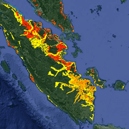
排水有机土壤排放量(年)1.0

以下是两个相关的 FAO 排水有机土壤数据集,其中提供了以下估计值:DROSA-A:为农业活动(耕地和放牧草地)而排水的有机土壤面积(以公顷为单位)DROSE-A:有机土壤的农业排水产生的碳 (C) 和一氧化二氮 (N2O) 估计值(以千兆克为单位),… 农业 气候 气候变化 排放 fao ghg -
FireCCI51:MODIS Fire_cci 烧毁面积像素产品,版本 5.1

MODIS Fire_cci Burned Area 像素产品版本 5.1 (FireCCI51) 是一个每月更新的全球数据集,空间分辨率约为 250 米,其中包含有关烧毁面积的信息以及辅助数据。该指数基于 MODIS 仪器在近红外 (NIR) 波段的地表反射率计算得出,… 燃烧 气候变化 哥白尼 esa 火灾 碎片化 -
RCMAP Rangeland Component Timeseries (1985-2023),v06

“RCMAP(牧草地状况监测评估和预测)数据集使用 1985 年至 2023 年的 Landsat 影像,量化了北美西部牧草地组成部分的覆盖百分比。RCMAP 产品套件包含 10 个分数组件:annual herbaceous、bare ground、herbaceous、litter、non-sagebrush shrub、perennial herbaceous、sagebrush、… climate-change disturbance landsat-derived landuse-landcover nlcd rangeland -
RCMAP 草地趋势年(1985-2023 年),v06

此合集包含 1985 年至 2023 年的 RCMAP 年度产品。RCMAP(牧草地状况监测评估和预测)数据集使用 1985 年至 2023 年的 Landsat 影像,量化了北美西部牧草地组成部分的覆盖百分比。RCMAP 产品套件包含 10 个分数组件:年… climate-change disturbance landsat-derived landuse-landcover nlcd rangeland -
RCMAP 草地分量时间序列趋势(1985 年至 2023 年),版本 06

RCMAP(牧草地状况监测评估和预测)数据集使用 1985 年至 2023 年的 Landsat 影像,量化了北美西部牧草地组成部分的覆盖百分比。RCMAP 产品套件包含 10 个分数组件:annual herbaceous、bare ground、herbaceous、litter、non-sagebrush shrub、perennial herbaceous、sagebrush、… climate-change disturbance landsat-derived landuse-landcover nlcd rangeland -
SPEIbase:标准化降水蒸散指数数据库,版本 2.10

全球 SPEI 数据库 (SPEIbase) 提供了全球范围内有关干旱情况的长期可靠信息,像素大小为 0.5 度,频率为每月一次。它提供 1 到 48 个月的 SPEI 时间尺度。标准化降水蒸散指数 (SPEI) 以标准化变量的形式表示… 气候 气候变化 干旱 蒸发蒸腾 全球 每月 -
联合国粮农组织排水有机土壤面积(年度)1.0

以下是两个相关的 FAO 排水有机土壤数据集,其中提供了以下估计值:DROSA-A:为农业活动(耕地和放牧草地)而排水的有机土壤面积(以公顷为单位)DROSE-A:有机土壤的农业排水产生的碳 (C) 和一氧化二氮 (N2O) 估计值(以千兆克为单位),… 农业 气候 气候变化 排放 fao ghg -
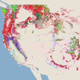
美国林务局 TreeMap v2016(美国本土)

此产品是 TreeMap 数据套件的一部分。该数据集提供了 2016 年美国大陆整个森林覆盖范围内的森林特征(包括活树和死树的数量、生物量和碳)的详细空间信息。TreeMap v2016 包含一张图片,即… 生物质 碳 气候变化 美国本土 森林 森林生物质 -
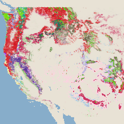
USFS TreeMap v2020

此产品是 TreeMap 数据套件的一部分。该数据集提供了 2020 年美国整个森林覆盖范围内的森林特征(包括活树和死树的数量、生物量和碳)的详细空间信息。TreeMap v2020 包含 22 个波段,分辨率为 30 x 30 米… 地上 生物质 碳 气候变化 美国本土 森林 -
USFS TreeMap v2022

此产品是 TreeMap 数据套件的一部分。该数据集提供了 2022 年美国整个森林覆盖范围内的森林特征(包括活树和死树的数量、生物量和碳)的详细空间信息。TreeMap v2022 包含 22 个波段的 30 x 30 米… 地上 生物质 碳 气候变化 美国本土 森林
Datasets tagged climate-change in Earth Engine
[null,null,[],[],[]]