-
NOAA CDR AVHRR LAI FAPAR: Leaf Area Index and Fraction of Absorbed Photosynthetically Active Radiation, Version 5
Rekord danych klimatycznych NOAA (CDR) z danych AVHRR o indeksie powierzchni liści (LAI) i ułamku pochłonionej promieniowania fotosyntetycznie czynnego (FAPAR) zawiera wartości pochodne, które charakteryzują aktywność fotosyntetyczną roślin i pokrywa. Ten zbiór danych pochodzi z produktu NOAA AVHRR Surface Reflectance i … avhrr cdr daily fapar lai land -
NOAA CDR VIIRS LAI FAPAR: Leaf Area Index and Fraction of Absorbed Photosynthetically Active Radiation, Version 1
Ten zbiór danych o klimacie (CDR) łączy zbiory danych o indeksie powierzchni liści (LAI) i ułamku pochłoniętej promieniowania fotosyntetycznie czynnego (FAPAR), czyli 2 zmiennych biofizycznych, które można wykorzystać do oceny stresu roślinnego, prognozowania plonów i innych zastosowań modelowania i zarządzania zasobami. LAI śledzi jednostronne … cdr daily fapar lai land noaa -
OpenLandMap Potential FAPAR Monthly
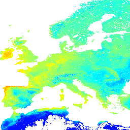
Średnia miesięczna wartość FAPAR potencjalnej roślinności naturalnej przewidywana na podstawie danych PROB-V FAPAR z lat 2014–2017. Opis. Aby uzyskać dostęp do map i ich wizualizacji poza Earth Engine, użyj tej strony. Jeśli na mapach LandGIS znajdziesz błąd, artefakt lub niespójność albo masz pytanie, skorzystaj z … envirometrix fapar monthly opengeohub openlandmap plant-productivity
Datasets tagged fapar in Earth Engine
[null,null,[],[[["\u003cp\u003eThe NOAA CDR AVHRR LAI FAPAR dataset provides insights into plant canopy and photosynthetic activity using derived values for Leaf Area Index (LAI) and Fraction of Absorbed Photosynthetically Active Radiation (FAPAR).\u003c/p\u003e\n"],["\u003cp\u003eThis NOAA dataset is generated from the AVHRR Surface Reflectance product and offers daily data.\u003c/p\u003e\n"],["\u003cp\u003eOpenLandMap Potential FAPAR Monthly dataset presents the predicted median potential natural vegetation FAPAR on a monthly basis, derived from PROB-V FAPAR data spanning 2014-2017.\u003c/p\u003e\n"]]],[],null,["# Datasets tagged fapar in Earth Engine\n\n-\n\n |----------------------------------------------------------------------------------------------------------------------------------------------------------------------------------------------------------------------------------------------------------------------------------------------------------------------------|\n | [### NOAA CDR AVHRR LAI FAPAR: Leaf Area Index and Fraction of Absorbed Photosynthetically Active Radiation, Version 5](/earth-engine/datasets/catalog/NOAA_CDR_AVHRR_LAI_FAPAR_V5) |\n | The NOAA Climate Data Record (CDR) of AVHRR Leaf Area Index (LAI) and Fraction of Absorbed Photosynthetically Active Radiation (FAPAR) dataset contains derived values that characterize the canopy and photosynthetic activity of plants. This dataset is derived from the NOAA AVHRR Surface Reflectance product and ... |\n | [avhrr](/earth-engine/datasets/tags/avhrr) [cdr](/earth-engine/datasets/tags/cdr) [daily](/earth-engine/datasets/tags/daily) [fapar](/earth-engine/datasets/tags/fapar) [lai](/earth-engine/datasets/tags/lai) [land](/earth-engine/datasets/tags/land) |\n\n-\n\n |------------------------------------------------------------------------------------------------------------------------------------------------------------------------------------------------------------------------------------------------------------------------------------------------------------------------------------------------|\n | [### NOAA CDR VIIRS LAI FAPAR: Leaf Area Index and Fraction of Absorbed Photosynthetically Active Radiation, Version 1](/earth-engine/datasets/catalog/NOAA_CDR_VIIRS_LAI_FAPAR_V1) |\n | This Climate Data Record (CDR) combines datasets for Leaf Area Index (LAI) and Fraction of Absorbed Photosynthetically Active Radiation (FAPAR), two biophysical variables that can be used to evaluate vegetation stress, forecast agricultural yields, and other modeling and resource management applications. LAI tracks the one-sided ... |\n | [cdr](/earth-engine/datasets/tags/cdr) [daily](/earth-engine/datasets/tags/daily) [fapar](/earth-engine/datasets/tags/fapar) [lai](/earth-engine/datasets/tags/lai) [land](/earth-engine/datasets/tags/land) [noaa](/earth-engine/datasets/tags/noaa) |\n\n-\n\n |-------------------------------------------------------------------------------------------------------------------------------------------------------------------------------------------------------------------------------------------------------------------------------------------------------------------------------------|\n | [### OpenLandMap Potential FAPAR Monthly](/earth-engine/datasets/catalog/OpenLandMap_PNV_PNV_FAPAR_PROBA-V_D_v01) |\n | Potential Natural Vegetation FAPAR predicted monthly median (based on PROB-V FAPAR 2014-2017). Description. To access and visualize maps outside of Earth Engine, use this page. If you discover a bug, artifact or inconsistency in the LandGIS maps or if you have a question please use ... |\n | [envirometrix](/earth-engine/datasets/tags/envirometrix) [fapar](/earth-engine/datasets/tags/fapar) [monthly](/earth-engine/datasets/tags/monthly) [opengeohub](/earth-engine/datasets/tags/opengeohub) [openlandmap](/earth-engine/datasets/tags/openlandmap) [plant-productivity](/earth-engine/datasets/tags/plant-productivity) |"]]