-
Landsat Collection 2 Tier 1 Level 2 32-Day BAI Composite

These Landsat Collection 2 Tier 1 Level 2 composites are made from Tier 1 Level 2 orthorectified scenes. The Burn Area Index (BAI) is generated from the Red and Near-IR bands, and measures the spectral distance of each pixel from a reference spectral point (the … bai fire landsat landsat-composite usgs vegetation-indices -
Landsat Collection 2 Tier 1 Level 2 32-Day Composite

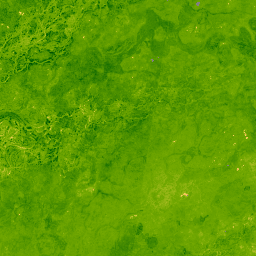
These Landsat Collection 2 Tier 1 Level 2 composites are made from Tier 1 Level 2 orthorectified scenes, and include the SR bands: blue, green, red, nir, swir1, swir2, and thermal. These composites are created from all the scenes in each 32-day period beginning from … landsat landsat-composite satellite-imagery sr usgs -
Landsat Collection 2 Tier 1 Level 2 32-Day NBR Composite

These Landsat Collection 2 Tier 1 Level 2 composites are made from Tier 1 Level 2 orthorectified scenes. The Normalized Burn Ratio Thermal (NBRT) index is generated from the Near-IR, Mid-IR (2215 nm), and Thermal bands, and has a range from -1.0 to 1.0. See … fire landsat landsat-composite nbrt usgs vegetation-indices -
Landsat Collection 2 Tier 1 Level 2 32-Day NDVI Composite
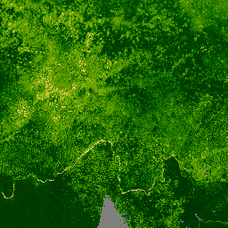
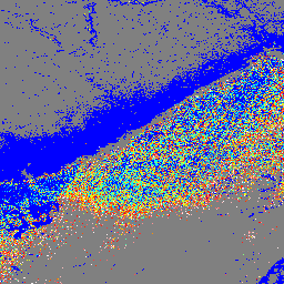
These Landsat Collection 2 Tier 1 Level 2 composites are made from Tier 1 Level 2 orthorectified scenes. The Normalized Difference Vegetation Index is generated from the Near-IR and Red bands of each scene as (NIR - Red) / (NIR + Red), and ranges in … landsat landsat-composite ndvi usgs vegetation vegetation-indices -
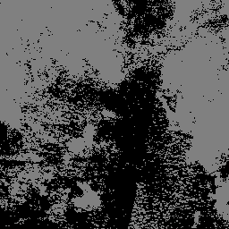
Landsat Collection 2 Tier 1 Level 2 32-Day NDWI Composite

These Landsat Collection 2 Tier 1 Level 2 composites are made from Tier 1 Level 2 orthorectified scenes. The Normalized Difference Water Index (NDWI) is designed to delineate open water features and enhance their presence in imagery while eliminating soil and terrestrial vegetation features. It … landsat landsat-composite ndwi surface-ground-water usgs -
Landsat Collection 2 Tier 1 Level 2 8-Day BAI Composite
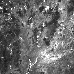
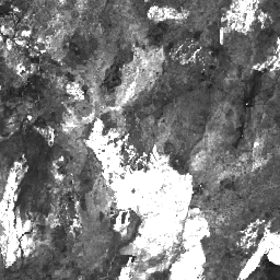
These Landsat Collection 2 Tier 1 Level 2 composites are made from Tier 1 Level 2 orthorectified scenes. The Burn Area Index (BAI) is generated from the Red and Near-IR bands, and measures the spectral distance of each pixel from a reference spectral point (the … bai fire landsat landsat-composite usgs vegetation-indices -
Landsat Collection 2 Tier 1 Level 2 8-Day Composite
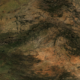
These Landsat Collection 2 Tier 1 Level 2 composites are made from Tier 1 Level 2 orthorectified scenes, and include the SR bands: blue, green, red, nir, swir1, swir2, and thermal. These composites are created from all the scenes in each 8-day period beginning from … landsat landsat-composite satellite-imagery sr usgs -
Landsat Collection 2 Tier 1 Level 2 8-Day EVI Composite

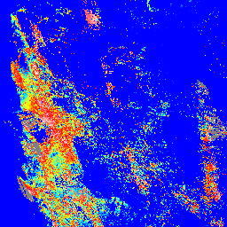
These Landsat Collection 2 Tier 1 Level 2 composites are made from Tier 1 Level 2 orthorectified scenes. The Enhanced Vegetation Index (EVI) is generated from the Near-IR, Red and Blue bands of each scene, and ranges in value from -1.0 to 1.0. See Huete … evi landsat landsat-composite usgs vegetation vegetation-indices -
Landsat Collection 2 Tier 1 Level 2 8-Day NBR Composite
These Landsat Collection 2 Tier 1 Level 2 composites are made from Tier 1 Level 2 orthorectified scenes. The Normalized Burn Ratio Thermal (NBRT) index is generated from the Near-IR, Mid-IR (2215 nm), and Thermal bands, and has a range from -1.0 to 1.0. See … fire landsat landsat-composite nbrt usgs vegetation-indices -
Landsat Collection 2 Tier 1 Level 2 8-Day NDVI Composite
These Landsat Collection 2 Tier 1 Level 2 composites are made from Tier 1 Level 2 orthorectified scenes. The Normalized Difference Vegetation Index is generated from the Near-IR and Red bands of each scene as (NIR - Red) / (NIR + Red), and ranges in … landsat landsat-composite ndvi usgs vegetation vegetation-indices -
Landsat Collection 2 Tier 1 Level 2 8-Day NDWI Composite
These Landsat Collection 2 Tier 1 Level 2 composites are made from Tier 1 Level 2 orthorectified scenes. The Normalized Difference Water Index (NDWI) is designed to delineate open water features and enhance their presence in imagery while eliminating soil and terrestrial vegetation features. It … landsat landsat-composite ndwi surface-ground-water usgs -
Landsat Collection 2 Tier 1 Level 2 Annual BAI Composite
These Landsat Collection 2 Tier 1 Level 2 composites are made from Tier 1 Level 2 orthorectified scenes. The Burn Area Index (BAI) is generated from the Red and Near-IR bands, and measures the spectral distance of each pixel from a reference spectral point (the … bai fire landsat landsat-composite usgs vegetation-indices -
Landsat Collection 2 Tier 1 Level 2 Annual Composite

These Landsat Collection 2 Tier 1 Level 2 composites are made from Tier 1 Level 2 orthorectified scenes, and include the SR bands: blue, green, red, nir, swir1, swir2, and thermal. These composites are created from all the scenes in each annual period beginning from … landsat landsat-composite satellite-imagery sr usgs -
Landsat Collection 2 Tier 1 Level 2 Annual EVI Composite

These Landsat Collection 2 Tier 1 Level 2 composites are made from Tier 1 Level 2 orthorectified scenes. The Enhanced Vegetation Index (EVI) is generated from the Near-IR, Red and Blue bands of each scene, and ranges in value from -1.0 to 1.0. See Huete … evi landsat landsat-composite usgs vegetation vegetation-indices -
Landsat Collection 2 Tier 1 Level 2 Annual NBR Composite

These Landsat Collection 2 Tier 1 Level 2 composites are made from Tier 1 Level 2 orthorectified scenes. The Normalized Burn Ratio Thermal (NBRT) index is generated from the Near-IR, Mid-IR (2215 nm), and Thermal bands, and has a range from -1.0 to 1.0. See … fire landsat landsat-composite nbrt usgs vegetation-indices -
Landsat Collection 2 Tier 1 Level 2 Annual NDVI Composite

These Landsat Collection 2 Tier 1 Level 2 composites are made from Tier 1 Level 2 orthorectified scenes. The Normalized Difference Vegetation Index is generated from the Near-IR and Red bands of each scene as (NIR - Red) / (NIR + Red), and ranges in … landsat landsat-composite ndvi usgs vegetation vegetation-indices -
Landsat Collection 2 Tier 1 Level 2 Annual NDWI Composite
These Landsat Collection 2 Tier 1 Level 2 composites are made from Tier 1 Level 2 orthorectified scenes. The Normalized Difference Water Index (NDWI) is designed to delineate open water features and enhance their presence in imagery while eliminating soil and terrestrial vegetation features. It … landsat landsat-composite ndwi surface-ground-water usgs
Datasets tagged landsat-composite in Earth Engine
[null,null,[],[],[]]