وسعت سالانه جنگلهای حرا در جهان (۱۹۸۴-۲۰۲۳) 
مجموعه داده CGMD-Extent30 (دینامیک پیوسته جهانی حرا - وسعت سالانه حرا با وضوح 30 متر) وسعت سالانه جهانی حرا را از سال 1984 تا 2023 ارائه میدهد. این مجموعه داده به صورت یک مجموعه ویژگی موتور زمین واحد توزیع شده است که هر ویژگی نشان دهنده یک چندضلعی حرا نقشه برداری شده برای یک سال خاص است. مجموعه داده ... زیست توده سالانه جنگل ساحلی ، کاربری اراضی ، پوشش اراضی جهانی مشتق شده از لندست پوشش تاجی کسری سالانه جهانی حرا (1984-2023) 
این مجموعه دادهها، پوشش تاجی کسری (FCC) سالانه جهانی جنگلهای حرا را با وضوح مکانی 30 متر از سال 1984 تا 2023 ارائه میدهد تا از تجزیه و تحلیلهای گسترده در مورد پویایی بلندمدت جنگلهای حرا، از جمله تخریب و بازیابی تاج پوشش، ارزیابی کربن آبی و نظارت بر اکوسیستم ساحلی، پشتیبانی کند. FCC نسبت هر لندست ... را کمّی میکند. زیست توده سالانه جنگل ساحلی ، جنگل حرا جهانی مشتق شده از لندست توزیع جهانی جنگلهای حرا، جلد ۱ (۲۰۰۰) 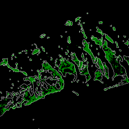
این پایگاه داده با استفاده از دادههای ماهواره لندست از سال ۲۰۰۰ تهیه شده است. بیش از ۱۰۰۰ صحنه لندست که از مرکز رصد و علوم منابع زمین (EROS) سازمان زمینشناسی ایالات متحده (USGS) به دست آمده است، با استفاده از تکنیکهای طبقهبندی تصاویر دیجیتال ترکیبی نظارتشده و نظارتنشده طبقهبندی شدهاند. این پایگاه داده اولین و پرکاربردترین ... تغییرات سالانه در زیست توده جنگلی، جنگل حرا مشتق شده از لندست جهانی تغییرات جهانی تالاب جزر و مدی موری نسخه ۱.۰ (۱۹۹۹-۲۰۱۹) 
مجموعه دادههای تغییرات تالاب جزر و مدی جهانی موری شامل نقشههایی از وسعت جهانی تالابهای جزر و مدی و تغییرات آنها است. این نقشهها از یک طبقهبندی سه مرحلهای تهیه شدهاند که به دنبال (۱) تخمین توزیع جهانی تالابهای جزر و مدی (که به صورت باتلاق جزر و مدی، جزر و مدی ... تعریف میشوند) است. اکوسیستم ساحلی، مانگرو مشتقشده از لندست، بین جزر و مدی ، مورای
Datasets tagged mangrove in Earth Engine
[null,null,[],[],[]]