Ежегодная площадь мангровых лесов в мире (1984-2023 гг.) 
Набор данных CGMD-Extent30 (Continuous Global Mangrove Dynamics-Annual Mangrove Extent at 30-m resolution) предоставляет данные о ежегодной площади мангровых зарослей в мире с 1984 по 2023 год. Набор данных распространяется в виде единой коллекции объектов Earth Engine FeatureCollection, где каждый объект представляет собой отображенный полигон мангровых зарослей за конкретный год. Набор данных… ежегодная биомасса прибрежных лесов, полученная на основе глобальных данных Landsat, землепользование и земельный покров Глобальная годовая доля площади, покрывающей мангровые заросли (1984-2023 гг.) 
Этот набор данных предоставляет глобальные ежегодные данные о доле растительного покрова мангровых лесов (FCC) с пространственным разрешением 30 м за период с 1984 по 2023 год для поддержки крупномасштабного анализа долгосрочной динамики мангровых лесов, включая деградацию и восстановление растительного покрова, оценку «голубого углерода» и мониторинг прибрежных экосистем. FCC количественно определяет долю каждого спутника Landsat… ежегодная биомасса прибрежных лесов, полученная с помощью глобальных спутниковых снимков мангровых зарослей Глобальное распространение мангровых лесов, т. 1 (2000) 
База данных была подготовлена с использованием спутниковых данных Landsat за 2000 год. Более 1000 снимков Landsat, полученных из Центра наблюдения и изучения земных ресурсов Геологической службы США (EROS), были классифицированы с использованием гибридных методов цифровой классификации изображений с обучением и без обучения. Эта база данных является первой и наиболее… ежегодный циезин лесная биомасса глобальные данные Landsat мангровые леса Изменения в глобальных приливных водно-болотных угодьях региона Мюррей, версия 1.0 (1999-2019) 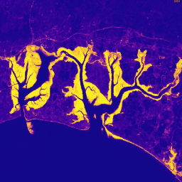
Набор данных Murray Global Tidal Wetland Change Dataset содержит карты глобального распространения приливных водно-болотных угодий и их изменений. Карты были разработаны на основе трехэтапной классификации, целью которой было (i) оценить глобальное распространение приливных водно-болотных угодий (определяемых как приливные болота, приливные…). прибрежная экосистема приливно-отливная зона мангровые леса Мюррей, полученные с помощью спутниковых снимков
Datasets tagged mangrove in Earth Engine
[null,null,[],[],[]]