-
GRIDMET 가뭄: 미국 본토 가뭄 지수

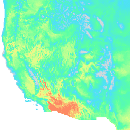
이 데이터 세트에는 4km 일일 격자형 지표면 기상 (GRIDMET) 데이터 세트에서 파생된 가뭄 지수가 포함되어 있습니다. 제공되는 가뭄 지수에는 표준화된 강수 지수 (SPI), 증발 가뭄 수요 지수 (EDDI), 표준화된 강수 증발 지수 (SPEI), 파머 가뭄 심각도 지수 (PDSI), 파머 … 기후 conus 농작물 가뭄 증발산량 지구물리학 -
GRIDMET: 아이다호 대학교 격자형 표면 기상 데이터 세트
그리드화된 지표 기상 데이터 세트는 1979년부터 미국 본토 전역의 온도, 강수량, 바람, 습도, 복사량에 관한 높은 공간 해상도 (~4km)의 일일 지표 필드를 제공합니다. 이 데이터 세트는 PRISM의 고해상도 공간 데이터와 …의 고시간 해상도 데이터를 혼합합니다. 기후 gridmet 습도 merced metdata 강수량
Datasets tagged metdata in Earth Engine
[null,null,[],[],["The datasets provide climate and drought-related information for the contiguous United States. The GRIDMET dataset offers daily surface measurements like temperature, precipitation, humidity, winds, and radiation at a 4-km resolution from 1979. The GRIDMET Drought dataset contains drought indices derived from the GRIDMET dataset, including the Standardized Precipitation Index (SPI), Evaporative Drought Demand Index (EDDI), and the Palmer Drought Severity Index (PDSI). These sets focus on daily, gridded data at a high resolution.\n"]]