-
GRIDMET DROUGHT: CONUS Drought Indices
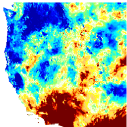
Ten zbiór danych zawiera wskaźniki suszy pochodzące z codziennie aktualizowanego zbioru danych meteorologicznych na powierzchni Ziemi (GRIDMET) o rozdzielczości 4 km. Dostępne wskaźniki suszy obejmują standaryzowany wskaźnik opadów (SPI), wskaźnik sprzyjający suszy przez parowanie (EDDI), standaryzowany wskaźnik klimatycznego bilansu wodnego (SPEI), wskaźnik dotkliwości suszy Palmera (PDSI) i wskaźnik … climate conus crop drought evapotranspiration geophysical -
GRIDMET: zbiór danych meteorologicznych z powierzchni Ziemi w postaci siatki, Uniwersytet w Idaho
Zbiór danych meteorologicznych na siatce powierzchniowej zawiera codzienne pola powierzchniowe temperatury, opadów, wiatrów, wilgotności i promieniowania na obszarze Stanów Zjednoczonych z 1979 r. z wysoką rozdzielczością przestrzenną (około 4 km). Zbiór danych łączy dane przestrzenne w wysokiej rozdzielczości z PRISM z danymi o wysokiej rozdzielczości czasowej z … climate gridmet humidity merced metdata precipitation
Datasets tagged metdata in Earth Engine
[null,null,[],[[["\u003cp\u003eThe GRIDMET Drought dataset offers various drought indices like SPI, EDDI, SPEI, and PDSI, calculated from the 4-km daily Gridded Surface Meteorological (GRIDMET) dataset for the contiguous US.\u003c/p\u003e\n"],["\u003cp\u003eThe GRIDMET dataset itself provides daily surface data for temperature, precipitation, winds, humidity, and radiation across the contiguous United States from 1979 at ~4km resolution.\u003c/p\u003e\n"],["\u003cp\u003eBoth datasets are valuable for climate studies, crop monitoring, and drought assessment.\u003c/p\u003e\n"]]],["The datasets provide climate and drought-related information for the contiguous United States. The GRIDMET dataset offers daily surface measurements like temperature, precipitation, humidity, winds, and radiation at a 4-km resolution from 1979. The GRIDMET Drought dataset contains drought indices derived from the GRIDMET dataset, including the Standardized Precipitation Index (SPI), Evaporative Drought Demand Index (EDDI), and the Palmer Drought Severity Index (PDSI). These sets focus on daily, gridded data at a high resolution.\n"],null,["# Datasets tagged metdata in Earth Engine\n\n-\n\n |---------------------------------------------------------------------------------------------------------------------------------------------------------------------------------------------------------------------------------------------------------------------------------------------------------------------------------------------------------------------------|\n | [### GRIDMET DROUGHT: CONUS Drought Indices](/earth-engine/datasets/catalog/GRIDMET_DROUGHT) |\n | This dataset contains drought indices derived from the 4-km daily Gridded Surface Meteorological (GRIDMET) dataset. The drought indices provided include the standardized precipitation index (SPI), the evaporative drought demand index (EDDI), the standardized precipitation evapotranspiration index (SPEI), the Palmer Drought Severity Index (PDSI) and Palmer ... |\n | [climate](/earth-engine/datasets/tags/climate) [conus](/earth-engine/datasets/tags/conus) [crop](/earth-engine/datasets/tags/crop) [drought](/earth-engine/datasets/tags/drought) [evapotranspiration](/earth-engine/datasets/tags/evapotranspiration) [geophysical](/earth-engine/datasets/tags/geophysical) |\n\n-\n\n |------------------------------------------------------------------------------------------------------------------------------------------------------------------------------------------------------------------------------------------------------------------------------------------------------------------------------------------|\n | [### GRIDMET: University of Idaho Gridded Surface Meteorological Dataset](/earth-engine/datasets/catalog/IDAHO_EPSCOR_GRIDMET) |\n | The Gridded Surface Meteorological dataset provides high spatial resolution (\\~4-km) daily surface fields of temperature, precipitation, winds, humidity and radiation across the contiguous United States from 1979. The dataset blends the high resolution spatial data from PRISM with the high temporal resolution data from the ... |\n | [climate](/earth-engine/datasets/tags/climate) [gridmet](/earth-engine/datasets/tags/gridmet) [humidity](/earth-engine/datasets/tags/humidity) [merced](/earth-engine/datasets/tags/merced) [metdata](/earth-engine/datasets/tags/metdata) [precipitation](/earth-engine/datasets/tags/precipitation) |"]]