-
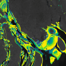
סיווג של שינויים גלובליים בתחום המפרץ של Murray
מערך הנתונים של Murray Global Intertidal Change מכיל מפות גלובליות של מערכות אקולוגיות של רצועות חוף שוצפות שנוצרו באמצעות סיווג בפיקוח של 707,528 תמונות מ-Landsat Archive. כל פיקסל סווג כמישור גאות, מים קבועים או 'אחר' בהתאם לקבוצה של נתוני אימון שמופצים ברחבי העולם. … coastal google intertidal landsat-derived murray surface-ground-water -
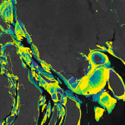
מסכת נתונים של שינויים גלובליים בתחום המפרץ של Murray
מערך הנתונים של Murray Global Intertidal Change מכיל מפות גלובליות של מערכות אקולוגיות של רצועות חוף שוצפות שנוצרו באמצעות סיווג בפיקוח של 707,528 תמונות מ-Landsat Archive. כל פיקסל סווג כמישור גאות, מים קבועים או 'אחר' בהתאם לקבוצה של נתוני אימון שמופצים ברחבי העולם. … coastal google intertidal landsat-derived murray surface-ground-water -
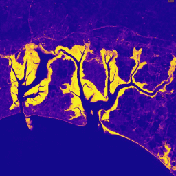
מספר הפיקסלים של בקרת האיכות של Murray Global Intertidal Change
מערך הנתונים של Murray Global Intertidal Change מכיל מפות גלובליות של מערכות אקולוגיות של רצועות חוף שוצפות שנוצרו באמצעות סיווג בפיקוח של 707,528 תמונות מ-Landsat Archive. כל פיקסל סווג כמישור גאות, מים קבועים או 'אחר' בהתאם לקבוצה של נתוני אימון שמופצים ברחבי העולם. … coastal google intertidal landsat-derived murray surface-ground-water -
Murray Global Tidal Wetland Change v1.0 (1999-2019)
מערך הנתונים של Murray Global Tidal Wetland Change מכיל מפות של ההיקף הגלובלי של ביצות שפועלות בתנועת גאות ושפל, ושל השינויים בהן. המפות פותחו על סמך סיווג בן שלושה שלבים, שמטרתו (1) להעריך את ההתפלגות הגלובלית של שטחי ביצות שפועלים לפי גאות ושפל (מוגדרים בתור ביצות גאות ושפל, … חופי אקוסיסטם בין גאות ושפל מ-landsat מאנגרוב murray
Datasets tagged murray in Earth Engine
[null,null,[],[[["\u003cp\u003eThe Murray datasets provide global maps of tidal wetlands and tidal flats, including their changes over time.\u003c/p\u003e\n"],["\u003cp\u003eThese datasets utilize a supervised classification of Landsat imagery to categorize areas into tidal flat, permanent water, or other land cover types.\u003c/p\u003e\n"],["\u003cp\u003eThe Global Tidal Wetland Change dataset specifically focuses on mapping tidal marshes and mangroves, along with their changes between 1999 and 2019.\u003c/p\u003e\n"],["\u003cp\u003eThe Global Intertidal Change dataset offers insights into tidal flat ecosystems based on a large-scale analysis of Landsat Archive images.\u003c/p\u003e\n"],["\u003cp\u003eQuality assessment information is also available through the Global Intertidal Change QA Pixel Count dataset.\u003c/p\u003e\n"]]],["The content describes the Murray Global datasets, which map tidal wetland and intertidal flat ecosystems. The Tidal Wetland Change Dataset estimates the global distribution of tidal marshes and other tidal ecosystems. The Intertidal Change datasets classify pixels from 707,528 Landsat images into tidal flat, permanent water, or other categories. These datasets use a globally distributed training data to classify and map the global extent of intertidal areas and track changes.\n"],null,["# Datasets tagged murray in Earth Engine\n\n-\n\n |---------------------------------------------------------------------------------------------------------------------------------------------------------------------------------------------------------------------------------------------------------------------------------------------------------------------------------------|\n | [### Murray Global Intertidal Change Classification](/earth-engine/datasets/catalog/UQ_murray_Intertidal_v1_1_global_intertidal) |\n | The Murray Global Intertidal Change Dataset contains global maps of tidal flat ecosystems produced via a supervised classification of 707,528 Landsat Archive images. Each pixel was classified into tidal flat, permanent water or other with reference to a globally distributed set of training data. The ... |\n | [coastal](/earth-engine/datasets/tags/coastal) [google](/earth-engine/datasets/tags/google) [intertidal](/earth-engine/datasets/tags/intertidal) [landsat-derived](/earth-engine/datasets/tags/landsat-derived) [murray](/earth-engine/datasets/tags/murray) [surface-ground-water](/earth-engine/datasets/tags/surface-ground-water) |\n\n-\n\n |---------------------------------------------------------------------------------------------------------------------------------------------------------------------------------------------------------------------------------------------------------------------------------------------------------------------------------------|\n | [### Murray Global Intertidal Change Data Mask](/earth-engine/datasets/catalog/UQ_murray_Intertidal_v1_1_data_mask) |\n | The Murray Global Intertidal Change Dataset contains global maps of tidal flat ecosystems produced via a supervised classification of 707,528 Landsat Archive images. Each pixel was classified into tidal flat, permanent water or other with reference to a globally distributed set of training data. The ... |\n | [coastal](/earth-engine/datasets/tags/coastal) [google](/earth-engine/datasets/tags/google) [intertidal](/earth-engine/datasets/tags/intertidal) [landsat-derived](/earth-engine/datasets/tags/landsat-derived) [murray](/earth-engine/datasets/tags/murray) [surface-ground-water](/earth-engine/datasets/tags/surface-ground-water) |\n\n-\n\n |---------------------------------------------------------------------------------------------------------------------------------------------------------------------------------------------------------------------------------------------------------------------------------------------------------------------------------------|\n | [### Murray Global Intertidal Change QA Pixel Count](/earth-engine/datasets/catalog/UQ_murray_Intertidal_v1_1_qa_pixel_count) |\n | The Murray Global Intertidal Change Dataset contains global maps of tidal flat ecosystems produced via a supervised classification of 707,528 Landsat Archive images. Each pixel was classified into tidal flat, permanent water or other with reference to a globally distributed set of training data. The ... |\n | [coastal](/earth-engine/datasets/tags/coastal) [google](/earth-engine/datasets/tags/google) [intertidal](/earth-engine/datasets/tags/intertidal) [landsat-derived](/earth-engine/datasets/tags/landsat-derived) [murray](/earth-engine/datasets/tags/murray) [surface-ground-water](/earth-engine/datasets/tags/surface-ground-water) |\n\n-\n\n |---------------------------------------------------------------------------------------------------------------------------------------------------------------------------------------------------------------------------------------------------------------------------------------------------------------------|\n | [### Murray Global Tidal Wetland Change v1.0 (1999-2019)](/earth-engine/datasets/catalog/JCU_Murray_GIC_global_tidal_wetland_change_2019) |\n | The Murray Global Tidal Wetland Change Dataset contains maps of the global extent of tidal wetlands and their change. The maps were developed from a three stage classification that sought to (i) estimate the global distribution of tidal wetlands (defined as either tidal marsh, tidal ... |\n | [coastal](/earth-engine/datasets/tags/coastal) [ecosystem](/earth-engine/datasets/tags/ecosystem) [intertidal](/earth-engine/datasets/tags/intertidal) [landsat-derived](/earth-engine/datasets/tags/landsat-derived) [mangrove](/earth-engine/datasets/tags/mangrove) [murray](/earth-engine/datasets/tags/murray) |"]]