-
AHN Netherlands 0.5m DEM, Interpolated

AHN DEM は、オランダ全土をカバーする 0.5 m の DEM です。これは、2007 年から 2012 年の春に取得された LIDAR データから生成されました。地面レベルのサンプルが含まれており、地面より上の他のすべてのアイテム(建物、橋、木など)は削除されています。このバージョンは… ahn dem elevation elevation-topography geophysical lidar -
AHN Netherlands 0.5m DEM, Non-Interpolated
AHN DEM は、オランダ全土をカバーする 0.5 m の DEM です。これは、2007 年から 2012 年の春に取得された LIDAR データから生成されました。地面レベルのサンプルが含まれており、地面より上の他のすべてのアイテム(建物、橋、木など)は削除されています。このバージョンは… ahn dem elevation elevation-topography geophysical lidar -
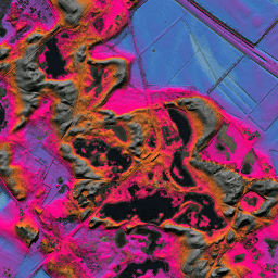
AHN オランダ 0.5 m DEM、未加工サンプル
AHN DEM は、オランダ全土をカバーする 0.5 m の DEM です。これは、2007 年から 2012 年の春に取得された LIDAR データから生成されました。このバージョンには、地上レベルのサンプルと地上レベルより上のアイテム(建物、橋、木など)の両方が含まれています。ポイント クラウド… ahn dem elevation elevation-topography geophysical lidar -
AHN3: オランダ AHN 0.5m
Actueel Hoogtebestand Nederland(AHN)は、オランダ全土の詳細で正確な標高データを含むデータセットです。標高情報は、ヘリコプターと航空機からレーザー技術を使用して収集され、垂直方向の精度は 5 cm でした。AHN3 データセットには、オランダの AHN 0.5m DSM が含まれています。 ahn dem elevation elevation-topography geophysical lidar -
AHN4: オランダ AHN 0.5m
Actueel Hoogtebestand Nederland(AHN)は、オランダ全土の詳細で正確な標高データを含むデータセットです。標高情報は、ヘリコプターと航空機からレーザー技術を使用して収集され、垂直方向の精度は 5 cm でした。AHN4 データセットには、オランダの AHN 0.5m DSM が含まれています。 ahn dem elevation elevation-topography geophysical lidar -
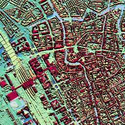
オランダのオルソフォト

Netherlands のオルソ写真は、カラー オルソ画像のセットです。全国の航空写真は、春に 7.5 cm の解像度で葉のない画像、夏に 25 cm の解像度で葉のある画像がそれぞれ 1 枚ずつ収集されます。詳細については、… をご覧ください。 netherlands orthophotos rgb
Datasets tagged netherlands in Earth Engine
[null,null,[],[],[]]