-
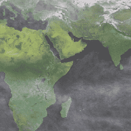
MOD09CMG.061 Terra 표면 반사율 일일 L3 전 세계 0.05도 CMG
MOD09CMG 버전 6.1 제품은 Terra Moderate Resolution Imaging Spectroradiometer (MODIS) 밴드 1~7의 표면 스펙트럼 반사율을 추정하여 5, 600m 픽셀 해상도로 리샘플링하고 가스, 에어로졸, 레이레이 산란과 같은 대기 조건을 보정합니다. MOD09CMG 데이터는 … brightness-temperature ozone satellite-imagery surface-reflectance terra -
MYD09CMG.061 아쿠아 표면 반사율 일일 L3 전 세계 0.05도 CMG
MYD09CMG 버전 6.1 제품은 Aqua Moderate Resolution Imaging Spectroradiometer (MODIS) 밴드 1~7의 표면 스펙트럼 반사율을 추정하여 5, 600m 픽셀 해상도로 리샘플링하고 가스, 에어로졸, 레이레이 산란과 같은 대기 조건을 보정합니다. MYD09CMG 데이터는 다음과 같습니다. aqua brightness-temperature ozone satellite-imagery surface-reflectance -
Sentinel-5P NRTI O3: 거의 실시간 오존
NRTI/L3_O3 이 데이터 세트는 총 오존 농도의 거의 실시간 고해상도 이미지를 제공합니다. 대류권 열 데이터는 COPERNICUS/S5P/OFFL/L3_O3_TCL도 참고하세요. 성층권에서는 오존층이 생물권을 태양의 유해한 자외선으로부터 보호합니다. 대류권에서는 효율적인 세정제로 작용하지만 … air-quality atmosphere copernicus esa eu o3 -
Sentinel-5P OFFL O3 TCL: 대류권 오존 오프라인
OFFL/L3_O3_TCL 이 데이터 세트는 북위 20도와 남위 20도 사이의 오존 농도에 관한 대류권 고해상도 오프라인 이미지를 제공합니다. 총 열 데이터의 경우 COPERNICUS/S5P/OFFL/L3_O3 및 COPERNICUS/S5P/NRTI/L3_O3도 참고하세요. 성층권에서는 오존층이 생물권을 태양의 유해한 자외선으로부터 보호합니다. 대류권에서는 다음과 같은 역할을 합니다. air-quality atmosphere copernicus esa eu o3 -
Sentinel-5P OFFL O3: 오프라인 오존
OFFL/L3_O3 이 데이터 세트는 총 오존 농도의 오프라인 고해상도 이미지를 제공합니다. 대류권 열 데이터는 COPERNICUS/S5P/OFFL/L3_O3_TCL도 참고하세요. 성층권에서는 오존층이 생물권을 태양의 유해한 자외선으로부터 보호합니다. 대류권에서는 효율적인 세정제로 작용하지만 … air-quality atmosphere copernicus esa eu o3 -
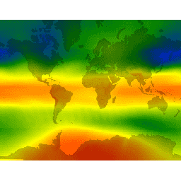
TOMS 및 OMI 병합 오존 데이터
총 오존 매핑 분광계 (TOMS) 데이터는 지난 25년 동안의 전 세계 및 지역 총 오존 동향을 모니터링하는 데 사용할 수 있는 위성 기반 관측의 주요 장기 연속 기록을 나타냅니다. 이 데이터는 NASA 고다드 우주센터의 대기학 연구소에서 생성합니다. 대기 기후 geophysical NASA 오존
Datasets tagged ozone in Earth Engine
[null,null,[],[[["\u003cp\u003eThis page provides access to various ozone datasets, including near real-time, offline, and tropospheric ozone data from Sentinel-5P.\u003c/p\u003e\n"],["\u003cp\u003eDatasets offer high-resolution imagery of total column and tropospheric ozone concentrations for monitoring and analysis.\u003c/p\u003e\n"],["\u003cp\u003eSurface reflectance data from Terra and Aqua MODIS sensors are also included, corrected for atmospheric conditions like gasses and aerosols.\u003c/p\u003e\n"],["\u003cp\u003eTOMS and OMI merged data provide a long-term record of satellite-based observations for monitoring global and regional ozone trends.\u003c/p\u003e\n"],["\u003cp\u003eThese datasets can be used for studying air quality, climate change, and the impact of ozone on the biosphere.\u003c/p\u003e\n"]]],[],null,["# Datasets tagged ozone in Earth Engine\n\n-\n\n |----------------------------------------------------------------------------------------------------------------------------------------------------------------------------------------------------------------------------------------------------------------------------------------------------------------------------------------|\n | [### MOD09CMG.061 Terra Surface Reflectance Daily L3 Global 0.05 Deg CMG](/earth-engine/datasets/catalog/MODIS_061_MOD09CMG) |\n | The MOD09CMG Version 6.1 product provides an estimate of the surface spectral reflectance of Terra Moderate Resolution Imaging Spectroradiometer (MODIS) Bands 1 through 7, resampled to 5600 meter pixel resolution and corrected for atmospheric conditions such as gasses, aerosols, and Rayleigh scattering. The MOD09CMG data ... |\n | [brightness-temperature](/earth-engine/datasets/tags/brightness-temperature) [ozone](/earth-engine/datasets/tags/ozone) [satellite-imagery](/earth-engine/datasets/tags/satellite-imagery) [surface-reflectance](/earth-engine/datasets/tags/surface-reflectance) [terra](/earth-engine/datasets/tags/terra) |\n\n-\n\n |---------------------------------------------------------------------------------------------------------------------------------------------------------------------------------------------------------------------------------------------------------------------------------------------------------------------------------------|\n | [### MYD09CMG.061 Aqua Surface Reflectance Daily L3 Global 0.05 Deg CMG](/earth-engine/datasets/catalog/MODIS_061_MYD09CMG) |\n | The MYD09CMG Version 6.1 product provides an estimate of the surface spectral reflectance of Aqua Moderate Resolution Imaging Spectroradiometer (MODIS) Bands 1 through 7, resampled to 5600 meter pixel resolution and corrected for atmospheric conditions such as gasses, aerosols, and Rayleigh scattering. The MYD09CMG data ... |\n | [aqua](/earth-engine/datasets/tags/aqua) [brightness-temperature](/earth-engine/datasets/tags/brightness-temperature) [ozone](/earth-engine/datasets/tags/ozone) [satellite-imagery](/earth-engine/datasets/tags/satellite-imagery) [surface-reflectance](/earth-engine/datasets/tags/surface-reflectance) |\n\n-\n\n |--------------------------------------------------------------------------------------------------------------------------------------------------------------------------------------------------------------------------------------------------------------------------------------------------------------------------------------------------------------------|\n | [### Sentinel-5P NRTI O3: Near Real-Time Ozone](/earth-engine/datasets/catalog/COPERNICUS_S5P_NRTI_L3_O3) |\n | NRTI/L3_O3 This dataset provides near-real-time high-resolution imagery of total column ozone concentrations. See also COPERNICUS/S5P/OFFL/L3_O3_TCL for the tropospheric column data. In the stratosphere, the ozone layer shields the biosphere from dangerous solar ultraviolet radiation. In the troposphere, it acts as an efficient cleansing agent, but ... |\n | [air-quality](/earth-engine/datasets/tags/air-quality) [atmosphere](/earth-engine/datasets/tags/atmosphere) [copernicus](/earth-engine/datasets/tags/copernicus) [esa](/earth-engine/datasets/tags/esa) [eu](/earth-engine/datasets/tags/eu) [o3](/earth-engine/datasets/tags/o3) |\n\n-\n\n |----------------------------------------------------------------------------------------------------------------------------------------------------------------------------------------------------------------------------------------------------------------------------------------------------------------------------------------------------------------------|\n | [### Sentinel-5P OFFL O3 TCL: Offline Tropospheric Ozone](/earth-engine/datasets/catalog/COPERNICUS_S5P_OFFL_L3_O3_TCL) |\n | OFFL/L3_O3_TCL This dataset provides offline tropospheric high-resolution imagery of ozone concentrations between 20N and 20S. See also COPERNICUS/S5P/OFFL/L3_O3 and COPERNICUS/S5P/NRTI/L3_O3 for the total column data. In the stratosphere, the ozone layer shields the biosphere from dangerous solar ultraviolet radiation. In the troposphere, it acts as ... |\n | [air-quality](/earth-engine/datasets/tags/air-quality) [atmosphere](/earth-engine/datasets/tags/atmosphere) [copernicus](/earth-engine/datasets/tags/copernicus) [esa](/earth-engine/datasets/tags/esa) [eu](/earth-engine/datasets/tags/eu) [o3](/earth-engine/datasets/tags/o3) |\n\n-\n\n |-------------------------------------------------------------------------------------------------------------------------------------------------------------------------------------------------------------------------------------------------------------------------------------------------------------------------------------------------------------|\n | [### Sentinel-5P OFFL O3: Offline Ozone](/earth-engine/datasets/catalog/COPERNICUS_S5P_OFFL_L3_O3) |\n | OFFL/L3_O3 This dataset provides offline high-resolution imagery of total column ozone concentrations. See also COPERNICUS/S5P/OFFL/L3_O3_TCL for the tropospheric column data. In the stratosphere, the ozone layer shields the biosphere from dangerous solar ultraviolet radiation. In the troposphere, it acts as an efficient cleansing agent, but ... |\n | [air-quality](/earth-engine/datasets/tags/air-quality) [atmosphere](/earth-engine/datasets/tags/atmosphere) [copernicus](/earth-engine/datasets/tags/copernicus) [esa](/earth-engine/datasets/tags/esa) [eu](/earth-engine/datasets/tags/eu) [o3](/earth-engine/datasets/tags/o3) |\n\n-\n\n |---------------------------------------------------------------------------------------------------------------------------------------------------------------------------------------------------------------------------------------------------------------------------------------------------------------------|\n | [### TOMS and OMI Merged Ozone Data](/earth-engine/datasets/catalog/TOMS_MERGED) |\n | The Total Ozone Mapping Spectrometer (TOMS) data represent the primary long-term, continuous record of satellite-based observations available for use in monitoring global and regional trends in total ozone over the past 25 years. The data are produced by the Laboratory for Atmospheres at NASA's Goddard ... |\n | [atmosphere](/earth-engine/datasets/tags/atmosphere) [climate](/earth-engine/datasets/tags/climate) [geophysical](/earth-engine/datasets/tags/geophysical) [nasa](/earth-engine/datasets/tags/nasa) [ozone](/earth-engine/datasets/tags/ozone) |"]]