-
ALOS-2 PALSAR-2 StripMap ระดับ 2.1

ตั้งแต่คืนวันที่ 1 มกราคม 2024 เป็นต้นมา JAXA ได้ดำเนินการสังเกตการณ์ฉุกเฉินด้วย ALOS-2 PALSAR-2 ตามคำขอจากกระทรวงของญี่ปุ่นและองค์กรที่เกี่ยวข้อง เนื่องจาก JAXA คาดหวังว่าข้อมูลการสังเกตการณ์ฉุกเฉินเหล่านี้จะมีประโยชน์อย่างยิ่งต่อการจัดการภัยพิบัติ JAXA จึงตัดสินใจเปิดเผยข้อมูลเหล่านี้ในวันที่ … alos2 eroc jaxa palsar2 radar sar -
แผนที่ป่า/ไม่ใช่ป่า PALSAR-2/PALSAR แบบ 3 คลาสทั่วโลก

คุณสามารถดูชุดข้อมูลเวอร์ชันใหม่กว่านี้ที่มี 4 คลาสสำหรับปี 2017-2020 ได้ใน JAXA/ALOS/PALSAR/YEARLY/FNF4 แผนที่ป่าไม้/พื้นที่ที่ไม่ใช่ป่าไม้ (FNF) ทั่วโลกสร้างขึ้นโดยการจัดประเภทภาพ SAR (สัมประสิทธิ์การกระเจิงย้อนกลับ) ในภาพโมเสก PALSAR-2/PALSAR SAR ความละเอียด 25 ม. ทั่วโลก เพื่อให้พิกเซลที่มีการกระเจิงย้อนกลับสูงและต่ำ … alos alos2 classification eroc forest forest-biomass -
แผนที่ป่า/ไม่ใช่ป่า PALSAR-2/PALSAR ทั่วโลกแบบ 4 คลาส

แผนที่ป่าไม้/พื้นที่ที่ไม่ใช่ป่าไม้ (FNF) ทั่วโลกสร้างขึ้นโดยการจัดประเภทภาพ SAR (สัมประสิทธิ์การกระเจิงย้อนกลับ) ในภาพโมเสก SAR ของ PALSAR-2/PALSAR ความละเอียด 25 ม. ทั่วโลก เพื่อให้พิกเซลที่มีการกระเจิงย้อนกลับสูงและต่ำได้รับการกำหนดเป็น "ป่าไม้" และ "พื้นที่ที่ไม่ใช่ป่าไม้" ตามลำดับ ในที่นี้ "ป่า" หมายถึงป่าธรรมชาติที่มี … alos alos2 classification eroc forest forest-biomass -
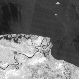
ภาพโมเสกรายปีของ PALSAR-2/PALSAR ทั่วโลก เวอร์ชัน 1

คุณดูชุดข้อมูลเวอร์ชันใหม่กว่านี้ซึ่งมีข้อมูลสำหรับปี 2015-2021 ได้ใน JAXA/ALOS/PALSAR/YEARLY/SAR_EPOCH โมเสก PALSAR/PALSAR-2 ขนาด 25 ม. ทั่วโลกคือภาพ SAR ทั่วโลกที่ไร้รอยต่อซึ่งสร้างขึ้นโดยการต่อแถบภาพ SAR จาก PALSAR/PALSAR-2 สำหรับแต่ละปีและสถานที่ตั้ง เราได้เลือกข้อมูลแถบ … alos alos2 eroc jaxa palsar palsar2 -
Global PALSAR-2/PALSAR Yearly Mosaic เวอร์ชัน 2.5.0

ภาพโมเสค PALSAR/PALSAR-2 ขนาด 25 ม. ทั่วโลกคือภาพ SAR ทั่วโลกที่ไร้รอยต่อซึ่งสร้างขึ้นโดยการต่อแถบภาพ SAR จาก PALSAR/PALSAR-2 สำหรับแต่ละปีและสถานที่ ระบบจะเลือกข้อมูลแถบผ่านการตรวจสอบด้วยสายตาของภาพโมเสกที่เรียกดูได้ในช่วงเวลาดังกล่าว โดยจะเลือกภาพที่แสดง … alos alos2 eroc jaxa palsar palsar2 -
PALSAR-2 ScanSAR ระดับ 2.2
ScanSAR ของ PALSAR-2 ขนาด 25 ม. คือข้อมูลการกระเจิงกลับที่ปรับให้เป็นมาตรฐานของโหมดการสังเกตพื้นที่กว้างของ PALSAR-2 ที่มีความกว้างในการสังเกต 350 กม. ภาพ SAR ได้รับการปรับแก้เชิงระนาบและปรับแก้ความชันโดยใช้แบบจำลองพื้นผิวดิจิทัล ALOS World 3D - 30 ม. (AW3D30) ระบบจะจัดเก็บข้อมูลการแบ่งขั้ว … alos2 eroc jaxa palsar2 radar sar
Datasets tagged palsar2 in Earth Engine
[null,null,[],[],[]]