-
ALOS-2 PALSAR-2 StripMap ระดับ 2.1

ตั้งแต่คืนวันที่ 1 มกราคม 2024 เป็นต้นมา JAXA ได้ดำเนินการสังเกตการณ์ฉุกเฉินด้วย ALOS-2 PALSAR-2 ตามคำขอจากกระทรวงของญี่ปุ่นและองค์กรที่เกี่ยวข้อง เนื่องจาก JAXA คาดหวังว่าข้อมูลการสังเกตการณ์ฉุกเฉินเหล่านี้จะมีประโยชน์อย่างยิ่งต่อการจัดการภัยพิบัติ JAXA จึงตัดสินใจเปิดเผยข้อมูลเหล่านี้ในวันที่ … alos2 eroc jaxa palsar2 radar sar -
แผนที่ป่า/ไม่ใช่ป่าทั่วโลก 3 คลาสจาก PALSAR-2/PALSAR

คุณดูชุดข้อมูลเวอร์ชันใหม่กว่านี้ที่มี 4 คลาสสำหรับปี 2017-2020 ได้ใน JAXA/ALOS/PALSAR/YEARLY/FNF4 แผนที่ป่า/ไม่ใช่ป่า (FNF) ทั่วโลกสร้างขึ้นโดยการจัดประเภทภาพ SAR (สัมประสิทธิ์การกระเจิงย้อนกลับ) ในภาพโมเสก SAR ของ PALSAR-2/PALSAR ที่ความละเอียด 25 ม. ทั่วโลก เพื่อให้พิกเซลที่มีการกระเจิงย้อนกลับสูงและต่ำ … alos alos2 classification eroc forest forest-biomass -
แผนที่ป่า/ไม่ใช่ป่า PALSAR-2/PALSAR แบบ 4 คลาสทั่วโลก

แผนที่ป่า/ไม่ใช่ป่า (FNF) ทั่วโลกสร้างขึ้นโดยการจัดประเภทภาพ SAR (สัมประสิทธิ์การกระเจิงกลับ) ในภาพโมเสก PALSAR-2/PALSAR SAR ความละเอียด 25 ม. ทั่วโลก เพื่อให้พิกเซลที่มีการกระเจิงกลับสูงและต่ำได้รับการกำหนดเป็น "ป่า" และ "ไม่ใช่ป่า" ตามลำดับ ในที่นี้ "ป่า" หมายถึงป่าธรรมชาติที่มี … alos alos2 classification eroc forest forest-biomass -
ภาพโมเสกรายปีของ PALSAR-2/PALSAR ทั่วโลก เวอร์ชัน 1

คุณดูชุดข้อมูลเวอร์ชันใหม่กว่านี้ซึ่งมีข้อมูลสำหรับปี 2015-2021 ได้ใน JAXA/ALOS/PALSAR/YEARLY/SAR_EPOCH โมเสก PALSAR/PALSAR-2 ขนาด 25 ม. ทั่วโลกคือภาพ SAR ทั่วโลกที่ไร้รอยต่อซึ่งสร้างขึ้นโดยการต่อแถบภาพ SAR จาก PALSAR/PALSAR-2 สำหรับแต่ละปีและสถานที่ตั้ง เราได้เลือกข้อมูลแถบ … alos alos2 eroc jaxa palsar palsar2 -
Global PALSAR-2/PALSAR Yearly Mosaic เวอร์ชัน 2.5.0

ภาพโมเสค PALSAR/PALSAR-2 ทั่วโลกที่ความละเอียด 25 ม. คือภาพ SAR ทั่วโลกที่ไร้รอยต่อซึ่งสร้างขึ้นโดยการต่อแถบภาพ SAR จาก PALSAR/PALSAR-2 สำหรับแต่ละปีและสถานที่ ระบบจะเลือกข้อมูลแถบผ่านการตรวจสอบด้วยสายตาของภาพโมเสกที่เรียกดูได้ในช่วงเวลาดังกล่าว โดยจะเลือกภาพที่แสดง … alos alos2 eroc jaxa palsar palsar2 -
การกระจายตัวของความสอดคล้องแบบอินเทอร์เฟอโรเมตริกและแบ็กสแคตเตอร์ของ Sentinel-1 ตามฤดูกาลทั่วโลก V2019 แบ็กสแคตเตอร์

ชุดข้อมูลนี้เป็นการแสดงพื้นที่แบบแรกของความสอดคล้องแบบซ้ำผ่านเชิงแทรกสอดของเรดาร์ชนิดช่องรับคลื่นสังเคราะห์ (SAR) ในย่านความถี่ C-Band ทั่วโลกแบบหลายฤดูกาล และลายเซ็นการกระเจิงกลับ โดยครอบคลุมผืนดินและแผ่นน้ำแข็งตั้งแต่ละติจูด 82 องศาเหนือถึง 79 องศาใต้ ชุดข้อมูลได้มาจาก … แบบหลายช่วงเวลา backscatter earth-big-data jpl nasa polarization radar -
ความสอดคล้องของ Sentinel-1 Interferometric และ Backscatter V2019 ตามฤดูกาลทั่วโลก

ชุดข้อมูลนี้เป็นการแสดงพื้นที่แบบแรกของความสอดคล้องแบบซ้ำผ่านเชิงแทรกสอดของเรดาร์ชนิดช่องรับคลื่นสังเคราะห์ (SAR) ในย่านความถี่ C-Band ทั่วโลกแบบหลายฤดูกาล และลายเซ็นการกระเจิงกลับ โดยครอบคลุมผืนดินและแผ่นน้ำแข็งตั้งแต่ละติจูด 82 องศาเหนือถึง 79 องศาใต้ ชุดข้อมูลได้มาจาก … แบบหลายช่วงเวลา earth-big-data jpl nasa polarization radar sar -
พารามิเตอร์โมเดลการลดทอนความสอดคล้องและการกระเจิงย้อนกลับของ Sentinel-1 แบบ Interferometric ตามฤดูกาลทั่วโลก V2019

ชุดข้อมูลนี้เป็นการแสดงพื้นที่แบบแรกของความสอดคล้องแบบซ้ำผ่านเชิงแทรกสอดของเรดาร์ชนิดช่องรับคลื่นสังเคราะห์ (SAR) ในย่านความถี่ C-Band ทั่วโลกแบบหลายฤดูกาล และลายเซ็นการกระเจิงกลับ โดยครอบคลุมผืนดินและแผ่นน้ำแข็งตั้งแต่ละติจูด 82 องศาเหนือถึง 79 องศาใต้ ชุดข้อมูลได้มาจาก … แบบหลายช่วงเวลา earth-big-data jpl nasa polarization radar sar -
ความสอดคล้องแบบอินเทอร์เฟอโรเมตริกและแบ็กสแคตของ Sentinel-1 ตามฤดูกาลทั่วโลก V2019 เงาที่ทับซ้อนกัน

ชุดข้อมูลนี้เป็นการแสดงพื้นที่แบบแรกของความสอดคล้องแบบซ้ำผ่านเชิงแทรกสอดของเรดาร์ชนิดช่องรับคลื่นสังเคราะห์ (SAR) ในย่านความถี่ C-Band ทั่วโลกแบบหลายฤดูกาล และลายเซ็นการกระเจิงกลับ โดยครอบคลุมผืนดินและแผ่นน้ำแข็งตั้งแต่ละติจูด 82 องศาเหนือถึง 79 องศาใต้ ชุดข้อมูลได้มาจาก … แบบหลายช่วงเวลา earth-big-data jpl nasa polarization radar sar -
การกระเจิงย้อนกลับของ SAR ที่แก้ไขภูมิประเทศตามการแผ่รังสีของ OPERA จากเลเยอร์คงที่ของ Sentinel-1 V1.0

ผลิตภัณฑ์นี้มีเลเยอร์เรขาคณิตเรดาร์แบบคงที่ซึ่งเชื่อมโยงกับค่าการกระเจิงย้อนกลับของ SAR ที่แก้ไขภูมิประเทศด้วยการวัดรังสีของ OPERA จากชุดข้อมูล Sentinel-1 เนื่องจากหลอดวงโคจรแคบของภารกิจ S1 เลเยอร์เรดาร์เรขาคณิต เช่น มุมตกกระทบ มุมตกกระทบท้องถิ่น จำนวนลุค และปัจจัยการปรับค่าปกติของพื้นที่ RTC (ANF) … jpl nasa opera sar satellite-imagery sentinel1-derived -
การกระเจิงกลับของ SAR ที่แก้ไขภูมิประเทศตามการแผ่รังสีของ OPERA จาก Sentinel-1 V1.0

ผลิตภัณฑ์นี้ประกอบด้วยการกระเจิงกลับของเรดาร์ที่ปรับให้เป็นมาตรฐานตามภูมิประเทศ โดยจะแมปสัญญาณที่เกี่ยวข้องกับคุณสมบัติทางกายภาพของวัตถุที่กระจัดกระจายบนพื้น เช่น ความขรุขระของพื้นผิวและความชื้นในดิน และ/หรือพืชพรรณ ผลิตภัณฑ์ RTC-S1 ของ OPERA ได้มาจาก Copernicus Sentinel-1 Interferometric Wide (IW) … backscatter jpl nasa opera polarization radar -
PALSAR-2 ScanSAR ระดับ 2.2
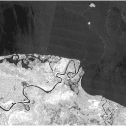
ScanSAR ของ PALSAR-2 ที่ความละเอียด 25 ม. คือข้อมูลการกระเจิงกลับที่ปรับให้เป็นมาตรฐานของโหมดการสังเกตการณ์พื้นที่กว้างของ PALSAR-2 ซึ่งมีความกว้างของการสังเกตการณ์ 350 กม. ภาพ SAR ได้รับการแก้ไขเชิงออร์โทและแก้ไขความลาดชันโดยใช้แบบจำลองพื้นผิวเชิงเลข (Digital Surface Model) ของ ALOS World 3D - 30 ม. (AW3D30) ระบบจะจัดเก็บข้อมูลโพลาไรเซชัน … alos2 eroc jaxa palsar2 radar sar -
SAR GRD ของ Sentinel-1: เรดาร์ชนิดช่องรับคลื่นสังเคราะห์ในย่านความถี่ C-Band ที่ตรวจพบระยะพื้นดิน, การปรับขนาดแบบลอการิทึม

ภารกิจ Sentinel-1 ให้ข้อมูลจากเครื่องมือเรดาร์ชนิดช่องรับคลื่นสังเคราะห์ (SAR) ในย่านความถี่ C-Band แบบโพลาไรเซชันคู่ที่ 5.405GHz (ย่านความถี่ C-Band) คอลเล็กชันนี้ประกอบด้วยฉาก S1 Ground Range Detected (GRD) ซึ่งประมวลผลโดยใช้ Sentinel-1 Toolbox เพื่อสร้างผลิตภัณฑ์ที่ได้รับการปรับเทียบและแก้ไขภาพออร์โท โดยคอลเล็กชันจะอัปเดตทุกวัน ใหม่ … backscatter copernicus esa eu polarization radar
Datasets tagged sar in Earth Engine
[null,null,[],[],[]]