-
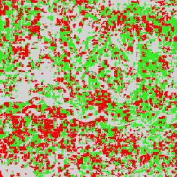
ขอบเขตน้ำผิวดินแบบไดนามิกจาก Sentinel-1 (DSWx-S1) V1

ชุดข้อมูลนี้มีขอบเขตน้ำผิวดินแบบไดนามิกของ OPERA ระดับ 3 จาก Sentinel-1 (DSWX-S1) DSWx-S1 ให้การทำแผนที่ทางภูมิศาสตร์แบบเกือบทั้งโลกของขอบเขตน้ำผิวดินเหนือพื้นดินที่ความละเอียดเชิงพื้นที่ 30 เมตรเหนือระบบกริด Military Grid Reference System (MGRS) โดยมีความถี่ในการกลับมาสังเกตการณ์ตามช่วงเวลาที่ … geophysical nasa opera sentinel1-derived surface surface-ground-water -
ESA WorldCereal 10 ม. v100

ชุดผลิตภัณฑ์ WorldCereal 10 ม. ปี 2021 ของ European Space Agency (ESA) ประกอบด้วยแผนที่พืชผลประจำปีและตามฤดูกาลในระดับโลก รวมถึงความน่าเชื่อถือที่เกี่ยวข้อง ซึ่งสร้างขึ้นเพื่อเป็นส่วนหนึ่งของโปรเจ็กต์ ESA-WorldCereal ดูข้อมูลเพิ่มเติมเกี่ยวกับเนื้อหาของผลิตภัณฑ์เหล่านี้และวิธีการที่ใช้ในการ … agriculture copernicus crop esa global landcover -
ESA WorldCereal Active Cropland 10 ม. v100
ชุดผลิตภัณฑ์ ESA WorldCereal Active Cropland 10 ม. ปี 2021 ของ European Space Agency (ESA) ประกอบด้วยเครื่องหมายพื้นที่เพาะปลูกที่ใช้งานอยู่ตามฤดูกาลในระดับโลก ซึ่งสร้างขึ้นเพื่อเป็นส่วนหนึ่งของโปรเจ็กต์ ESA-WorldCereal ผลิตภัณฑ์พื้นที่เพาะปลูกที่ใช้งานอยู่จะระบุว่าพิกเซลที่ระบุว่าเป็นพืชผลชั่วคราวมีการ … อย่างจริงจังหรือไม่ agriculture copernicus crop esa global landcover -
ESA WorldCover 10 ม. v100

ผลิตภัณฑ์ ESA WorldCover 10 ม. ปี 2020 ของ European Space Agency (ESA) ให้แผนที่พื้นผิวปกคลุมดินของพื้นที่ทั่วโลกปี 2020 ที่ความละเอียด 10 เมตรโดยอิงตามข้อมูล Sentinel-1 และ Sentinel-2 ผลิตภัณฑ์ WorldCover มีพื้นผิวปกคลุมดิน 11 ประเภทและสร้างขึ้นในกรอบของ … esa landcover landuse landuse-landcover sentinel1-derived sentinel2-derived -
ESA WorldCover 10 ม. v200

ผลิตภัณฑ์ ESA WorldCover 10 ม. ปี 2021 ของ European Space Agency (ESA) ให้แผนที่พื้นผิวปกคลุมดินของพื้นที่ทั่วโลกปี 2021 ที่ความละเอียด 10 เมตรโดยอิงตามข้อมูล Sentinel-1 และ Sentinel-2 ผลิตภัณฑ์ WorldCover มีพื้นผิวปกคลุมดิน 11 ประเภทและสร้างขึ้นในกรอบของ … esa landcover landuse landuse-landcover sentinel1-derived sentinel2-derived -
EUCROPMAP

แผนที่ประเภทพืชผลของยุโรปโดยอิงตามการสังเกตการณ์ในแหล่งกำเนิดของ Sentinel-1 และ LUCAS Copernicus ปี 2018 สำหรับปี 2018 และการผสมผสานระหว่าง Sentinel-1, Sentinel-2 และข้อมูลเสริมกับการสังเกตการณ์ LUCAS Copernicus ปี 2022 สำหรับปี 2022 ชุดข้อมูลนี้แสดงถึง … ชุดแรกโดยอิงตามการสำรวจในแหล่งกำเนิดของ LUCAS 2018 Copernicus ที่ไม่ซ้ำกัน agriculture crop eu jrc lucas sentinel1-derived -
ความสอดคล้องและความเข้มของการสะท้อนกลับแบบอินเตอร์เฟอโรเมตริกตามฤดูกาลทั่วโลกของ Sentinel-1 V2019 ความเข้มของการสะท้อนกลับ

ชุดข้อมูลนี้เป็นการแสดงเชิงพื้นที่แบบแรกของความสอดคล้องและความเข้มของการสะท้อนกลับแบบอินเตอร์เฟอโรเมตริกตามฤดูกาลหลายฤดูกาลทั่วโลกของเรดาร์รูรับแสงสังเคราะห์ (SAR) ในย่านความถี่ C-Band การครอบคลุมประกอบด้วยแผ่นดินและแผ่นน้ำแข็งตั้งแต่ละติจูดเหนือ 82 องศาถึงละติจูดใต้ 79 องศา ชุดข้อมูลได้มาจาก … แบบหลายช่วงเวลา backscatter earth-big-data jpl nasa polarization radar -
ความสอดคล้องและความเข้มของการสะท้อนกลับแบบอินเตอร์เฟอโรเมตริกตามฤดูกาลทั่วโลกของ Sentinel-1 V2019 ความสอดคล้อง

ชุดข้อมูลนี้เป็นการแสดงเชิงพื้นที่แบบแรกของความสอดคล้องและความเข้มของการสะท้อนกลับแบบอินเตอร์เฟอโรเมตริกตามฤดูกาลหลายฤดูกาลทั่วโลกของเรดาร์รูรับแสงสังเคราะห์ (SAR) ในย่านความถี่ C-Band การครอบคลุมประกอบด้วยแผ่นดินและแผ่นน้ำแข็งตั้งแต่ละติจูดเหนือ 82 องศาถึงละติจูดใต้ 79 องศา ชุดข้อมูลได้มาจาก … แบบหลายช่วงเวลา earth-big-data jpl nasa polarization radar sar -
พารามิเตอร์โมเดลการเสื่อมสภาพของความสอดคล้องและความเข้มของการสะท้อนกลับแบบอินเตอร์เฟอโรเมตริกตามฤดูกาลทั่วโลกของ Sentinel-1 V2019

ชุดข้อมูลนี้เป็นการแสดงเชิงพื้นที่แบบแรกของความสอดคล้องและความเข้มของการสะท้อนกลับแบบอินเตอร์เฟอโรเมตริกตามฤดูกาลหลายฤดูกาลทั่วโลกของเรดาร์รูรับแสงสังเคราะห์ (SAR) ในย่านความถี่ C-Band การครอบคลุมประกอบด้วยแผ่นดินและแผ่นน้ำแข็งตั้งแต่ละติจูดเหนือ 82 องศาถึงละติจูดใต้ 79 องศา ชุดข้อมูลได้มาจาก … แบบหลายช่วงเวลา earth-big-data jpl nasa polarization radar sar -
การซ้อนทับเงาของความสอดคล้องและความเข้มของการสะท้อนกลับแบบอินเตอร์เฟอโรเมตริกตามฤดูกาลทั่วโลกของ Sentinel-1 V2019

ชุดข้อมูลนี้เป็นการแสดงเชิงพื้นที่แบบแรกของความสอดคล้องและความเข้มของการสะท้อนกลับแบบอินเตอร์เฟอโรเมตริกตามฤดูกาลหลายฤดูกาลทั่วโลกของเรดาร์รูรับแสงสังเคราะห์ (SAR) ในย่านความถี่ C-Band การครอบคลุมประกอบด้วยแผ่นดินและแผ่นน้ำแข็งตั้งแต่ละติจูดเหนือ 82 องศาถึงละติจูดใต้ 79 องศา ชุดข้อมูลได้มาจาก … แบบหลายช่วงเวลา earth-big-data jpl nasa polarization radar sar -
ความเข้มของการสะท้อนกลับของ SAR ที่แก้ไขเชิงรังสีของภูมิประเทศจากเลเยอร์คงที่ของ Sentinel-1 V1.0 ของ OPERA

ผลิตภัณฑ์นี้มีเลเยอร์เรขาคณิตของเรดาร์คงที่ที่เชื่อมโยงกับชุดข้อมูลความเข้มของการสะท้อนกลับของ SAR ที่แก้ไขเชิงรังสีของภูมิประเทศจาก Sentinel-1 ของ OPERA เนื่องจากท่อวงโคจรแคบของภารกิจ S1 เลเยอร์เรขาคณิตของเรดาร์ เช่น มุมตกกระทบ มุมตกกระทบในพื้นที่ จำนวนการมอง และปัจจัยการปรับให้เป็นมาตรฐานพื้นที่ RTC (ANF) … jpl nasa opera sar satellite-imagery sentinel1-derived -
ความเข้มของการสะท้อนกลับของ SAR ที่แก้ไขเชิงรังสีของภูมิประเทศจาก Sentinel-1 V1.0 ของ OPERA

ผลิตภัณฑ์นี้ประกอบด้วยความเข้มของการสะท้อนกลับของเรดาร์ที่ปรับให้เป็นมาตรฐานตามภูมิประเทศ โดยจะทำแผนที่สัญญาณที่เกี่ยวข้องกับคุณสมบัติทางกายภาพของวัตถุที่กระเจิงบนพื้นดิน เช่น ความขรุขระของพื้นผิวและความชื้นในดินและ/หรือพืชพรรณ ผลิตภัณฑ์ OPERA RTC-S1 ได้มาจาก Copernicus Sentinel-1 Interferometric Wide (IW) … backscatter jpl nasa opera polarization radar -
การฝังดาวเทียม V1
ชุดข้อมูลการฝังดาวเทียมของ Google เป็นคอลเล็กชันการฝังเชิงพื้นที่ที่ได้เรียนรู้แล้วและพร้อมสำหรับการวิเคราะห์ในระดับโลก พิกเซลขนาด 10 เมตรแต่ละพิกเซลในชุดข้อมูลนี้เป็นการแสดง 64 มิติ หรือ "เวกเตอร์การฝัง" ที่เข้ารหัสวิถีชั่วคราวของสภาพพื้นผิวที่และรอบๆ พิกเซลนั้นๆ ตามที่วัดโดยการสังเกตการณ์โลกต่างๆ … annual global google landsat-derived satellite-imagery sentinel1-derived -
รอยเท้าการตั้งถิ่นฐานของโลกปี 2015

รอยเท้าการตั้งถิ่นฐานของโลก (WSF) ปี 2015 เป็นมาสก์ไบนารีความละเอียด 10 เมตรที่แสดงขอบเขตของการตั้งถิ่นฐานของมนุษย์ทั่วโลกซึ่งได้มาจากการถ่ายภาพ Landsat-8 และ Sentinel-1 แบบหลายช่วงเวลาปี 2014-2015 (ซึ่งมีการประมวลผลฉากต่างๆ ประมาณ 217,000 และ 107,000 ฉากตามลำดับ) การเปลี่ยนแปลงตามช่วงเวลาของการตั้งถิ่นฐานของมนุษย์ … landcover landsat-derived population sentinel1-derived settlement urban
Datasets tagged sentinel1-derived in Earth Engine
[null,null,[],[],[]]