-
ALOS-2 PALSAR-2 StripMap ระดับ 2.1

ตั้งแต่คืนวันที่ 1 มกราคม 2024 เป็นต้นไป JAXA ได้ดำเนินการสังเกตการณ์ฉุกเฉินด้วย ALOS-2 PALSAR-2 ตามคำขอจากกระทรวงและองค์กรที่เกี่ยวข้องของญี่ปุ่น เนื่องจาก JAXA คาดว่าข้อมูลการสังเกตการณ์ฉุกเฉินเหล่านี้จะมีประโยชน์อย่างยิ่งในการจัดการภัยพิบัติ JAXA จึงตัดสินใจเปิดเผยข้อมูลเหล่านี้ในวันที่… alos2 eroc jaxa palsar2 radar sar -
การสังเกตการณ์กระแสน้ำในมหาสมุทรทั่วโลกแบบ In-situ จาก Copernicus - เรดาร์แบบรัศมี

In Situ TAC เป็นศูนย์กลางแบบกระจายที่จัดตั้งขึ้นโดยอิงตามภูมิภาคสมุทรศาสตร์ 7 แห่ง ได้แก่ มหาสมุทรทั่วโลกและพันธมิตรระดับภูมิภาค 6 แห่งของ EUROGOOS โดยมีพาร์ทเนอร์ 14 รายจาก 11 ประเทศในยุโรป ซึ่งไม่ได้ติดตั้งระบบการสังเกตการณ์ใดๆ และอาศัยข้อมูลที่ได้รับเงินทุนจากแหล่งอื่นๆ เท่านั้น… copernicus currents insitu oceans radar -
การสังเกตการณ์กระแสน้ำในมหาสมุทรทั่วโลกแบบ In-situ จาก Copernicus - เรดาร์แบบรวม

In Situ TAC เป็นศูนย์กลางแบบกระจายที่จัดตั้งขึ้นโดยอิงตามภูมิภาคสมุทรศาสตร์ 7 แห่ง ได้แก่ มหาสมุทรทั่วโลกและพันธมิตรระดับภูมิภาค 6 แห่งของ EUROGOOS โดยมีพาร์ทเนอร์ 14 รายจาก 11 ประเทศในยุโรป ซึ่งไม่ได้ติดตั้งระบบการสังเกตการณ์ใดๆ และอาศัยข้อมูลที่ได้รับเงินทุนจากแหล่งอื่นๆ เท่านั้น… copernicus currents insitu oceans radar -
ความสอดคล้องแบบอินเตอร์เฟอโรเมตริกและการกระเจิงย้อนกลับตามฤดูกาลทั่วโลกจาก Sentinel-1 V2019 การกระเจิงย้อนกลับ

ชุดข้อมูลนี้เป็นการแสดงข้อมูลเชิงพื้นที่แบบแรกในโลกของความสอดคล้องแบบอินเตอร์เฟอโรเมตริกและการกระเจิงย้อนกลับแบบหลายฤดูกาลทั่วโลกจากเรดาร์ชนิดช่องรับคลื่นสังเคราะห์ (SAR) ในย่านความถี่ C-Band แบบหลายรอบ โดยครอบคลุมผืนดินและแผ่นน้ำแข็งตั้งแต่ละติจูดเหนือ 82 องศาถึงละติจูดใต้ 79 องศา ชุดข้อมูลนี้ได้มาจาก…แบบหลายช่วงเวลา backscatter earth-big-data jpl nasa polarization radar -
ความสอดคล้องแบบอินเตอร์เฟอโรเมตริกและการกระเจิงย้อนกลับตามฤดูกาลทั่วโลกจาก Sentinel-1 V2019 ความสอดคล้อง

ชุดข้อมูลนี้เป็นการแสดงข้อมูลเชิงพื้นที่แบบแรกในโลกของความสอดคล้องแบบอินเตอร์เฟอโรเมตริกและการกระเจิงย้อนกลับแบบหลายฤดูกาลทั่วโลกจากเรดาร์ชนิดช่องรับคลื่นสังเคราะห์ (SAR) ในย่านความถี่ C-Band แบบหลายรอบ โดยครอบคลุมผืนดินและแผ่นน้ำแข็งตั้งแต่ละติจูดเหนือ 82 องศาถึงละติจูดใต้ 79 องศา ชุดข้อมูลนี้ได้มาจาก…แบบหลายช่วงเวลา earth-big-data jpl nasa polarization radar sar -
พารามิเตอร์โมเดลการเสื่อมสภาพของความสอดคล้องแบบอินเตอร์เฟอโรเมตริกและการกระเจิงย้อนกลับตามฤดูกาลทั่วโลกจาก Sentinel-1 V2019

ชุดข้อมูลนี้เป็นการแสดงข้อมูลเชิงพื้นที่แบบแรกในโลกของความสอดคล้องแบบอินเตอร์เฟอโรเมตริกและการกระเจิงย้อนกลับแบบหลายฤดูกาลทั่วโลกจากเรดาร์ชนิดช่องรับคลื่นสังเคราะห์ (SAR) ในย่านความถี่ C-Band แบบหลายรอบ โดยครอบคลุมผืนดินและแผ่นน้ำแข็งตั้งแต่ละติจูดเหนือ 82 องศาถึงละติจูดใต้ 79 องศา ชุดข้อมูลนี้ได้มาจาก…แบบหลายช่วงเวลา earth-big-data jpl nasa polarization radar sar -
ความสอดคล้องแบบอินเตอร์เฟอโรเมตริกและการกระเจิงย้อนกลับตามฤดูกาลทั่วโลกจาก Sentinel-1 V2019 การเกิด การซ้อนทับ และการบัง

ชุดข้อมูลนี้เป็นการแสดงข้อมูลเชิงพื้นที่แบบแรกในโลกของความสอดคล้องแบบอินเตอร์เฟอโรเมตริกและการกระเจิงย้อนกลับแบบหลายฤดูกาลทั่วโลกจากเรดาร์ชนิดช่องรับคลื่นสังเคราะห์ (SAR) ในย่านความถี่ C-Band แบบหลายรอบ โดยครอบคลุมผืนดินและแผ่นน้ำแข็งตั้งแต่ละติจูดเหนือ 82 องศาถึงละติจูดใต้ 79 องศา ชุดข้อมูลนี้ได้มาจาก…แบบหลายช่วงเวลา earth-big-data jpl nasa polarization radar sar -
การกระเจิงย้อนกลับจากเรดาร์ชนิดช่องรับคลื่นสังเคราะห์ (SAR) ที่แก้ไขความผิดเพี้ยนเชิงเรขาคณิตของภูมิประเทศจาก Sentinel-1 V1.0 ของ OPERA

ผลิตภัณฑ์นี้ประกอบด้วยการกระเจิงย้อนกลับจากเรดาร์ที่แปลงเป็นรูปแบบมาตรฐานโดยอิงตามภูมิประเทศ โดยจะแสดงสัญญาณที่เกี่ยวข้องกับคุณสมบัติทางกายภาพของวัตถุที่กระเจิงบนพื้นดิน เช่น ความขรุขระของพื้นผิว ความชื้นในดิน และ/หรือพืช ผลิตภัณฑ์ OPERA RTC-S1 ได้มาจากเรดาร์ชนิดช่องรับคลื่นสังเคราะห์ (SAR) ในย่านความถี่ C-Band แบบหลายรอบของ Copernicus Sentinel-1… backscatter jpl nasa opera polarization radar -
PALSAR-2 ScanSAR ระดับ 2.2
PALSAR-2 ScanSAR ที่ความละเอียด 25 เมตรคือข้อมูลการกระเจิงย้อนกลับที่แปลงเป็นรูปแบบมาตรฐานของโหมดการสังเกตการณ์พื้นที่กว้างของ PALSAR-2 ที่มีระยะการสังเกตการณ์ 350 กม. ภาพจากเรดาร์ชนิดช่องรับคลื่นสังเคราะห์ (SAR) ได้รับการแก้ไขความผิดเพี้ยนเชิงเรขาคณิตและแก้ไขความลาดชันโดยใช้แบบจำลองพื้นผิวเชิงเลข (DSM) ALOS World 3D - 30 ม. (AW3D30) ข้อมูลโพลาไรเซชันจะจัดเก็บไว้… alos2 eroc jaxa palsar2 radar sar -
Sentinel-1 SAR GRD: เรดาร์ชนิดช่องรับคลื่นสังเคราะห์ (SAR) ในย่านความถี่ C-Band ที่ตรวจพบระยะพื้นดิน, การปรับสเกลแบบลอการิทึม

ภารกิจ Sentinel-1 ให้ข้อมูลจากเครื่องมือเรดาร์ชนิดช่องรับคลื่นสังเคราะห์ (SAR) ในย่านความถี่ C-Band แบบโพลาไรเซชันคู่ที่ความถี่ 5.405 GHz (ย่านความถี่ C-Band) คอลเล็กชันนี้มีฉากเรดาร์ชนิดช่องรับคลื่นสังเคราะห์ (SAR) ในย่านความถี่ C-Band แบบหลายรอบที่ตรวจพบระยะพื้นดิน (GRD) ซึ่งประมวลผลโดยใช้ Sentinel-1 Toolbox เพื่อสร้างผลิตภัณฑ์ที่ปรับเทียบและแก้ไขความผิดเพี้ยนเชิงเรขาคณิตแล้ว คอลเล็กชันนี้จะอัปเดตทุกวัน ใหม่… backscatter copernicus esa eu polarization radar
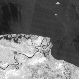
Datasets tagged radar in Earth Engine
[null,null,[],[],[]]