-
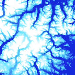
ArcticDEM Mosaic V4.1
ArcticDEM は、光学ステレオ画像、ハイ パフォーマンス コンピューティング、オープンソースの写真測量ソフトウェアを使用して、北極圏の高解像度で高品質なデジタル表層モデル(DSM)を自動生成する、国立地理空間情報庁(NGA)および国立科学財団(NSF)の官民イニシアチブです。これには、植生、樹木エリア、建物などが含まれます。 北極圏 dem 標高地形図 地球物理学的 pgc umn -
ArcticDEM ストリップ
ArcticDEM は、光学ステレオ画像、ハイ パフォーマンス コンピューティング、オープンソースの写真測量ソフトウェアを使用して、北極圏の高解像度で高品質なデジタル表層モデル(DSM)を自動生成する、国立地理空間情報庁(NGA)および国立科学財団(NSF)の官民イニシアチブです。これには、植生、樹木エリア、建物などが含まれます。 北極圏 dem 標高地形図 地球物理学的 pgc umn -
REMA モザイク
南極大陸の基準高度モデル(REMA)は、南極大陸の高解像度でタイムスタンプ付きの数値表層モデル(DSM)で、2 m と 8 m の空間分解能です。モザイク化された DEM ファイルは、複数のストリップからコンパイルされます。これらのストリップは、同時に登録、ブレンド、フェザリングされ、エッジマッチングのアーティファクトを削減しています。 dem 標高・地形学 地球物理学的 pgc rema umn -
REMA ストリップ 2m
南極大陸の基準高度モデル(REMA)は、南極大陸の高解像度でタイムスタンプ付きの数値表層モデル(DSM)で、2 m と 8 m の空間分解能です。ストリップ DEM ファイルは、DigitalGlobe の... dem 標高・地形学 地球物理学的 pgc rema umn -
REMA ストリップ 8m
南極大陸の基準高度モデル(REMA)は、南極大陸の高解像度でタイムスタンプ付きの数値表層モデル(DSM)で、2 m と 8 m の空間分解能です。ストリップ DEM ファイルは、DigitalGlobe の... dem 標高・地形学 地球物理学的 pgc rema umn
Datasets tagged pgc in Earth Engine
[null,null,[],[[["\u003cp\u003eArcticDEM provides high-resolution digital surface models (DSMs) of the Arctic, including vegetation, tree canopy, buildings, and other features.\u003c/p\u003e\n"],["\u003cp\u003eREMA offers high-resolution, time-stamped DSMs of Antarctica at 2-meter and 8-meter resolutions, available as both individual strips and a mosaic.\u003c/p\u003e\n"],["\u003cp\u003eBoth ArcticDEM and REMA are products of public-private initiatives involving NGA, NSF, and PGC, utilizing optical stereo imagery and advanced computing techniques.\u003c/p\u003e\n"]]],[],null,["# Datasets tagged pgc in Earth Engine\n\n-\n\n |--------------------------------------------------------------------------------------------------------------------------------------------------------------------------------------------------------------------------------------------------------------------------------------------------------------------------------------------------------------------------------------------|\n | [### ArcticDEM Mosaic V4.1](/earth-engine/datasets/catalog/UMN_PGC_ArcticDEM_V4_2m_mosaic) |\n | ArcticDEM is a National Geospatial-Intelligence Agency (NGA) and National Science Foundation (NSF) public-private initiative to automatically produce a high-resolution, high-quality digital surface model (DSM) of the Arctic using optical stereo imagery, high-performance computing, and open source photogrammetry software. It includes vegetation, tree canopy, buildings, and ... |\n | [arctic](/earth-engine/datasets/tags/arctic) [dem](/earth-engine/datasets/tags/dem) [elevation-topography](/earth-engine/datasets/tags/elevation-topography) [geophysical](/earth-engine/datasets/tags/geophysical) [pgc](/earth-engine/datasets/tags/pgc) [umn](/earth-engine/datasets/tags/umn) |\n\n-\n\n |--------------------------------------------------------------------------------------------------------------------------------------------------------------------------------------------------------------------------------------------------------------------------------------------------------------------------------------------------------------------------------------------|\n | [### ArcticDEM Strips](/earth-engine/datasets/catalog/UMN_PGC_ArcticDEM_V3_2m) |\n | ArcticDEM is a National Geospatial-Intelligence Agency (NGA) and National Science Foundation (NSF) public-private initiative to automatically produce a high-resolution, high-quality digital surface model (DSM) of the Arctic using optical stereo imagery, high-performance computing, and open source photogrammetry software. It includes vegetation, tree canopy, buildings, and ... |\n | [arctic](/earth-engine/datasets/tags/arctic) [dem](/earth-engine/datasets/tags/dem) [elevation-topography](/earth-engine/datasets/tags/elevation-topography) [geophysical](/earth-engine/datasets/tags/geophysical) [pgc](/earth-engine/datasets/tags/pgc) [umn](/earth-engine/datasets/tags/umn) |\n\n-\n\n |---------------------------------------------------------------------------------------------------------------------------------------------------------------------------------------------------------------------------------------------------------------------------------------------------------------------------|\n | [### REMA Mosaic](/earth-engine/datasets/catalog/UMN_PGC_REMA_V1_1_8m) |\n | The Reference Elevation Model of Antarctica (REMA) is a high resolution, time-stamped Digital Surface Model (DSM) of Antarctica at 2-meter and 8-meter spatial resolutions. Mosaicked DEM files are compiled from multiple strips that have been co-registered, blended, and feathered to reduce edge-matching artifacts. |\n | [dem](/earth-engine/datasets/tags/dem) [elevation-topography](/earth-engine/datasets/tags/elevation-topography) [geophysical](/earth-engine/datasets/tags/geophysical) [pgc](/earth-engine/datasets/tags/pgc) [rema](/earth-engine/datasets/tags/rema) [umn](/earth-engine/datasets/tags/umn) |\n\n-\n\n |--------------------------------------------------------------------------------------------------------------------------------------------------------------------------------------------------------------------------------------------------------------------------------------------------------------------------|\n | [### REMA Strips 2m](/earth-engine/datasets/catalog/UMN_PGC_REMA_V1_2m) |\n | The Reference Elevation Model of Antarctica (REMA) is a high resolution, time-stamped Digital Surface Model (DSM) of Antarctica at 2-meter and 8-meter spatial resolutions. Strip DEM files correspond to the overlapping area of the input stereoscopic imagery pair strips as they are collected by DigitalGlobe's ... |\n | [dem](/earth-engine/datasets/tags/dem) [elevation-topography](/earth-engine/datasets/tags/elevation-topography) [geophysical](/earth-engine/datasets/tags/geophysical) [pgc](/earth-engine/datasets/tags/pgc) [rema](/earth-engine/datasets/tags/rema) [umn](/earth-engine/datasets/tags/umn) |\n\n-\n\n |--------------------------------------------------------------------------------------------------------------------------------------------------------------------------------------------------------------------------------------------------------------------------------------------------------------------------|\n | [### REMA Strips 8m](/earth-engine/datasets/catalog/UMN_PGC_REMA_V1_8m) |\n | The Reference Elevation Model of Antarctica (REMA) is a high resolution, time-stamped Digital Surface Model (DSM) of Antarctica at 2-meter and 8-meter spatial resolutions. Strip DEM files correspond to the overlapping area of the input stereoscopic imagery pair strips as they are collected by DigitalGlobe's ... |\n | [dem](/earth-engine/datasets/tags/dem) [elevation-topography](/earth-engine/datasets/tags/elevation-topography) [geophysical](/earth-engine/datasets/tags/geophysical) [pgc](/earth-engine/datasets/tags/pgc) [rema](/earth-engine/datasets/tags/rema) [umn](/earth-engine/datasets/tags/umn) |"]]