-
ArcticDEM 모자이크 V4.1
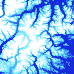
ArcticDEM은 광학 스테레오 이미지, 고성능 컴퓨팅, 오픈소스 사진 측량 소프트웨어를 사용하여 북극의 고해상도 고품질 디지털 표면 모델 (DSM)을 자동으로 생성하는 국가지리정보국 (NGA) 및 국립과학재단 (NSF)의 민관 이니셔티브입니다. 여기에는 초목, 나무 덮개, 건물 등이 포함됩니다. arctic dem elevation-topography geophysical pgc umn -
ArcticDEM 스트립
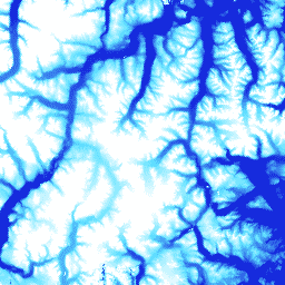
ArcticDEM은 광학 스테레오 이미지, 고성능 컴퓨팅, 오픈소스 사진 측량 소프트웨어를 사용하여 북극의 고해상도 고품질 디지털 표면 모델 (DSM)을 자동으로 생성하는 국가지리정보국 (NGA) 및 국립과학재단 (NSF)의 민관 이니셔티브입니다. 여기에는 초목, 나무 덮개, 건물 등이 포함됩니다. arctic dem elevation-topography geophysical pgc umn -
REMA 모자이크

남극 기준 고도 모델 (REMA)은 2미터 및 8미터 공간 해상도의 남극 고해상도 타임스탬프 디지털 표면 모델 (DSM)입니다. 모자이크 DEM 파일은 가장자리 일치 아티팩트를 줄이기 위해 공동 등록, 혼합, 페더링된 여러 스트립에서 컴파일됩니다. dem elevation-topography geophysical pgc rema umn -
REMA 스트립 2m

남극 기준 고도 모델 (REMA)은 2미터 및 8미터 공간 해상도의 남극 고해상도 타임스탬프 디지털 표면 모델 (DSM)입니다. 스트립 DEM 파일은 DigitalGlobe에서 수집한 입력 스테레오스코픽 이미지 쌍 스트립의 겹치는 영역에 해당합니다. dem elevation-topography geophysical pgc rema umn -
REMA 스트립 8m

남극 기준 고도 모델 (REMA)은 2미터 및 8미터 공간 해상도의 남극 고해상도 타임스탬프 디지털 표면 모델 (DSM)입니다. 스트립 DEM 파일은 DigitalGlobe에서 수집한 입력 스테레오스코픽 이미지 쌍 스트립의 겹치는 영역에 해당합니다. dem elevation-topography geophysical pgc rema umn
Datasets tagged pgc in Earth Engine
[null,null,[],[],[]]