GHSL: Глобальные характеристики расчетов (10 м), 2018 г. (P2023A) Этот набор пространственных растровых данных описывает населенные пункты с разрешением 10 м и описывает их внутренние характеристики с точки зрения функциональных и высотных компонентов застроенной среды. Более подробную информацию о продуктах данных GHSL можно найти в отчете GHSL Data Package 2023… здание построено застроенное коперник ghsl высота ТИГР: Перепись дорог США 
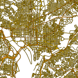
Этот набор данных TIGER Бюро переписи населения США содержит все сегменты дорог из версии 2016 года, включая более 19 миллионов отдельных линейных объектов, охватывающих Соединенные Штаты, округ Колумбия, Пуэрто-Рико и островные территории. Каждый объект представляет собой геометрию сегмента дороги (… перепись инфраструктура границы дороги таблица тигр США
Datasets tagged roads in Earth Engine
[null,null,[],[[["\u003cp\u003eThe Global Human Settlement Layer (GHSL) dataset provides a 10-meter resolution view of human settlements, including building heights and functional characteristics.\u003c/p\u003e\n"],["\u003cp\u003eThe TIGER/Line dataset from the US Census Bureau offers a comprehensive inventory of over 19 million road segments across the United States, District of Columbia, Puerto Rico, and Island Areas.\u003c/p\u003e\n"]]],["The content describes two spatial datasets. The first, GHSL, delineates human settlements at 10m resolution, detailing functional and height-related aspects of the built environment. The second, TIGER, from the US Census Bureau, contains over 19 million road segments from the 2016 release, covering the US, District of Columbia, Puerto Rico, and Island Areas, each represented by a road segment geometry.\n"],null,["# Datasets tagged roads in Earth Engine\n\n-\n\n |---------------------------------------------------------------------------------------------------------------------------------------------------------------------------------------------------------------------------------------------------------------------------------------------------------------|\n | [### GHSL: Global settlement characteristics (10 m) 2018 (P2023A)](/earth-engine/datasets/catalog/JRC_GHSL_P2023A_GHS_BUILT_C) |\n | This spatial raster dataset delineates human settlements at 10 m resolution, and describes their inner characteristics in terms of the functional and height-related components of the built environment. More information about the GHSL data products can be found in the GHSL Data Package 2023 report ... |\n | [building](/earth-engine/datasets/tags/building) [built](/earth-engine/datasets/tags/built) [builtup](/earth-engine/datasets/tags/builtup) [copernicus](/earth-engine/datasets/tags/copernicus) [ghsl](/earth-engine/datasets/tags/ghsl) [height](/earth-engine/datasets/tags/height) |\n\n-\n\n |-----------------------------------------------------------------------------------------------------------------------------------------------------------------------------------------------------------------------------------------------------------------------------------------------------------|\n | [### TIGER: US Census Roads](/earth-engine/datasets/catalog/TIGER_2016_Roads) |\n | This United States Census Bureau TIGER dataset contains all road segments from the 2016 release, containing more than 19 million individual line features covering the United States, the District of Columbia, Puerto Rico, and the Island Areas. Each feature represents a road segment geometry (a ... |\n | [census](/earth-engine/datasets/tags/census) [infrastructure-boundaries](/earth-engine/datasets/tags/infrastructure-boundaries) [roads](/earth-engine/datasets/tags/roads) [table](/earth-engine/datasets/tags/table) [tiger](/earth-engine/datasets/tags/tiger) [us](/earth-engine/datasets/tags/us) |"]]