-
ESA WorldCereal 10 m v100
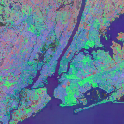
تتألف مجموعة منتجات WorldCereal 10 m 2021 من وكالة الفضاء الأوروبية (ESA) من خرائط المحاصيل السنوية والموسمية على مستوى العالم ومؤشرات الثقة ذات الصلة. تم إنشاؤها كجزء من مشروع ESA-WorldCereal. مزيد من المعلومات حول محتوى هذه المنتجات والمنهجية المستخدَمة في … الزراعة كوبرنيكوس المحاصيل وكالة الفضاء الأوروبية عالمي الغطاء الأرضي -
ESA WorldCereal Active Cropland 10 m v100
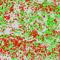
تتضمّن مجموعة منتجات WorldCereal Active Cropland 10 m 2021 من "وكالة الفضاء الأوروبية" علامات أراضي زراعية نشطة موسمية على مستوى العالم. تم إنشاؤها كجزء من مشروع ESA-WorldCereal. تشير منتجات الأراضي الزراعية النشطة إلى ما إذا كان قد تم بشكل نشط استخدام بكسل تم تحديده على أنّه محاصيل مؤقتة أم لا. الزراعة كوبرنيكوس المحاصيل وكالة الفضاء الأوروبية عالمي الغطاء الأرضي -
ESA WorldCover 10m v100
يقدّم منتج WorldCover 10 m 2020 الصادر عن "وكالة الفضاء الأوروبية" خريطة عالمية لتغطية الأرض لعام 2020 بدرجة دقة تبلغ 10 أمتار استنادًا إلى بيانات Sentinel-1 وSentinel-2. يتضمّن منتج WorldCover 11 فئة من الغطاء الأرضي، وقد تم إنشاؤه في إطار … esa landcover landuse landuse-landcover sentinel1-derived sentinel2-derived -
ESA WorldCover 10m v200
يوفّر منتج WorldCover 10 m 2021 من "وكالة الفضاء الأوروبية" خريطة عالمية للغطاء الأرضي لعام 2021 بدرجة دقة تبلغ 10 أمتار استنادًا إلى بيانات Sentinel-1 وSentinel-2. يتضمّن منتج WorldCover 11 فئة من الغطاء الأرضي، وقد تم إنشاؤه في إطار … esa landcover landuse landuse-landcover sentinel1-derived sentinel2-derived -
EUCROPMAP
خريطة أنواع المحاصيل في أوروبا استنادًا إلى الملاحظات الميدانية لعام 2018 من Sentinel-1 وLUCAS Copernicus 2018، وخريطة أخرى استنادًا إلى الملاحظات الميدانية لعام 2022 من Sentinel-2 وLUCAS Copernicus 2022 استنادًا إلى مسح LUCAS 2018 الفريد من نوعه الذي أجرته خدمة Copernicus في الموقع، تشكّل مجموعة بيانات 2018 أول خريطة لأنواع المحاصيل على مستوى القارة … agriculture crop eu jrc lucas sentinel1-derived -
الإصدار 1 من ميزة "إدراج إعلانات على شبكة Google الإعلانية"
مجموعة بيانات "إدراج الصور من الأقمار الصناعية" من Google هي مجموعة عالمية جاهزة للتحليل من إدراجات جغرافية مكانية تم تعلّمها. كل بكسل بحجم 10 أمتار في مجموعة البيانات هذه هو تمثيل من 64 سمة، أو "متجه تضمين"، الذي يُشفِّر المسارات الزمنية لظروف السطح في هذا البكسل وحوله كما تم قياسها من خلال أدوات مختلفة لرصد الأرض. سنوية عالمية من Google مشتقة من Landsat صور من الأقمار الصناعية مشتقة من Sentinel1 -
البصمة البيئية للمناطق المأهولة في العالم لعام 2015
"مساحة الاستيطان البشري في العالم" لعام 2015 هي قناع ثنائي بدقة 10 أمتار يوضّح مدى انتشار المستوطنات البشرية على مستوى العالم، وقد تم الحصول عليه من خلال صور Landsat-8 وSentinel-1 متعددة الفترات الزمنية من 2014 إلى 2015 (تم معالجة 217,000 مشهد تقريبًا و107,000 مشهد تقريبًا على التوالي). الديناميكيات الزمنية للمستوطنات البشرية … الغطاء الأرضي مصدرها Landsat السكان مصدرها Sentinel1 المستوطنات المناطق الحضرية
Datasets tagged sentinel1-derived in Earth Engine
[null,null,[],[[["\u003cp\u003eThe datasets provided offer various land cover and land use information at a 10m resolution.\u003c/p\u003e\n"],["\u003cp\u003eThey utilize satellite imagery from sources like Landsat-8, Sentinel-1, and Sentinel-2.\u003c/p\u003e\n"],["\u003cp\u003eData focuses on aspects such as human settlements, cropland, and global land cover classification.\u003c/p\u003e\n"],["\u003cp\u003eThe European Space Agency (ESA) and the Joint Research Centre (JRC) are key data providers.\u003c/p\u003e\n"],["\u003cp\u003eThese datasets are valuable for research and analysis related to agriculture, urban development, and environmental monitoring.\u003c/p\u003e\n"]]],[],null,["# Datasets tagged sentinel1-derived in Earth Engine\n\n-\n\n |--------------------------------------------------------------------------------------------------------------------------------------------------------------------------------------------------------------------------------------------------------------------------------------------------------|\n | [### ESA WorldCereal 10 m v100](/earth-engine/datasets/catalog/ESA_WorldCereal_2021_MODELS_v100) |\n | The European Space Agency (ESA) WorldCereal 10 m 2021 product suite consists of global-scale annual and seasonal crop maps and their related confidence. They were generated as part of the ESA-WorldCereal project. More information on the content of these products and the methodology used to ... |\n | [agriculture](/earth-engine/datasets/tags/agriculture) [copernicus](/earth-engine/datasets/tags/copernicus) [crop](/earth-engine/datasets/tags/crop) [esa](/earth-engine/datasets/tags/esa) [global](/earth-engine/datasets/tags/global) [landcover](/earth-engine/datasets/tags/landcover) |\n\n-\n\n |--------------------------------------------------------------------------------------------------------------------------------------------------------------------------------------------------------------------------------------------------------------------------------------------------------------------------|\n | [### ESA WorldCereal Active Cropland 10 m v100](/earth-engine/datasets/catalog/ESA_WorldCereal_2021_MARKERS_v100) |\n | The European Space Agency (ESA) WorldCereal Active Cropland 10 m 2021 product suite contains global-scale seasonal active cropland markers. They were generated as part of the ESA-WorldCereal project. The active cropland products indicate whether or not a pixel identified as temporary crops has been actively ... |\n | [agriculture](/earth-engine/datasets/tags/agriculture) [copernicus](/earth-engine/datasets/tags/copernicus) [crop](/earth-engine/datasets/tags/crop) [esa](/earth-engine/datasets/tags/esa) [global](/earth-engine/datasets/tags/global) [landcover](/earth-engine/datasets/tags/landcover) |\n\n-\n\n |---------------------------------------------------------------------------------------------------------------------------------------------------------------------------------------------------------------------------------------------------------------------------------------------------------------------------------------------------|\n | [### ESA WorldCover 10m v100](/earth-engine/datasets/catalog/ESA_WorldCover_v100) |\n | The European Space Agency (ESA) WorldCover 10 m 2020 product provides a global land cover map for 2020 at 10 m resolution based on Sentinel-1 and Sentinel-2 data. The WorldCover product comes with 11 land cover classes and has been generated in the framework of ... |\n | [esa](/earth-engine/datasets/tags/esa) [landcover](/earth-engine/datasets/tags/landcover) [landuse](/earth-engine/datasets/tags/landuse) [landuse-landcover](/earth-engine/datasets/tags/landuse-landcover) [sentinel1-derived](/earth-engine/datasets/tags/sentinel1-derived) [sentinel2-derived](/earth-engine/datasets/tags/sentinel2-derived) |\n\n-\n\n |---------------------------------------------------------------------------------------------------------------------------------------------------------------------------------------------------------------------------------------------------------------------------------------------------------------------------------------------------|\n | [### ESA WorldCover 10m v200](/earth-engine/datasets/catalog/ESA_WorldCover_v200) |\n | The European Space Agency (ESA) WorldCover 10 m 2021 product provides a global land cover map for 2021 at 10 m resolution based on Sentinel-1 and Sentinel-2 data. The WorldCover product comes with 11 land cover classes and has been generated in the framework of ... |\n | [esa](/earth-engine/datasets/tags/esa) [landcover](/earth-engine/datasets/tags/landcover) [landuse](/earth-engine/datasets/tags/landuse) [landuse-landcover](/earth-engine/datasets/tags/landuse-landcover) [sentinel1-derived](/earth-engine/datasets/tags/sentinel1-derived) [sentinel2-derived](/earth-engine/datasets/tags/sentinel2-derived) |\n\n-\n\n |--------------------------------------------------------------------------------------------------------------------------------------------------------------------------------------------------------------------------------------------------------------------------------------------------|\n | [### EUCROPMAP](/earth-engine/datasets/catalog/JRC_D5_EUCROPMAP_V1) |\n | European crop type map based on Sentinel-1 and LUCAS Copernicus 2018 in-situ observations for 2018; and one based on Sentinel-2 and LUCAS Copernicus 2022 for 2022. Capitalizing on the unique LUCAS 2018 Copernicus in-situ survey, the 2018 dataset is the first continental crop type map ... |\n | [agriculture](/earth-engine/datasets/tags/agriculture) [crop](/earth-engine/datasets/tags/crop) [eu](/earth-engine/datasets/tags/eu) [jrc](/earth-engine/datasets/tags/jrc) [lucas](/earth-engine/datasets/tags/lucas) [sentinel1-derived](/earth-engine/datasets/tags/sentinel1-derived) |\n\n-\n\n |-----------------------------------------------------------------------------------------------------------------------------------------------------------------------------------------------------------------------------------------------------------------------------------------------------------------------------------------------|\n | [### Satellite Embedding V1](/earth-engine/datasets/catalog/GOOGLE_SATELLITE_EMBEDDING_V1_ANNUAL) |\n | The Google Satellite Embedding dataset is a global, analysis-ready collection of learned geospatial embeddings. Each 10-meter pixel in this dataset is a 64-dimensional representation, or \"embedding vector,\" that encodes temporal trajectories of surface conditions at and around that pixel as measured by various Earth observation ... |\n | [annual](/earth-engine/datasets/tags/annual) [global](/earth-engine/datasets/tags/global) [google](/earth-engine/datasets/tags/google) [landsat-derived](/earth-engine/datasets/tags/landsat-derived) [satellite-imagery](/earth-engine/datasets/tags/satellite-imagery) [sentinel1-derived](/earth-engine/datasets/tags/sentinel1-derived) |\n\n-\n\n |-------------------------------------------------------------------------------------------------------------------------------------------------------------------------------------------------------------------------------------------------------------------------------------------------------------------------------------------|\n | [### World Settlement Footprint 2015](/earth-engine/datasets/catalog/DLR_WSF_WSF2015_v1) |\n | The World Settlement Footprint (WSF) 2015 is a 10m resolution binary mask outlining the extent of human settlements globally derived by means of 2014-2015 multitemporal Landsat-8 and Sentinel-1 imagery (of which \\~217,000 and \\~107,000 scenes have been processed, respectively). The temporal dynamics of human settlements ... |\n | [landcover](/earth-engine/datasets/tags/landcover) [landsat-derived](/earth-engine/datasets/tags/landsat-derived) [population](/earth-engine/datasets/tags/population) [sentinel1-derived](/earth-engine/datasets/tags/sentinel1-derived) [settlement](/earth-engine/datasets/tags/settlement) [urban](/earth-engine/datasets/tags/urban) |"]]