-
المساحة السنوية العالمية لأشجار المانغروف (1984-2023)

توفّر مجموعة بيانات CGMD-Extent30 (ديناميكيات غابات المانغروف العالمية المستمرة - مساحة غابات المانغروف السنوية بدقة مكانية تبلغ 30 مترًا) مساحة غابات المانغروف السنوية العالمية من عام 1984 إلى 2023. يتم توزيع مجموعة البيانات كـ FeatureCollection واحدة في Earth Engine، ويمثّل كل عنصر مضلّعًا لغابات المانغروف تمّت مطابقته لسنة معيّنة. مجموعة البيانات … سنوي ساحلي كتلة حيوية للغابات عالمي مستند إلى Landsat استخدام الأراضي والغطاء الأرضي -
Global Annual Mangrove Fractional Canopy Cover (1984-2023)

توفّر مجموعة البيانات هذه معلومات عن الغطاء الأرضي السنوي الجزئي لأشجار المانغروف على مستوى العالم بدقة مكانية تبلغ 30 مترًا من عام 1984 إلى 2023، وذلك بهدف دعم التحليلات الواسعة النطاق لديناميكيات أشجار المانغروف على المدى الطويل، بما في ذلك تدهور الغطاء الأرضي واستعادته، وتقييم الكربون الأزرق، ومراقبة النظم البيئية الساحلية. تحدّد FCC نسبة كل Landsat … سنوي ساحلي كتلة حيوية للغابات عالمي مستند إلى Landsat أشجار المانغروف -
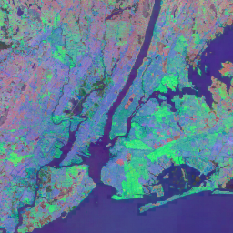
توزيع غابات المنغروف في العالم، الإصدار 1 (2000)

تم إعداد قاعدة البيانات باستخدام بيانات القمر الصناعي Landsat من عام 2000. تم تصنيف أكثر من 1,000 مشهد من Landsat تم الحصول عليها من مركز USGS Earth Resources Observation and Science Center (EROS) باستخدام تقنيات تصنيف الصور الرقمية المختلطة الخاضعة للإشراف وغير الخاضعة للإشراف. هذه القاعدة هي الأولى والأكثر … annual ciesin forest-biomass global landsat-derived mangrove -
سجلّ تصنيف المياه السنوي في مركز أبحاث المياه، الإصدار 1.4

تحتوي مجموعة البيانات هذه على خرائط لموقع المياه السطحية وتوزيعها الزمني من عام 1984 إلى 2021، وتقدّم إحصاءات حول مدى تغيُّر هذه المسطحات المائية. لمزيد من المعلومات، يُرجى الاطّلاع على المقالة الأكاديمية المرتبطة بهذه البيانات: High-resolution mapping of global surface water and its … سنوي جيوفيزيائي google history jrc landsat-derived -
MOD44B.061 Terra Vegetation Continuous Fields Yearly Global 250m

منتج "حقول الغطاء النباتي المتواصلة" (VCF) من Terra MODIS هو تمثيل على مستوى وحدات البكسل الفرعية لتقديرات الغطاء النباتي على السطح على مستوى العالم. تم تصميم هذه الطبقة لتمثيل سطح الأرض بشكل مستمر كنسبة من سمات الغطاء النباتي الأساسية، وهي توفّر تدرّجًا لثلاثة عناصر من غطاء السطح: النسبة المئوية لغطاء الأشجار، والنسبة المئوية … annual geophysical global landuse-landcover modis nasa -
Open Buildings Temporal V1

تحتوي مجموعة بيانات Open Buildings 2.5D Temporal Dataset على بيانات حول وجود المباني، وأعداد المباني الجزئية، وارتفاعات المباني بدقة مكانية فعالة1 تبلغ 4 أمتار (يتم توفير الصور النقطية بدقة 0.5 متر) بوتيرة سنوية من 2016 إلى 2023. يتم إنتاجها من صور منخفضة الدقة ومفتوحة المصدر من … africa annual asia built-up height open-buildings -
الإصدار الأول من ميزة "تضمين الخرائط"
مجموعة بيانات Google Satellite Embedding هي مجموعة عالمية من عمليات التضمين الجغرافية المكانية التي تمّ تعلّمها، وهي جاهزة للتحليل. كل بكسل يبلغ طول ضلعه 10 أمتار في مجموعة البيانات هذه هو تمثيل بـ 64 بُعدًا، أو "متّجه تضمين"، يشفّر المسارات الزمنية لظروف السطح في هذا البكسل وحوله كما تم قياسها بواسطة أدوات مختلفة لمراقبة الأرض … سنوي عالمي google مشتق من Landsat صور الأقمار الصناعية مشتق من Sentinel1 -
VIIRS Nighttime Day/Night Annual Band Composites V2.1

مجموعة البيانات السنوية العالمية لأضواء الليل VIIRS هي سلسلة زمنية تم إنتاجها من شبكات متوسط الإشعاع الشهرية الخالية من السحب والتي تغطي الفترة من 2013 إلى 2021. تتوفّر بيانات عام 2022 في مجموعة بيانات NOAA/VIIRS/DNB/ANNUAL_V22. أزالت خطوة الفلترة الأولية وحدات البكسل التي تظهر فيها أشعة الشمس والقمر والغيوم، ما أدّى إلى الحصول على صور مركّبة غير دقيقة … سنوي dnb eog lights nighttime noaa -
VIIRS Nighttime Day/Night Annual Band Composites V2.2

مجموعة بيانات الأضواء الليلية السنوية العالمية VIIRS هي سلسلة زمنية تم إنتاجها من شبكات متوسط الإشعاع الشهرية الخالية من السحب لعام 2022. وتتوفّر بيانات السنوات السابقة في مجموعة بيانات NOAA/VIIRS/DNB/ANNUAL_V21. وقد أدت خطوة الفلترة الأولية إلى إزالة وحدات البكسل المضاءة بنور الشمس والقمر والملبّدة بالغيوم، ما أدّى إلى إنشاء مركّبات تقريبية تحتوي على … سنوي dnb eog lights nighttime noaa
Datasets tagged annual in Earth Engine
[null,null,[],[],["The datasets provide annual global information on various Earth features. The Open Buildings dataset offers building presence, counts, and heights from 2016-2023. JRC data maps surface water distribution and changes from 1984-2021. Another dataset, based on data from 2000, details mangrove forest distribution. MODIS data provides continuous vegetation cover estimates, including tree cover percentages. Lastly, VIIRS data sets map annual nighttime light composites from 2013-2022, based on cloud-free average radiance grids.\n"]]