Page Summary
-
The GHSL: Degree of Urbanization dataset provides a global, multitemporal rural-urban classification from 1975-2030 based on population and built-up data.
-
Several GHSL datasets depict the distribution of built-up surfaces at different resolutions (10m and 100m) and time periods (2018 and 1975-2030).
-
The GHSL: Global settlement characteristics dataset delineates human settlements at 10m resolution and describes their inner characteristics.
-
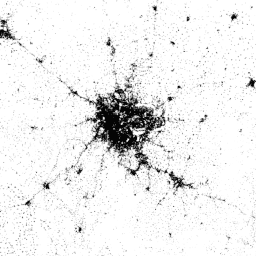
The World Settlement Footprint 2015 is a 10m resolution binary mask outlining the extent of human settlements globally based on satellite imagery.
-
GHSL: Degree of Urbanization 1975-2030 V2-0 (P2023A)
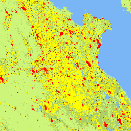
This raster dataset represents a global, multitemporal rural-urban classification, applying the "Degree of Urbanisation" stage I methodology recommended by UN Statistical Commission, based on global gridded population and built-up surface data generated by the GHSL project for the epochs 1975-2030 in 5-year intervals. The Degree … ghsl jrc population sdg settlement -
GHSL: Global built-up surface 10m (P2023A)
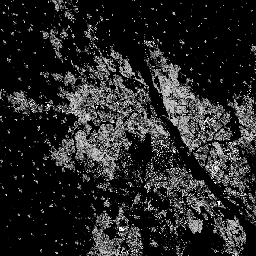
This raster dataset depicts the distribution of built-up surfaces, expressed in square metres per 10 m grid cell, for 2018 as observed from the S2 image data. The datasets measure: a) the total built-up surface, and b) the built-up surface allocated to grid cells of … built built-environment builtup copernicus ghsl jrc -
GHSL: Global built-up surface 1975-2030 (P2023A)
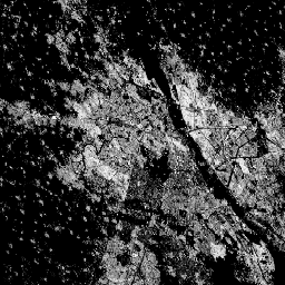
This raster dataset depicts the distribution of built-up surfaces, expressed in square metres per 100 m grid cell. The dataset measures: a) the total built-up surface, and b) the built-up surface allocated to grid cells of predominant non-residential (NRES) use. Data are spatially-temporally interpolated or … built built-environment builtup copernicus ghsl jrc -
GHSL: Global settlement characteristics (10 m) 2018 (P2023A)
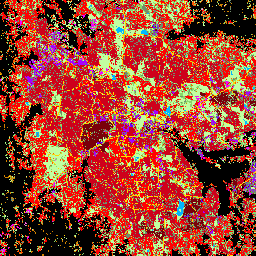
This spatial raster dataset delineates human settlements at 10 m resolution, and describes their inner characteristics in terms of the functional and height-related components of the built environment. More information about the GHSL data products can be found in the GHSL Data Package 2023 report … building built builtup copernicus ghsl height -
World Settlement Footprint 2015
The World Settlement Footprint (WSF) 2015 is a 10m resolution binary mask outlining the extent of human settlements globally derived by means of 2014-2015 multitemporal Landsat-8 and Sentinel-1 imagery (of which ~217,000 and ~107,000 scenes have been processed, respectively). The temporal dynamics of human settlements … landcover landsat-derived population sentinel1-derived settlement urban