-
Phân loại thay đổi ở vùng gian triều toàn cầu của Murray

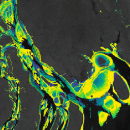
Tập dữ liệu về sự thay đổi của vùng gian triều toàn cầu của Murray chứa bản đồ toàn cầu về hệ sinh thái bãi bùn được tạo ra thông qua quá trình phân loại có giám sát 707.528 hình ảnh trong Kho lưu trữ Landsat. Mỗi điểm ảnh được phân loại thành bãi bùn, vùng nước vĩnh cửu hoặc vùng khác dựa trên một tập hợp dữ liệu huấn luyện được phân phối trên toàn cầu. … coastal google intertidal landsat-derived murray surface-ground-water -
Mặt nạ dữ liệu thay đổi vùng gian triều toàn cầu của Murray

Tập dữ liệu về sự thay đổi của vùng gian triều toàn cầu của Murray chứa bản đồ toàn cầu về hệ sinh thái bãi bùn được tạo ra thông qua quá trình phân loại có giám sát 707.528 hình ảnh trong Kho lưu trữ Landsat. Mỗi điểm ảnh được phân loại thành bãi bùn, vùng nước vĩnh cửu hoặc vùng khác dựa trên một tập hợp dữ liệu huấn luyện được phân phối trên toàn cầu. … coastal google intertidal landsat-derived murray surface-ground-water -
Murray Global Intertidal Change QA Pixel Count
Tập dữ liệu về sự thay đổi của vùng gian triều toàn cầu của Murray chứa bản đồ toàn cầu về hệ sinh thái bãi bùn được tạo ra thông qua quá trình phân loại có giám sát 707.528 hình ảnh trong Kho lưu trữ Landsat. Mỗi điểm ảnh được phân loại thành bãi bùn, vùng nước vĩnh cửu hoặc vùng khác dựa trên một tập hợp dữ liệu huấn luyện được phân phối trên toàn cầu. … coastal google intertidal landsat-derived murray surface-ground-water
Datasets tagged tidal-flats in Earth Engine
[null,null,[],[],[]]