-
DESS China Terrace Map v1
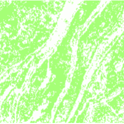
このデータセットは、2018 年の中国のテラス地図で、解像度は 30 m です。このモデルは、Google Earth Engine プラットフォームに基づくマルチソースおよびマルチタイムラベル データを使用して、教師ありのピクセルベース分類によって開発されました。全体的な精度とカパ係数はそれぞれ 94% と 0.72 でした。この最初の … agriculture landcover landuse landuse-landcover tsinghua -
清華大学の FROM-GLC で、不浸透性サーフェスに変更された年
このデータセットには、1985 年から 2018 年までの世界全体の不浸透面積の年間変化情報が 30 m 解像度で含まれています。透水性から不浸透性への変化は、教師あり分類と時間的な整合性チェックを組み合わせたアプローチを使用して決定されました。不浸透ピクセルは、50% 以上が不浸透であると定義されます。… 建設 人口 清華 都市部
Datasets tagged tsinghua in Earth Engine
[null,null,[],[[["\u003cp\u003eThe DESS China Terrace Map provides a 30m resolution view of terrace farming across China in 2018, achieving high accuracy through supervised classification using multi-source data.\u003c/p\u003e\n"],["\u003cp\u003eThe Tsinghua FROM-GLC dataset offers insights into annual changes in global impervious surfaces from 1985 to 2018 at 30m resolution, identifying areas where pervious land has become impervious.\u003c/p\u003e\n"]]],["Two datasets are described: a 2018 China terrace map at 30m resolution, created via supervised pixel-based classification using multisource and multi-temporal data. The method had an overall accuracy of 94% and a kappa coefficient of 0.72. The second dataset provides annual changes in global impervious surface area, from 1985 to 2018 at 30m resolution. This was done by a combination of supervised classification and temporal consistency checking. Impervious pixels are above 50% impervious.\n"],null,["# Datasets tagged tsinghua in Earth Engine\n\n-\n\n |--------------------------------------------------------------------------------------------------------------------------------------------------------------------------------------------------------------------------------------------------------------------------------------------------------------------|\n | [### DESS China Terrace Map v1](/earth-engine/datasets/catalog/Tsinghua_DESS_ChinaTerraceMap_v1) |\n | This dataset is a China terrace map at 30 m resolution in 2018. It was developed through supervised pixel-based classification using multisource and multi-temporal data based on the Google Earth Engine platform. The overall accuracy and kappa coefficient achieved 94% and 0.72, respectively. This first ... |\n | [agriculture](/earth-engine/datasets/tags/agriculture) [landcover](/earth-engine/datasets/tags/landcover) [landuse](/earth-engine/datasets/tags/landuse) [landuse-landcover](/earth-engine/datasets/tags/landuse-landcover) [tsinghua](/earth-engine/datasets/tags/tsinghua) |\n\n-\n\n |---------------------------------------------------------------------------------------------------------------------------------------------------------------------------------------------------------------------------------------------------------------------------------------------------------------------------------|\n | [### Tsinghua FROM-GLC Year of Change to Impervious Surface](/earth-engine/datasets/catalog/Tsinghua_FROM-GLC_GAIA_v10) |\n | This dataset contains annual change information of global impervious surface area from 1985 to 2018 at a 30m resolution. Change from pervious to impervious was determined using a combined approach of supervised classification and temporal consistency checking. Impervious pixels are defined as above 50% impervious. ... |\n | [built](/earth-engine/datasets/tags/built) [population](/earth-engine/datasets/tags/population) [tsinghua](/earth-engine/datasets/tags/tsinghua) [urban](/earth-engine/datasets/tags/urban) |"]]