-
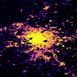
GHSL: 世界各国の建物の高さ 2018(P2023A)
この空間ラスター データセットは、2018 年を基準として、建物の高さのグローバルな分布を 100 m の解像度で示しています。建物の高さを予測するために使用される入力データは、ALOS グローバル デジタル地表モデル(30 m)、NASA シャトル レーダー地形測量ミッションなどです。 alos building built built-environment builtup copernicus -
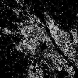
GHSL: グローバル建造物サーフェス 10 m(P2023A)
このラスター データセットは、S2 画像データから観測された 2018 年の建造物サーフェスの分布を、10 m グリッドセルあたりの平方メートルで表しています。データセットでは、a)建造物の総面積と、b)… のグリッドセルに割り当てられた建造物の面積を測定します。 built built-environment builtup copernicus ghsl jrc -
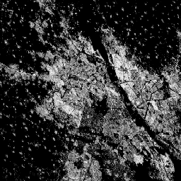
GHSL: 1975 ~ 2030 年の世界の建造物(P2023A)
このラスター データセットは、建造物が建てられている地表の分布を示しています。値は 100 m グリッドセルあたりの平方メートルで表されます。このデータセットでは、a)総建て込み面積と、b)主に非住宅(NRES)用途のグリッドセルに割り当てられた建て込み面積を測定しています。データが空間的および時間的に補間されている built built-environment builtup copernicus ghsl jrc -
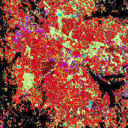
GHSL: グローバル決済の特性(10 m)2018(P2023A)
この空間ラスター データセットは、人間の居住地を 10 m の解像度で描画し、建造環境の機能と高さに関連するコンポーネントの観点からその内部特性を記述します。GHSL データ プロダクトの詳細については、GHSL データ パッケージ 2023 レポートをご覧ください。 building built builtup copernicus ghsl height -
清華大学の FROM-GLC で、不浸透性サーフェスに変更された年
このデータセットには、1985 年から 2018 年までの世界全体の不浸透面積の年間変化情報が 30 m 解像度で含まれています。透水性から不浸透性への変化は、教師あり分類と時間的な整合性チェックを組み合わせたアプローチを使用して決定されました。不浸透ピクセルは、50% 以上が不浸透であると定義されます。… 建設 人口 清華 都市部
Datasets tagged built in Earth Engine
[null,null,[],[[["\u003cp\u003eThe Global Human Settlement Layer (GHSL) provides datasets characterizing human settlements, including building heights and built-up surfaces, at resolutions ranging from 10m to 100m.\u003c/p\u003e\n"],["\u003cp\u003eGHSL data utilizes various sources like ALOS, SRTM, and Sentinel-2 imagery to model built environments and their functional components.\u003c/p\u003e\n"],["\u003cp\u003eBuilt-up surface datasets within GHSL offer insights into total and non-residential built areas, spanning multiple years and resolutions.\u003c/p\u003e\n"],["\u003cp\u003eThe Tsinghua FROM-GLC dataset provides insights into annual impervious surface changes globally from 1985 to 2018 at a 30m resolution.\u003c/p\u003e\n"]]],[],null,["# Datasets tagged built in Earth Engine\n\n-\n\n |-------------------------------------------------------------------------------------------------------------------------------------------------------------------------------------------------------------------------------------------------------------------------------------------------------------|\n | [### GHSL: Global building height 2018 (P2023A)](/earth-engine/datasets/catalog/JRC_GHSL_P2023A_GHS_BUILT_H) |\n | This spatial raster dataset depicts the global distribution of building heights at a resolution of 100 m, referred to the year 2018. The input data used to predict building heights are the ALOS Global Digital Surface Model (30 m), the NASA Shuttle Radar Topographic Mission ... |\n | [alos](/earth-engine/datasets/tags/alos) [building](/earth-engine/datasets/tags/building) [built](/earth-engine/datasets/tags/built) [built-environment](/earth-engine/datasets/tags/built-environment) [builtup](/earth-engine/datasets/tags/builtup) [copernicus](/earth-engine/datasets/tags/copernicus) |\n\n-\n\n |---------------------------------------------------------------------------------------------------------------------------------------------------------------------------------------------------------------------------------------------------------------------------------------------------|\n | [### GHSL: Global built-up surface 10m (P2023A)](/earth-engine/datasets/catalog/JRC_GHSL_P2023A_GHS_BUILT_S_10m) |\n | This raster dataset depicts the distribution of built-up surfaces, expressed in square metres per 10 m grid cell, for 2018 as observed from the S2 image data. The datasets measure: a) the total built-up surface, and b) the built-up surface allocated to grid cells of ... |\n | [built](/earth-engine/datasets/tags/built) [built-environment](/earth-engine/datasets/tags/built-environment) [builtup](/earth-engine/datasets/tags/builtup) [copernicus](/earth-engine/datasets/tags/copernicus) [ghsl](/earth-engine/datasets/tags/ghsl) [jrc](/earth-engine/datasets/tags/jrc) |\n\n-\n\n |--------------------------------------------------------------------------------------------------------------------------------------------------------------------------------------------------------------------------------------------------------------------------------------------------------------------------|\n | [### GHSL: Global built-up surface 1975-2030 (P2023A)](/earth-engine/datasets/catalog/JRC_GHSL_P2023A_GHS_BUILT_S) |\n | This raster dataset depicts the distribution of built-up surfaces, expressed in square metres per 100 m grid cell. The dataset measures: a) the total built-up surface, and b) the built-up surface allocated to grid cells of predominant non-residential (NRES) use. Data are spatially-temporally interpolated or ... |\n | [built](/earth-engine/datasets/tags/built) [built-environment](/earth-engine/datasets/tags/built-environment) [builtup](/earth-engine/datasets/tags/builtup) [copernicus](/earth-engine/datasets/tags/copernicus) [ghsl](/earth-engine/datasets/tags/ghsl) [jrc](/earth-engine/datasets/tags/jrc) |\n\n-\n\n |---------------------------------------------------------------------------------------------------------------------------------------------------------------------------------------------------------------------------------------------------------------------------------------------------------------|\n | [### GHSL: Global settlement characteristics (10 m) 2018 (P2023A)](/earth-engine/datasets/catalog/JRC_GHSL_P2023A_GHS_BUILT_C) |\n | This spatial raster dataset delineates human settlements at 10 m resolution, and describes their inner characteristics in terms of the functional and height-related components of the built environment. More information about the GHSL data products can be found in the GHSL Data Package 2023 report ... |\n | [building](/earth-engine/datasets/tags/building) [built](/earth-engine/datasets/tags/built) [builtup](/earth-engine/datasets/tags/builtup) [copernicus](/earth-engine/datasets/tags/copernicus) [ghsl](/earth-engine/datasets/tags/ghsl) [height](/earth-engine/datasets/tags/height) |\n\n-\n\n |---------------------------------------------------------------------------------------------------------------------------------------------------------------------------------------------------------------------------------------------------------------------------------------------------------------------------------|\n | [### Tsinghua FROM-GLC Year of Change to Impervious Surface](/earth-engine/datasets/catalog/Tsinghua_FROM-GLC_GAIA_v10) |\n | This dataset contains annual change information of global impervious surface area from 1985 to 2018 at a 30m resolution. Change from pervious to impervious was determined using a combined approach of supervised classification and temporal consistency checking. Impervious pixels are defined as above 50% impervious. ... |\n | [built](/earth-engine/datasets/tags/built) [population](/earth-engine/datasets/tags/population) [tsinghua](/earth-engine/datasets/tags/tsinghua) [urban](/earth-engine/datasets/tags/urban) |"]]