-
GHSL: Global building height 2018(P2023A)
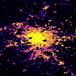
この空間ラスター データセットは、2018 年の全球の建物の高さの分布を 100 m の解像度で示しています。建物の高さの予測に使用される入力データは、ALOS グローバル デジタル サーフェス モデル(30 m)、NASA スペースシャトル レーダー地形ミッションなどです。 alos building built built-environment builtup copernicus -
GHSL: Global settlement characteristics (10 m) 2018(P2023A)
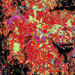
この空間ラスター データセットは、10 m の解像度で人間の居住地を区切り、その内部特性を、構築された環境の機能的および高さ関連のコンポーネントの観点から記述します。GHSL データ プロダクトの詳細については、GHSL Data Package 2023 レポートをご覧ください。 building built builtup copernicus ghsl height -
Open Buildings Temporal V1
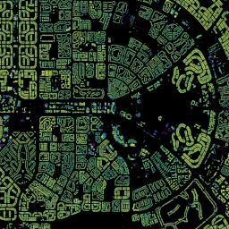
Open Buildings 2.5D Temporal データセットには、2016 年から 2023 年までの年次で、建物の存在、建物の部分的な数、建物の高さに関するデータが、4 m の実効空間解像度(ラスターは 0.5 m の解像度で提供)で含まれています。これは、… のオープンソースの低解像度画像から生成されます。 africa annual asia built-up height open-buildings
Datasets tagged height in Earth Engine
[null,null,[],[],["The Open Buildings Temporal Dataset offers annual data from 2016-2023 on building presence, counts, and heights at a 4m resolution, derived from low-resolution imagery. The GHSL dataset provides 10m resolution data on human settlements, detailing built environment characteristics and heights. Another GHSL dataset maps global building heights at 100m resolution for 2018, using data from sources like the ALOS Global Digital Surface Model.\n"]]