-
GHSL: Global building height 2018(P2023A)
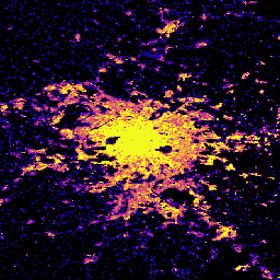
この空間ラスター データセットは、2018 年を基準として、100 m の解像度で建物の高さのグローバル分布を示しています。建物の高さの予測に使用された入力データは、ALOS グローバル デジタル サーフェス モデル(30 m)、NASA スペースシャトル レーダー地形ミッション… alos building built built-environment builtup copernicus -
GHSL: 世界の建築量 1975 ~ 2030 年(P2023A)
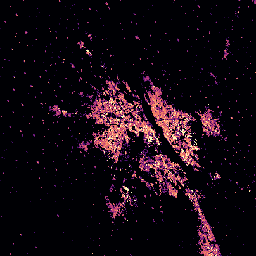
このラスター データセットは、建物の体積の世界的な分布を 100 メートル四方のグリッド セルあたりの立方メートルで表しています。このデータセットでは、建物の総容積と、主に非住宅(NRES)用途のグリッドセルに割り当てられた建物の容積を測定します。推定値は、蓄積された… alos building built-environment copernicus dem ghsl -
GHSL: 全球の集落の特性(10 m)2018 年(P2023A)
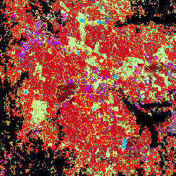
この空間ラスター データセットは、10 m の解像度で人間の居住地を区切り、その内部特性を、構築された環境の機能的および高さ関連のコンポーネントの観点から説明しています。GHSL データ プロダクトの詳細については、GHSL データ パッケージ 2023 レポートをご覧ください。 building built builtup copernicus ghsl height -
Open Buildings V3 ポリゴン
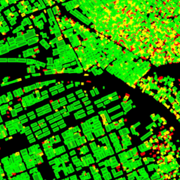
この大規模なオープン データセットは、高解像度 50 cm 衛星画像から取得した建物の輪郭で構成されています。アフリカ、ラテンアメリカ、カリブ海、南アジア、東南アジアの 18 億件の建物検出が含まれています。推論は 5,800 万 km² の範囲に及びました。このデータセット内の各建物について… africa asia building built-up open-buildings population
Datasets tagged building in Earth Engine
[null,null,[],[],["The content describes four datasets focused on building data. One dataset, \"Open Buildings V3 Polygons,\" provides 1.8 billion building outlines derived from 50 cm satellite imagery across Africa, Latin America, the Caribbean, and South and Southeast Asia. The other three, from GHSL, provide spatial raster data describing human settlements at 10m resolution with functional and height characteristics; global building heights at 100m resolution; and global building volume from 1975-2030 in cubic meters.\n"]]