-
Open Buildings Temporal V1
Open Buildings 2.5D 時系列データセットには、2016 ~ 2023 年の年次で、有効な空間解像度 4 m(ラスターは 0.5 m 解像度で提供)の建物の存在、建物の小数カウント、建物の高さに関するデータが含まれています。オープンソースの低解像度画像から生成されます。 africa annual asia built-up height open-buildings -
Open Buildings V3 ポリゴン
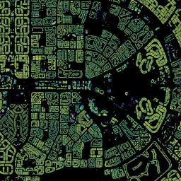
この大規模なオープンデータセットは、50 cm の高解像度衛星画像から取得された建物の輪郭で構成されています。アフリカ、ラテンアメリカ、カリブ海、南アジア、東南アジアの 18 億件の建物検出結果が含まれています。推論の対象範囲は 5,800 万 km² におよび、このデータセット内の建物ごとに次のように処理されます。 africa asia building built-up open-buildings population
Datasets tagged built-up in Earth Engine
[null,null,[],[[["\u003cp\u003eThe Open Buildings 2.5D Temporal Dataset provides annual data on building presence, counts, and heights at a 4m resolution from 2016-2023, covering Africa and Asia.\u003c/p\u003e\n"],["\u003cp\u003eThe Open Buildings V3 Polygons dataset offers outlines of 1.8B buildings derived from 50cm satellite imagery, spanning Africa, Latin America, the Caribbean, South Asia, and Southeast Asia.\u003c/p\u003e\n"]]],[],null,["# Datasets tagged built-up in Earth Engine\n\n-\n\n |--------------------------------------------------------------------------------------------------------------------------------------------------------------------------------------------------------------------------------------------------------------------------------------------------------------------------------|\n | [### Open Buildings Temporal V1](/earth-engine/datasets/catalog/GOOGLE_Research_open-buildings-temporal_v1) |\n | The Open Buildings 2.5D Temporal Dataset contains data about building presence, fractional building counts, and building heights at an effective1 spatial resolution of 4m (rasters are provided at 0.5m resolution) at an annual cadence from 2016-2023. It is produced from open-source, low-resolution imagery from the ... |\n | [africa](/earth-engine/datasets/tags/africa) [annual](/earth-engine/datasets/tags/annual) [asia](/earth-engine/datasets/tags/asia) [built-up](/earth-engine/datasets/tags/built-up) [height](/earth-engine/datasets/tags/height) [open-buildings](/earth-engine/datasets/tags/open-buildings) |\n\n-\n\n |----------------------------------------------------------------------------------------------------------------------------------------------------------------------------------------------------------------------------------------------------------------------------------------------------------------|\n | [### Open Buildings V3 Polygons](/earth-engine/datasets/catalog/GOOGLE_Research_open-buildings_v3_polygons) |\n | This large-scale open dataset consists of outlines of buildings derived from high-resolution 50 cm satellite imagery. It contains 1.8B building detections in Africa, Latin America, Caribbean, South Asia and Southeast Asia. The inference spanned an area of 58M km². For each building in this dataset ... |\n | [africa](/earth-engine/datasets/tags/africa) [asia](/earth-engine/datasets/tags/asia) [building](/earth-engine/datasets/tags/building) [built-up](/earth-engine/datasets/tags/built-up) [open-buildings](/earth-engine/datasets/tags/open-buildings) [population](/earth-engine/datasets/tags/population) |"]]