-
GHSL: Global building height 2018(P2023A)
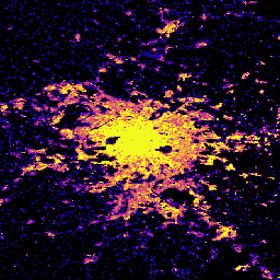
この空間ラスター データセットは、2018 年の建物の高さのグローバル分布を 100 m の解像度で示しています。建物の高さの予測に使用される入力データは、ALOS グローバル デジタル サーフェス モデル(30 m)、NASA スペースシャトル レーダー地形ミッションなどです。 alos building built built-environment builtup copernicus -
GHSL: Global building volume 1975-2030(P2023A)
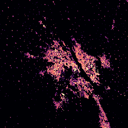
このラスター データセットは、100 メートル四方あたりの立方メートルで表された建物の体積のグローバル分布を示しています。このデータセットは、建物の総体積と、主に非住宅(NRES)用途のグリッドセルに割り当てられた建物の体積を測定します。推定値は、蓄積された… alos building built-environment copernicus dem ghsl -
GHSL: Global built-up surface 10m(P2023A)
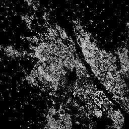
このラスター データセットは、S2 画像データから観測された 2018 年の建物表面の分布を、10 m グリッドセルあたりの平方メートルで表しています。データセットは、a) 総建築面積と、b) … のグリッド セルに割り当てられた建築面積を測定します。 built built-environment builtup copernicus ghsl jrc -
GHSL: Global built-up surface 1975-2030(P2023A)
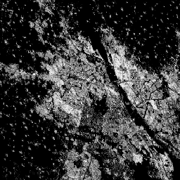
このラスター データセットは、100 m グリッド セルあたりの平方メートルで表される、建物が建っている表面の分布を示しています。このデータセットでは、a) 総建築面積と、b) 主に非住宅(NRES)用途のグリッド セルに割り当てられた建築面積を測定します。データは空間的および時間的に補間されるか、… built built-environment builtup copernicus ghsl jrc
Datasets tagged built-environment in Earth Engine
[null,null,[],[],["The content describes four spatial raster datasets from the Global Human Settlement Layer (GHSL). One dataset maps global building heights in 2018 at 100m resolution. Two datasets map built-up surfaces: one at 100m resolution from 1975-2030, and another at 10m resolution for 2018. These built up surfaces also differentiate between residential and non-residential. The final dataset details the global building volume from 1975-2030, measured in cubic meters per 100m grid cell.\n"]]