-
ArcticDEM Mosaic V4.1
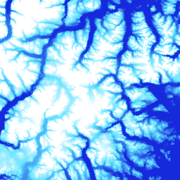
ArcticDEM to inicjatywa publiczno-prywatna Agencji Wywiadu Geoprzestrzennego (NGA) i Narodowej Fundacji Nauki (NSF), której celem jest automatyczne tworzenie modelu powierzchniowego (DSM) Arktyki o wysokiej rozdzielczości i jakości przy użyciu optycznych zdjęć stereoskopowych, komputerów o dużej mocy obliczeniowej i oprogramowania do fotogrametrii o otwartym kodzie źródłowym. Obejmuje roślinność, korony drzew, budynki i … arctic dem elevation-topography geophysical pgc umn -
ArcticDEM Strips
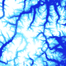
ArcticDEM to inicjatywa publiczno-prywatna Agencji Wywiadu Geoprzestrzennego (NGA) i Narodowej Fundacji Nauki (NSF), której celem jest automatyczne tworzenie modelu powierzchniowego (DSM) Arktyki o wysokiej rozdzielczości i jakości przy użyciu optycznych zdjęć stereoskopowych, komputerów o dużej mocy obliczeniowej i oprogramowania do fotogrametrii o otwartym kodzie źródłowym. Obejmuje roślinność, korony drzew, budynki i … arctic dem elevation-topography geophysical pgc umn -
REMA Mosaic

Referencyjny model wysokościowy Antarktydy (REMA) to model powierzchniowy (DSM) Antarktydy o wysokiej rozdzielczości i z sygnaturą czasową, dostępny w rozdzielczości przestrzennej 2 m i 8 m. Mozaikowe pliki DEM są tworzone z wielu pasów, które zostały zarejestrowane, połączone i wygładzone w celu zmniejszenia artefaktów dopasowania krawędzi. dem elevation-topography geophysical pgc rema umn -
REMA Strips 2m

Referencyjny model wysokościowy Antarktydy (REMA) to model powierzchniowy (DSM) Antarktydy o wysokiej rozdzielczości i z sygnaturą czasową, dostępny w rozdzielczości przestrzennej 2 m i 8 m. Pliki DEM pasów odpowiadają obszarowi nakładania się pasów wejściowych stereoskopowych zdjęć, które są zbierane przez … dem elevation-topography geophysical pgc rema umn -
REMA Strips 8m

Referencyjny model wysokościowy Antarktydy (REMA) to model powierzchniowy (DSM) Antarktydy o wysokiej rozdzielczości i z sygnaturą czasową, dostępny w rozdzielczości przestrzennej 2 m i 8 m. Pliki DEM pasów odpowiadają obszarowi nakładania się pasów wejściowych stereoskopowych zdjęć, które są zbierane przez … dem elevation-topography geophysical pgc rema umn
Datasets tagged umn in Earth Engine
[null,null,[],[],[]]