- Доступность набора данных
- 2015-01-01T00:00:00Z–2016-01-01T00:00:00Z
- Производитель наборов данных
- Deutsches Zentrum für Luft- und Raumfahrt (DLR)
- Теги
Описание
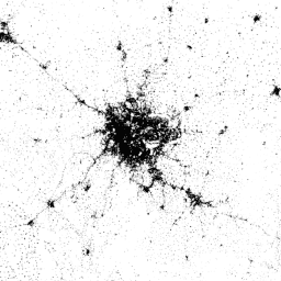
Карта World Settlement Footprint (WSF) 2015 представляет собой бинарную маску с разрешением 10 м, отображающую масштабы населенных пунктов по всему миру, полученную на основе многовременных снимков Landsat-8 и Sentinel-1 за 2014-2015 годы (из которых обработано около 217 000 и 107 000 снимков соответственно).
Динамика развития населенных пунктов во времени существенно отличается от динамики всех других классов информации, не связанных с населенными пунктами. Поэтому, имея все доступные многовременные изображения интересующего региона в выбранном временном интервале, извлекаются ключевые временные статистические данные (например, среднее значение, минимум, максимум и т. д.) для:
- исходное значение обратного рассеяния в случае радиолокационных данных; и
- различные спектральные индексы (например, индекс растительности, индекс застроенности и т. д.), полученные после маскирования облаков на оптических изображениях.
Далее, к оптическим и радиолокационным временным характеристикам отдельно применяются различные схемы классификации на основе машин опорных векторов (SVM), и, наконец, полученные результаты корректно объединяются.
Для количественной оценки высокой точности и надежности слоя в сотрудничестве с Google было проведено масштабное исследование на основе огромного количества эталонных образцов (900 000), размеченных с помощью краудсорсинговой фотоинтерпретации. Был разработан статистически надежный и прозрачный протокол, соответствующий современным рекомендациям, описанным в литературе.
Для получения всех технических подробностей, пожалуйста, обратитесь к публикации.
Группы
Группы
Размер пикселя: 10 метров (все диапазоны)
| Имя | Мин | Макс | Размер пикселя | Описание |
|---|---|---|---|---|
settlement | 255 | 255 | 10 метров | Населенный пункт |
Условия эксплуатации
Условия эксплуатации
Цитаты
Маркончини, М., Метц-Маркончини, А., Урейен, С., Паласиос-Лопес, Д., Ханке, В., Бахофер, Ф., Цайдлер, Й., Эш, Т., Горелик, Н., Какарла, А., Паганини, М., Страно, Э. (2020). Определение мест проживания людей: Всемирный след поселений 2015. Научные данные, 7(1), 1-14. doi:10.1038/s41597-020-00580-5
DOI
Исследуйте мир с помощью Earth Engine.
Редактор кода (JavaScript)
var dataset = ee.Image('DLR/WSF/WSF2015/v1');

var opacity = 0.75;
var blackBackground = ee.Image(0);
Map.addLayer(blackBackground, null, 'Black background', true, opacity);

var visualization = {
  min: 0,
  max: 255,
};
Map.addLayer(dataset, visualization, 'Human settlement areas');

Map.setCenter(90.45, 23.7, 7);