GHSL: Степень урбанизации 1975-2030 V2-0 (P2023A) 
Этот набор растровых данных представляет собой глобальную многовременную сельско-городскую классификацию, основанную на методологии «Степень урбанизации» (этап I), рекомендованной Статистической комиссией ООН, на основе глобальных данных о населении и застроенных территориях, полученных в рамках проекта GHSL за период с 1975 по 2030 год с пятилетним интервалом. Степень… ghsl jrc население поселение sdg GHSL: Общая площадь застройки 10 м (P2023A) 
Этот набор растровых данных отображает распределение площади застроенных территорий, выраженное в квадратных метрах на 10-метровую ячейку сетки, за 2018 год, согласно данным снимка S2. Наборы данных измеряют: а) общую площадь застроенных территорий и б) площадь застроенных территорий, распределенную по ячейкам сетки… встроенная среда, построенная copernicus ghsl jrc GHSL: Глобальная застроенная площадь 1975-2030 (P2023A) 
Этот набор растровых данных отображает распределение площади застроенных территорий, выраженное в квадратных метрах на 100-метровую ячейку сетки. Набор данных измеряет: а) общую площадь застроенных территорий и б) площадь застроенных территорий, относящихся к ячейкам сетки с преобладающим нежилым использованием (NRES). Данные интерполируются пространственно-временно или… встроенная среда, построенная copernicus ghsl jrc GHSL: Глобальные характеристики осадконакопления (10 м) 2018 (P2023A) 
Этот набор пространственных растровых данных отображает границы населённых пунктов с разрешением 10 м и описывает их внутренние характеристики с точки зрения функциональных и высотных компонентов застроенной среды. Более подробную информацию о продуктах данных GHSL можно найти в отчёте GHSL Data Package 2023… здание построено, построено, высота Коперника , высота Мировой след поселений 2015 г. 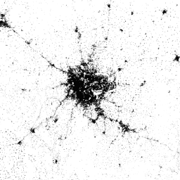
Мировой след поселений (WSF) 2015 года представляет собой бинарную маску с разрешением 10 м, описывающую площадь населённых пунктов по всему миру, полученную с помощью многовременных снимков Landsat-8 и Sentinel-1, сделанных в 2014–2015 годах (из которых было обработано около 217 000 и около 107 000 сцен соответственно). Временная динамика населённых пунктов… Почва, полученная с помощью Landsat, население , городское поселение, полученное с помощью Sentinel1
Datasets tagged settlement in Earth Engine
[null,null,[],[],[]]