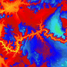
Dies ist das nahtlose 3DEP-DEM-Dataset für die USA mit vollständiger Abdeckung der 48 angrenzenden Bundesstaaten, Hawaii und der US-Territorien. Die Abdeckung von Alaska ist teilweise verfügbar und wird im Rahmen der Alaska Mapping Initiative auf den gesamten Bundesstaat ausgeweitet.
Der Bodenabstand beträgt ungefähr 10 Meter in Nord-Süd-Richtung, ist aber in Ost-West-Richtung aufgrund der Konvergenz der Meridiane mit der geografischen Breite variabel.
Der 1-Meter-Datensatz wird als USGS_3DEP_1m aufgenommen.
Dies ist der nahtlose 3DEP-DEM-Datensatz für die USA mit vollständiger Abdeckung der 48 angrenzenden Bundesstaaten, Hawaii und der US-Territorien. Die Abdeckung von Alaska ist teilweise verfügbar und wird im Rahmen der Alaska Mapping Initiative auf den gesamten Bundesstaat ausgeweitet. Der Bodenabstand beträgt ungefähr 10 Meter in Nord-Süd-Richtung, aber …
[null,null,[],[],[],null,["# USGS 3DEP 10m National Map Seamless (1/3 Arc-Second)\n\nDataset Availability\n: 1998-08-16T00:00:00Z--2020-05-06T00:00:00Z\n\nDataset Provider\n:\n\n\n [United States Geological Survey](https://www.usgs.gov/core-science-systems/ngp/3dep/about-3dep-products-services)\n\nTags\n:\n[3dep](/earth-engine/datasets/tags/3dep) [dem](/earth-engine/datasets/tags/dem) [elevation](/earth-engine/datasets/tags/elevation) [elevation-topography](/earth-engine/datasets/tags/elevation-topography) [geophysical](/earth-engine/datasets/tags/geophysical) [topography](/earth-engine/datasets/tags/topography) [usgs](/earth-engine/datasets/tags/usgs) \n\n#### Description\n\nThis is the seamless 3DEP DEM dataset for the U.S.\nwith full coverage of the 48 conterminous states, Hawaii, and\nU.S. territories. Alaska coverage is partially available now and is being\nexpanded to statewide coverage as part of the Alaska Mapping Initiative.\nGround spacing is approximately 10 meters north/south, but variable\neast/west due to convergence of meridians with latitude.\n\nThe 1m dataset is ingested\nas [USGS_3DEP_1m](/earth-engine/datasets/catalog/USGS_3DEP_1m).\n\nDataset uploaded by [Farmers Business Network](https://fbn.com).\n\n### Bands\n\n**Bands**\n\n| Name | Units | Pixel Size | Description |\n|-------------|-------|-------------|-------------|\n| `elevation` | m | 10.2 meters | Elevation |\n\n### Terms of Use\n\n**Terms of Use**\n\nMost U.S. Geological Survey (USGS) information resides\nin the public domain and may be used without restriction. Additional\ninformation on [Acknowledging or Crediting USGS as Information\nSource](https://www.usgs.gov/information-policies-and-instructions/crediting-usgs)\nis available.\n\n### Citations\n\nCitations:\n\n- U.S. Geological Survey, 3D Elevation Program 10-Meter Resolution Digital Elevation Model.\n\n### Explore with Earth Engine\n\n| **Important:** Earth Engine is a platform for petabyte-scale scientific analysis and visualization of geospatial datasets, both for public benefit and for business and government users. Earth Engine is free to use for research, education, and nonprofit use. To get started, please [register for Earth Engine access.](https://console.cloud.google.com/earth-engine)\n\n### Code Editor (JavaScript)\n\n```javascript\nvar dataset = ee.ImageCollection('USGS/3DEP/10m_collection')\nvar elevation = dataset.select('elevation');\n\nMap.setCenter(-112.8598, 36.2841, 7);\nMap.addLayer(elevation, {min: 0, max: 3000, palette: [\n '3ae237', 'b5e22e', 'd6e21f', 'fff705', 'ffd611', 'ffb613', 'ff8b13',\n 'ff6e08', 'ff500d', 'ff0000', 'de0101', 'c21301', '0602ff', '235cb1',\n '307ef3', '269db1', '30c8e2', '32d3ef', '3be285', '3ff38f', '86e26f'\n ],\n}, 'elevation');\n```\n[Open in Code Editor](https://code.earthengine.google.com/?scriptPath=Examples:Datasets/USGS/USGS_3DEP_10m_collection) \n[USGS 3DEP 10m National Map Seamless (1/3 Arc-Second)](/earth-engine/datasets/catalog/USGS_3DEP_10m_collection) \nThis is the seamless 3DEP DEM dataset for the U.S. with full coverage of the 48 conterminous states, Hawaii, and U.S. territories. Alaska coverage is partially available now and is being expanded to statewide coverage as part of the Alaska Mapping Initiative. Ground spacing is approximately 10 meters north/south, but ... \nUSGS/3DEP/10m_collection, 3dep,dem,elevation,elevation-topography,geophysical,topography,usgs \n1998-08-16T00:00:00Z/2020-05-06T00:00:00Z \n-16.6 -171 76.9 164 \nGoogle Earth Engine \nhttps://developers.google.com/earth-engine/datasets\n\n- [](https://doi.org/https://www.usgs.gov/core-science-systems/ngp/3dep/about-3dep-products-services)\n- [](https://doi.org/https://developers.google.com/earth-engine/datasets/catalog/USGS_3DEP_10m_collection)"]]