-
USGS 3DEP 10m National Map Seamless(1/3 秒)
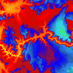
これは、米国本土 48 州、ハワイ州、米国領土を完全にカバーする米国のシームレスな 3DEP DEM データセットです。アラスカ州のカバー範囲は現在一部のみですが、アラスカ州マッピング イニシアチブの一環として州全域に拡大されています。地上間隔は … 3dep dem elevation elevation-topography geophysical topography -
USGS 3DEP 1m 全国地図
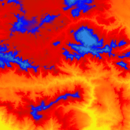
これは、3D 標高プログラム(3DEP)の 1 メートルのピクセルサイズの画像のタイル コレクションです。3DEP データは、The National Map の標高レイヤとして機能し、米国における地球科学研究とマッピング アプリケーションの基礎となる標高情報を提供します。 3dep dem elevation elevation-topography geophysical topography -
USGS 3DEP 全国地図空間メタデータ 1/3 秒(10 m)
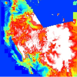
これは、3DEP 10m DEM アセットのメタデータを含むテーブルです。作業単位範囲空間メタデータ(WESM)には、現在の LiDAR データの可用性と、LiDAR の品質レベル、データ取得日、プロジェクト レベルのメタデータへのリンクなど、LiDAR プロジェクトに関する基本情報が含まれています。詳細を見る… 3dep elevation-topography table usgs
Datasets tagged 3dep in Earth Engine
[null,null,[],[],["The USGS 3DEP dataset offers seamless DEM data for the US, including the 48 contiguous states, Hawaii, and US territories, with partial coverage of Alaska that is being expanded. This data is available at 10m and 1m resolution. The 10m DEM has corresponding metadata table for lidar data availability. This 3DEP information serves as the elevation layer for the National Map and supports earth science studies and mapping applications.\n"]]