-
ภาพโมเสคกรีนแลนด์ปี 2000 - โครงการทำแผนที่น้ำแข็งกรีนแลนด์ (GIMP)

ชุดข้อมูลนี้แสดงภาพโมเสกความละเอียด 15 เมตรที่สมบูรณ์ของแผ่นน้ำแข็งกรีนแลนด์ซึ่งได้มาจากภาพ Landsat 7 ETM+ และ RADARSAT-1 SAR จากปี 1999 ถึง 2002 วิธีการดังกล่าวรวมถึงการผสมผสานการมาสก์เมฆในรูปภาพ การเพิ่มความคมชัด การสุ่มตัวอย่างและการปรับขนาดรูปภาพ ฯลฯ arctic gimp greenland imagery nasa polar -
ArcticDEM Mosaic เวอร์ชัน 4.1
ArcticDEM เป็นโครงการริเริ่มภาครัฐและเอกชนของสำนักงานข่าวกรองภูมิสารสนเทศแห่งชาติ (NGA) และมูลนิธิวิทยาศาสตร์แห่งชาติ (NSF) ในการสร้างแบบจำลองพื้นผิวดิจิทัล (DSM) ความละเอียดสูงและมีคุณภาพสูงของอาร์กติกโดยอัตโนมัติโดยใช้ภาพสเตอริโอออปติคัล การประมวลผลประสิทธิภาพสูง และซอฟต์แวร์โฟโตแกรมเมตรีแบบโอเพนซอร์ส ซึ่งรวมถึงพืชพันธุ์ ร่มไม้ อาคาร และ… arctic dem elevation-topography geophysical pgc umn -
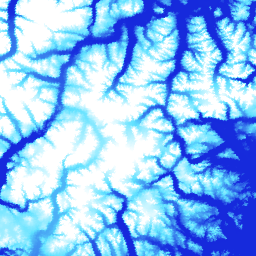
แถบ ArcticDEM

ArcticDEM เป็นโครงการริเริ่มภาครัฐและเอกชนของสำนักงานข่าวกรองภูมิสารสนเทศแห่งชาติ (NGA) และมูลนิธิวิทยาศาสตร์แห่งชาติ (NSF) ในการสร้างแบบจำลองพื้นผิวดิจิทัล (DSM) ความละเอียดสูงและมีคุณภาพสูงของอาร์กติกโดยอัตโนมัติโดยใช้ภาพสเตอริโอออปติคัล การประมวลผลประสิทธิภาพสูง และซอฟต์แวร์โฟโตแกรมเมตรีแบบโอเพนซอร์ส ซึ่งรวมถึงพืชพันธุ์ ร่มไม้ อาคาร และ… arctic dem elevation-topography geophysical pgc umn -
DEM กรีนแลนด์ - โครงการทำแผนที่กรีนแลนด์ (GIMP)

แบบจำลองระดับความสูงเชิงดิจิทัล (DEM) นี้สร้างขึ้นจากการรวมกันของ DEM ของ ASTER และ SPOT-5 สำหรับขอบและขอบของแผ่นน้ำแข็ง (เช่น ต่ำกว่าระดับความสูงของเส้นสมดุล) ทางใต้ของประมาณ 82.5°N และโฟโตคลินอเมทรี AVHRR ในส่วนด้านในของแผ่นน้ำแข็งและทางเหนือสุด (Scambos and … arctic elevation-topography gimp greenland nasa polar -
มาสก์น้ำแข็งและมหาสมุทรของกรีนแลนด์ - โครงการทำแผนที่กรีนแลนด์ (GIMP)

ชุดข้อมูลนี้มีมาสก์การแยกประเภทน้ำแข็งบนบกและมหาสมุทรที่สมบูรณ์ที่ 15 ม. สำหรับแผ่นน้ำแข็งกรีนแลนด์ ระบบได้ทำแผนที่ของชั้นน้ำแข็งโดยใช้การผสมผสานของภาพถ่ายออร์โธรีคติฟายด์แบบแพนโครมาติก (แถบ 8) จาก Landsat 7 Enhanced Thematic Mapper Plus (ETM+) ซึ่งจัดจำหน่ายโดย USGS และ … arctic cryosphere gimp greenland ice nasa -
MEaSUREs Greenland Ice Velocity: Selected Glacier Site Velocity Maps from Optical Images Version 2

ชุดข้อมูลนี้เป็นส่วนหนึ่งของโปรแกรม NASA Making Earth System Data Records for Use in Research Environments (MEaSUREs) ซึ่งประกอบด้วยแผนที่ความเร็วเฉลี่ยรายเดือนสำหรับพื้นที่ทางออกของธารน้ำแข็งที่เลือก แผนที่สร้างขึ้นโดยการติดตามฟีเจอร์ที่มองเห็นได้ระหว่างคู่ภาพออปติคัลที่ได้จาก Landsat … arctic cryosphere gimp greenland ice nasa
Datasets tagged arctic in Earth Engine
[null,null,[],[],["The content details datasets from the Greenland Ice Mapping Project (GIMP) and ArcticDEM initiatives. GIMP provides a 15m resolution ice/ocean classification mask and a 2000 image mosaic of Greenland derived from Landsat 7 and RADARSAT-1. It also includes a digital elevation model (DEM) and mean monthly glacier velocity maps. ArcticDEM, a joint NGA/NSF project, offers high-resolution digital surface models (DSMs) of the Arctic, encompassing features like vegetation and buildings.\n"]]