-
ArcticDEM Mosaic เวอร์ชัน 4.1
ArcticDEM เป็นโครงการริเริ่มภาครัฐและเอกชนของ National Geospatial-Intelligence Agency (NGA) และ National Science Foundation (NSF) ในการสร้างโมเดลพื้นผิวดิจิทัล (DSM) ความละเอียดสูงและมีคุณภาพสูงของอาร์กติกโดยอัตโนมัติโดยใช้ภาพสเตอริโอออปติคัล การประมวลผลประสิทธิภาพสูง และซอฟต์แวร์โฟโตแกรมเมตรีแบบโอเพนซอร์ส ซึ่งรวมถึงพืชพันธุ์ เรือนยอดของต้นไม้ อาคาร และ… arctic dem elevation-topography geophysical pgc umn -
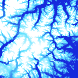
แถบ ArcticDEM

ArcticDEM เป็นโครงการริเริ่มภาครัฐและเอกชนของ National Geospatial-Intelligence Agency (NGA) และ National Science Foundation (NSF) ในการสร้างโมเดลพื้นผิวดิจิทัล (DSM) ความละเอียดสูงและมีคุณภาพสูงของอาร์กติกโดยอัตโนมัติโดยใช้ภาพสเตอริโอออปติคัล การประมวลผลประสิทธิภาพสูง และซอฟต์แวร์โฟโตแกรมเมตรีแบบโอเพนซอร์ส ซึ่งรวมถึงพืชพันธุ์ เรือนยอดของต้นไม้ อาคาร และ… arctic dem elevation-topography geophysical pgc umn -
REMA Mosaic

โมเดลความสูงอ้างอิงของทวีปแอนตาร์กติกา (REMA) คือโมเดลพื้นผิวดิจิทัล (DSM) ความละเอียดสูงที่มีการประทับเวลาของทวีปแอนตาร์กติกาที่ความละเอียดเชิงพื้นที่ 2 เมตรและ 8 เมตร ไฟล์ DEM แบบโมเสกจะรวบรวมมาจากแถบหลายแถบที่ลงทะเบียนร่วมกัน ผสมกัน และเฟดเพื่อลดอาร์ติแฟกต์การจับคู่ขอบ dem elevation-topography geophysical pgc rema umn -
REMA Strips 2m

โมเดลความสูงอ้างอิงของทวีปแอนตาร์กติกา (REMA) คือโมเดลพื้นผิวดิจิทัล (DSM) ความละเอียดสูงที่มีการประทับเวลาของทวีปแอนตาร์กติกาที่ความละเอียดเชิงพื้นที่ 2 เมตรและ 8 เมตร ไฟล์ DEM แถบจะสอดคล้องกับพื้นที่ทับซ้อนของแถบคู่ภาพสเตอริโอสโคปที่ป้อนเนื่องจาก DigitalGlobe รวบรวม … dem elevation-topography geophysical pgc rema umn -
REMA Strips 8m

โมเดลความสูงอ้างอิงของทวีปแอนตาร์กติกา (REMA) คือโมเดลพื้นผิวดิจิทัล (DSM) ความละเอียดสูงที่มีการประทับเวลาของทวีปแอนตาร์กติกาที่ความละเอียดเชิงพื้นที่ 2 เมตรและ 8 เมตร ไฟล์ DEM แถบจะสอดคล้องกับพื้นที่ทับซ้อนของแถบคู่ภาพสเตอริโอสโคปที่ป้อนเนื่องจาก DigitalGlobe รวบรวม … dem elevation-topography geophysical pgc rema umn
Datasets tagged umn in Earth Engine
[null,null,[],[],[]]