تبخیر و تعرق واقعی برای استرالیا (CMRSET Landsat V2.2) 
این مجموعه داده، تبخیر و تعرق واقعی (AET یا ETa) دقیقی را برای استرالیا با استفاده از الگوریتم CMRSET ارائه میدهد. باند AET (با نام 'ETa') شامل میانگین مقدار روزانه از مدل CMRSET برای تمام مشاهدات لندست بدون ابر در آن ماه است (با مقدار 3 در دادههای AET نشان داده شده است ... کشاورزی استرالیا ، تبخیر، تبخیر و تعرق، دادههای لندست، مشتق شده از 5M DEM استرالیا 
مدل ارتفاعی رقومی (DEM) شبکه ۵ متری استرالیا که از مدل LiDAR مشتق شده است، نشان دهنده یک DEM ملی ۵ متری (زمین لخت) است که از حدود ۲۳۶ نقشهبرداری LiDAR جداگانه بین سالهای ۲۰۰۱ تا ۲۰۱۵ استخراج شده و منطقهای بالغ بر ۲۴۵۰۰۰ کیلومتر مربع را پوشش میدهد. … ارتفاع dem استرالیا ، ارتفاع-توپوگرافی ga، ژئوفیزیک DEM-H: مدل ارتفاعی رقومی SRTM هیدرولوژیکی اعمال شده استرالیایی 
مدل ارتفاعی رقومی هیدرولوژیکی اعمالشده (DEM-H) از دادههای SRTM که توسط ناسا در فوریه ۲۰۰۰ به دست آمد، استخراج شد. این مدل از نظر هیدرولوژیکی اصلاح و زهکشی آن اعمال شده است. DEM-H مسیرهای جریان را بر اساس ارتفاعات SRTM و خطوط جریان نقشهبرداریشده ثبت میکند و از ترسیم ... پشتیبانی میکند. ارتفاع dem استرالیا ، ارتفاع-توپوگرافی ga، ژئوفیزیک DEM-S: مدل ارتفاعی رقومی هموار شده استرالیایی 
مدل ارتفاعی رقومی هموار شده (DEM-S) از دادههای SRTM که توسط ناسا در فوریه ۲۰۰۰ به دست آمد، استخراج شده است. DEM-S نشان دهنده توپوگرافی سطح زمین (به استثنای ویژگیهای پوشش گیاهی) است و برای کاهش نویز و بهبود نمایش شکل سطح، هموار شده است. یک فرآیند تطبیقی بیشتر اعمال میشود… ارتفاع dem استرالیا ، ارتفاع-توپوگرافی ga، ژئوفیزیک پیشنمایش مدل ارتفاعی دیجیتال بین جزر و مدی ملی ۲۵ متر ۱.۰.۰ 
مدل ملی ارتفاع دیجیتال بین جزر و مدی (NIDEM؛ بیشاپ-تیلور و همکاران، ۲۰۱۸، ۲۰۱۹) یک مجموعه داده ارتفاعی در مقیاس قارهای برای منطقه جزر و مدی استرالیا است. NIDEM اولین نمایش سهبعدی از سواحل و کرانههای شنی بین جزر و مدی، پهنههای جزر و مدی و سواحل سنگی و صخرههای مرجانی استرالیا را در ارتفاع ۲۵ متری ارائه میدهد... ارتفاع-توپوگرافی dem استرالیا ga SLGA: شبکه خاک و منظر استرالیا (ویژگیهای خاک) 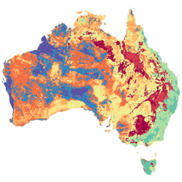
شبکه خاک و منظر استرالیا (SLGA) یک مجموعه داده جامع از ویژگیهای خاک در سراسر استرالیا با وضوح ۳ ثانیه قوسی (حدود ۹۰ میلیون پیکسل) است. سطوح، نتایج مدلسازی هستند که توزیع مکانی ویژگیهای خاک را با استفاده از دادههای خاک موجود و دادههای محیطی توصیف میکنند... پرستوی خاک استرالیا csiro
Datasets tagged australia in Earth Engine
[null,null,[],[],["Several datasets provide detailed geographic and environmental information about Australia. Digital Elevation Models (DEMs) include a 5-meter grid from LiDAR surveys, a hydrologically enforced model, and a smoothed model from SRTM data, as well as a national intertidal DEM. Additional data includes the Soil and Landscape Grid of Australia (SLGA) with soil attributes. Landsat data is processed to show actual evapotranspiration (AET), land cover, water observations, and statistical analysis.\n"]]