-
Lượng mưa CHIRPS theo ngày: Dữ liệu lượng mưa hồng ngoại kết hợp trạm đo của Trung tâm Rủi ro Khí hậu (Phiên bản 2.0 cuối cùng)

Dữ liệu lượng mưa hồng ngoại kết hợp trạm đo của Trung tâm Rủi ro Khí hậu (CHIRPS) là một tập dữ liệu lượng mưa gần như toàn cầu trong hơn 30 năm. CHIRPS kết hợp hình ảnh vệ tinh có độ phân giải 0,05° với dữ liệu trạm đo tại chỗ để tạo chuỗi thời gian lượng mưa dạng lưới nhằm phân tích xu hướng và theo dõi hạn hán theo mùa. chg khí hậu địa vật lý lượng mưa ucsb thời tiết -
Lượng mưa CHIRPS theo chu kỳ 5 ngày: Dữ liệu lượng mưa hồng ngoại kết hợp trạm đo của Trung tâm Rủi ro Khí hậu (Phiên bản 2.0 cuối cùng)

Dữ liệu lượng mưa hồng ngoại kết hợp trạm đo của Trung tâm Rủi ro Khí hậu (CHIRPS) là một tập dữ liệu lượng mưa gần như toàn cầu trong hơn 30 năm. CHIRPS kết hợp hình ảnh vệ tinh có độ phân giải 0,05° với dữ liệu trạm đo tại chỗ để tạo chuỗi thời gian lượng mưa dạng lưới nhằm phân tích xu hướng và theo dõi hạn hán theo mùa. chg khí hậu địa vật lý lượng mưa ucsb thời tiết -
Lượng mưa CHIRPS theo chu kỳ 5 ngày: Dữ liệu lượng mưa hồng ngoại kết hợp trạm đo của Trung tâm Rủi ro Khí hậu (Phiên bản 3.0)
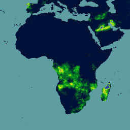
Dữ liệu lượng mưa hồng ngoại kết hợp trạm đo của Trung tâm Rủi ro Khí hậu (CHIRPS phiên bản 3) là một tập dữ liệu lượng mưa có độ phân giải cao, gần như trên toàn cầu trong hơn 40 năm. Dữ liệu này trải dài từ 60°B đến 60°N và bao gồm tất cả các kinh độ, cung cấp dữ liệu từ năm 1981 đến gần đây. CHIRPS phiên bản 3 kết hợp dữ liệu lượng mưa hồng ngoại nhiệt dựa trên vệ tinh với dữ liệu quan sát tại trạm đo thực tế… chc chg khí hậu địa vật lý lượng mưa ucsb -
Nhiệt độ CHIRTS hằng ngày: Sản phẩm dữ liệu hằng ngày về nhiệt độ hồng ngoại kết hợp trạm đo của Trung tâm Rủi ro Khí hậu

Sản phẩm dữ liệu nhiệt độ hằng ngày của Trung tâm Rủi ro Khí hậu (CHIRTS-daily; Verdin và cộng sự, 2020) là một tập dữ liệu dạng lưới có độ phân giải cao trên toàn cầu (độ phân giải 0,05° × 0,05°, 60°N – 70°N) cung cấp nhiệt độ tối thiểu (Tmin) và tối đa (Tmax) hằng ngày ở độ cao 2 mét, cùng 4 biến số phái sinh: áp suất hơi bão hoà … chg climate daily era5 geophysical reanalysis
Datasets tagged chg in Earth Engine
[null,null,[],[],[]]